Sunday, May 04, 2008

Full Metal Fleche


Last weekend I put the limits of my strength and endurance, not to mention sanity, to the test by participating in the Oregon Randonneurs "Fleche Ouragon". A "fleche" is a 24-hour team cycling event in which each team must complete at least 360 kilometers in 24 hours. There is a central finish point, but each team creates its own route to get to that point - usually a straight(ish) line from a distant point, but some routes have a more loop-like quality than others. The rule is that you cannot start and end your ride in the same town. But if you just HAPPEN to plan a route that starts in the next town over from the end, and if that next town over is, say, 1.5 miles from the town you end in, well, that's not EXACTLY a loop, is it?

Completing a fleche would mean riding at least 225 miles in one shot (the longest rest period allowed is 2 hours). That is 28 miles longer than my previous one-day record of 197 miles. But I've been riding further and further each time out, so I figured it was worth a try. So when my friend Rickey Smith started talking about doing a fleche last fall, I started giving the concept serious thought. And when my friend Susan France suggested I be on the all-woman team, I said sure. That was before Susan advised me that she wasn't actually riding and that I would have to be the team captain and put together the route and other documents. Fortunately, she let me use the route she designed last year; with a little tweaking to make it less loop-like (they had started and ended in the same location, a no-no under the new rules - or "non-non," I guess, given that the rulemakers are French). Instead of starting in Forest Grove, we would start in Cornelius. Normally, to get to Forest Grove from Cornelius, you would head west on Highway 8 for about 1.5 miles. We took the scenic route instead, and got there by way of Corvallis. Corvallis is roughly 97 miles south of Cornelius.

Having chosen a route, the next item of business was to chose a team name. My in-depth research had shown that past fleche teams have generally chosen names that played on the word "fleche." Names like "In the Fleche," "Fleche for Fantasy," you get the picture. So we bandied some of those kinds of names about: "Fleche Pots," "Fleche-Eating Bacteria,' "Flechely Delights," "Fleche-Ripping Weasels," etc. None of those really caught our fancy, and in the end we went with "Full Metal Fleche": an homage to one of my favorite movies and an acknowledgment that we all ride steel bikes. The fact that the movie is about the idiocy of entering into an extended ordeal with no clear exit strategy did not factor into the decision. Perhaps it should have.

We decided to start at 9:00 PM. When you do a 24-hour ride, you have no choice but to ride at night at some point. We wanted to get the night riding out of the way while we were still relatively alert. Of course, when we picked that starting time I had no idea that an emergency situation at work would have me pulling some all-nighters at the beginning of the week and just draining me in general. Oh well, if I was going to test my endurance, this was going to be the mother of all tests.

We met at the Grand Lodge, with the plan being to ride from there to our starting point in Cornelius. We all arrived at the Grand Lodge at around 7:30, giving us plenty of time to mess with our bikes and other gear.
More Gear Talk
At 8:30 we saddled up and rode over to the start. It took us all of 15 minutes to get there, so we hung around the local Plaid Pantry.
Grace Incarnate
The clerk was extremely tolerant of our odd behavior, even though every time one of us went in or out the front door an annoying little bell went off. Peg started jumping over the electric eye beam that triggered the bell, but none of the rest of us were willing to risk a slip and fall.
No Pictures, Please


9:00 came, and we had the clerk sign our cards, and we were off. By this time it was dark.

Pre-Ride, No More Daylight

Heading south (and slightly west) out of Cornelius, we traveled on winding rural roads through wine country. Because it was night, we were not worried about being run over by inebriated wine tasters. Inebriated locals in big pickup trucks, perhaps, but there weren't many of them, either. Our first control was in Dayton. Although it was close to 11 PM when we arrived, the local convenience store was open. I highly recommend the hot chocolate machine there. Its product actually tastes like chocolate. The man at the counter was somewhat bemused by our appearance, and our request that he sign our brevet cards. While we were standing outside finishing our drinks, a car pulled up and a rotound young man who looked like he was straight out of Yoknapatawpha County rolled out of the back seat, looked at us, flashed devil's horns with his hands, and yelled "Smoke marijuana!" No wonder the cashier was so perplexed by us. We were not his usual demographic.


From Dayton we continued to roll south, through the western outskirts of Salem toward our next control in Independence. I have been known to describe Salem as "flat, flat, and more flat." That's true, if your definition of "flat" contains room for the occasional 11% grade. One nice thing about night riding is that when you can't see the top of a hill, you can't psych yourself out thinking how far away from that hilltop you are.
Night Vision.
After our tour of the West Salem hills, we turned west onto the debris-filled shoulder of Highway 22 for a mercifully short distance, after which we turned south on to the slightly less debris-filled, but also slightly less-existent shoulder of State Route 51, which we would follow into Independence. Independence was rocking. Well, at least the one bar across the street from the surprisingly nice public restroom was rocking. Rocking with very bad, live band backed karaoke. I have heard some bad versions of "Dream On" before, but I am pretty sure the one we heard in Independence was the worst. We decided not to try to get our cards signed at the bar, and hit up an ATM machine, instead.

Next stop, Albany, where there were no businesses, but I had the address for another ATM at which we obtained a time-stamped receipt. At this point, all the water I had been drinking decided to make its presence felt, and we lost some time while I tried to locate a discreet place to relieve the pressure. Another good thing about night riding.

And it was on to Corvallis, where breakfast awaited us in Lynne's son's apartment. Breakfast ingredients, at least; the fixing of said breakfast was up to us. A very sleepy boy greeted us at the door, initialed our cards, and sat up with us while we ate. Lynne set the alarm on her cell phone for 1/2 an hour, and we all catnapped until the alarm startled us all awake. We has wasted too much time, he sun was up and it was time to leave. We still had 12 hours and at least 130 miles to go.

From Corvallis, we turned east toward the bustling metropoli of Shedd and Waterloo, our next two controls. The market in Shedd was open, and we got our cards signed and lost some time snacking, using the bathroom, and changing clothes as it was starting to get warm. Of course, as soon as I stripped off some of my warmer layers, the sun went behind a cloud never to return.

Waterloo, our next control, is a tiny town with one market and no other businesses.

This IS Downtown Waterloo

Although it was almost 10 AM, the market was closed. I had a postcard we could have used to show we had been there, except I had forgotten to stamp it. Oops. Fortunately, we found a man standing in his front yard, and had him sign our cards.

From Waterloo, we turned to the northwest, directly into the wind. This would be the story for the rest of the day. I hate wind. It utterly demoralizes me. And this particular wind was particularly demoralizing; it just didn't let up. It was a struggle to maintain a speed greater than 12 mph. I began to obsess that we were not going to make it on time. That obsession would only get worse as the day progressed. From Waterloo we passed through Lebanon and on to the next control in Jefferson. There is a very nice market there, and Peg and Lesli bought jo-jos, which we all shared. I followed the jo-jos with a jelly bean chaser. My devotion to healthy food had dropped by the roadside somewhere on the outskirts of Waterloo. It was around this time that I stopped taking pictures - I was too tired to reach into my jersey pocket for my camera while riding, and we did not have time to stop.

In Aumsville, I decided that I REALLY REALLY REALLY needed to change my shorts. Earlier in the day, Peg had quoted a friend as describing some difficult rides as "death by a thousand cuts." Well, I was dying that death, and all thousand of those cuts were in one very specific, and very sensitive, place. The new shorts helped. About 15 minutes after I changed into the new shorts, the skies opened up and dumped a few hundred buckets of rain directly on me. Fortunately, we had seen the rain in the distance and put on our jackets, but our shorts and feet were soaked. I had spare socks and bootie in my pannier, though, and at the next control in Gervais I put them on, along with my leg warmers. After which, of course, the rain stopped and the temperature went back up.

It was around Gervais that I started losing the will to live. The wind continued to make forward progress difficult, time was ticking off, and I was convinced we were not going to make it. Lynne kept reassuring me we would be okay, but I was running on empty with 65-some miles to go. In Donald, I told the other three to go ahead without me; I'd try to catch up with them for the 22-hour control, but couldn't promise. As long as the three of them finished, they'd get credit. They were all riding more strongly than I was, and I didn't want to keep them back. They reluctantly agreed, but after that slowed down enough that I was able to keep up. I am not sure if it was intentional on their part, but I sure appreciated it.

The next 3 or 4 hours all sort of blurred together. I was in Bataan Death Ride mode; I just wanted it to be over. Lesli said I looked like I'd gotten a second wind. I told her no, it was merely sheer desperation to be done. We made it through our Wilsonville control, which involved a short stretch of travel on the shoulder of I-5 over the Willametter River. and headed toward our 22-hour control, which was supposed to be the Starbucks in a strip mall at the corner of Scholls Ferry Road and Murray Blvd. in Beaverton (or is it Scholls?). We were about 3 miles away from there when the 22-hour point hit, though, so our 22-hr point was a house on Roy Rogers Road, instead.
22-Hour "control"

We still had to go to the Starbucks, however, because we needed the distance to ensure we'd get in 360 K by 9 PM. Sadly for my no-longer-working left leg, the 3 miles from where we were to the Starbucks was comprised of three very steep hills, separated by a couple not quite as steep hills. I gritted my teeth and powered through, even though I was still convinced we would fall short of our goal.

We were now on the home stretch, riding roads that Lynne and I have ridden dozens of times on Portland Velo rides. This was good, because I was officially on auto-pilot. The wind had turned very cold, and there was just a hint of drizzle in the air. At some point on Rood Bridge Road, or maybe it was Burkhalter, Lynne turned to me and said "Cecil, we did it. You can relax now." I started to cry. At the 24-hr mark, we stopped, noted our mileage and signed each other's cards. We were still five miles from the Grand Lodge, however, so we could not rest on our laurels quite yet. We limped on in to Forest Grove, finally arriving at the Lodge sometime around 9:30 PM. I checked in, showered, and headed straight for the bar. I wanted to enjoy a beer before I fell asleep, and I figured I had a window of about 45 minutes before I became comatose. Lesli, Peg, and Lynne arrived shortly thereafter, along with Lynne's husband, Fitz, and we ordered dinner. Tater tots. Lots of tots. Then it was time for me to go to bed. Normally I have trouble falling asleep. Not this time.

The next morning we all gathered for breakfast to share our stories and eat large quantities of starchy food. Another rider, Dave Read, had brought me a doughnut from Voodoo Doughnuts in Portland (one of his team's controls) and I enjoyed that as a pre-breakfast snack. Later we posed for a non-lycra clad team photo, and then I had a much-needed soak in the Japanese-style soaking pool before heading for home.

The Day After

Happy Not To Be Cycling (at least for the moment)

More of my pictures here
Lynne's write-up here

Ride Stats:

Total distance: 226-234 miles, depending on whose computer we looked at
Total ride time: 24 hours
Total saddle time: 19 hours, 8 minutes, 49 seconds
Average speed: 12.2 mph (damned wind!)
Total elevation gain: 5002 feet
Max altitude: 484 feet
Average climb: 2%
Max climb: 11 %

Friday, May 02, 2008

Wednesday, April 30, 2008

Li'l HW Jr.'s First Brevet

Wilson River Highway

HW was two weeks old last weekend, and it was time for her to hit the road for her first brevet - a 300 kilometer jaunt to the coast and back, by way of the Wilson River Highway, Tillamook, the Three Capes, Pacific City and the back roads of Yamhill and Washington Counties.

The brevet was originally scheduled for April 19, but the weather was uncooperative. On our rescheduled date of April 26, the weather was spectacular. Although it was only 33 degrees when we started out at 6 AM, it quickly warmed up and by the time we reached Tillamook at about 10, it was 70 degrees. The temperature stayed right around that mark until the sun went down, at which point it started to drop, but not much.

I started the day hoping to complete the 300 km in 15 hours. And for the first 10 hours, I was on target. But my energy level, which had been low all day, took a nosedive at about 6 PM, and I ended up not getting in until 10:27 - 16 hours and 27 minutes after I started. But I had a great day, nevertheless. I rode for quite some time with Tomas, one of my flickr.com "contacts" whom I had not yet met in person, and also with my friends Sal, Lesli, Sara, and Peg. Plus, I got to go to my favorite bakery in Pacific City, where I partook of a delicious apricot scone . . . .
Apricot Cream Cheese Scone

Not to mention the chance to commune with friendly farm animals
Friendly Llama

Sunday, April 13, 2008

The Heliotrope Wonder (Jr.)'s First Ride!

Behold The Heliotrope Wonder (Jr.)

Sunrise Sweetpea

At long last, she is mine. I picked her up from the builder on Monday, April 7. It was late, and I was still getting over the flu, so I only rode her around the block a few minutes to check the lights. I was not able to get out for her first REAL ride until the weekend. The weather gods looked kindly upon my plight, though, and served up the most spectacular two days that Portland has seen since sometime last September.

On Saturday, I got up very early and rode up and over the West Hills to Longbottom's, the coffee shop in Hillsboro where my cycling club meets for its rides. I couldn't ride with them, because I had to get back to Portland for a much-needed massage appointment, but I wanted to show off my new toy. I left a little earlier than usual and detoured out to Sellwood and then back downtown by way of the Springwater Corridor.

On my way to Hillsboro, I stopped by Lynne's house. She had left a phone message the night before that she would ride out with me. I had not been able to call her back, but figured she'd probably be up and ready to go. She was, and we headed off. We took a slightly different route, and I was going a little slower, so we ended up getting to Longbottom's just in time for Lynne to take off with the group she was leading. I bought a muffin and headed for home.

The weather was shaping up to be spectacular. At 9:00 it was already almost 70 degrees. I decided to take a longer, steeper route home, and headed up West Union Road to climb up to Skyline on Thompson. There were bicyclists everywhere I looked! I was anxious to see how my climbing would be on the new bike, given its somewhat heavier weight and fatter tires. I needn't have worried. I'm running a 30-42-53 triple with a 12-25 10-speed, and I got everywhere I needed to go with no more effort than on the ol' semi-speedy Bianchi.

When I reached the top of Skyline, I stopped to eat the rest of my muffin and take more glamour shots of the bike. Another cyclist stopped to make sure I was OK. I told him I was fine, just admiring my new baby. He joined in the admiration session and we had a nice chat about what a great bike builder Natalie was.

Sweetpea on Skyline

Then it was time to get home. The drop down from Skyline on Thompson is a glorious series of steep, sweeping curves. I took full advantage of both the curves and the new bike's exquisite balance and blasted my way down. When I got back to my neighborhood, the odometer showed 48.7 miles, so I obsessively rode around the central circle park to reach 50.

Sunday dawned bright and sunny again, but the weather forecast was for cooler air and clouds later. Lynne and I had decided to ride out to Multnomah Falls from my house, so this time she came to meet me. The first (and last) 14 miles of our route was urban riding at its worst - busy, dirty streets filled with fast cars driven by rude or oblivious people. I can understand why a lot of cyclists choose to drive to a less stressful starting point. I don't approve of it, and lecture them every chance I get, but I know that some folks are just daunted by all the traffic on some surface streets.

Once we reached Troutdale, the route became MUCH nicer. We took the Historic Columbia River Highway (of course) which climbs up, up, up to just past Corbett and then goes down to Crown Point and the Vista House, a lovely historic building (a WPA construction).

Li'l HW Jr. at Vista House

It's just abut 11 miles from the Vista House to Multnomah Falls. It's not ALL downhill, but mostly so. It's never very steep, though; I don't think it ever exceeded a 4% grade. Again I took advantage of Li'l HW Jr's superb balance and went for maximum speed. What fun, especially on those parts of the highway that were recently repaved.

Once we reached the Falls, we spent a ridiculous amount of time screwing around, taking pictures and eating pastries. We chatted with a couple of guys who were riding speedy little racing bikes (their two bikes together plus a couple of U-locks would still have weighed less than my fully-loaded baby). They were very admiring of Li'l HW, Jr., and condescendingly told Lynne that she had "a nice bike, too." She was very gracious, but later told me that Little Pink Bear had advised her that her bike, Bleriot, was a little jealous . . .

Heading back up to Corbett from the Falls, we stopped many times to take more pictures. Our plan had been to stop at the McMenamin's in Edgefield for a tater tots snack, but we had also wanted to go to Clever Cycles back in Portland (I've had a gift card burning a hole in my pocket since Christmas and Lynne had never been there). Once we realized how much time we had wasted, we decided to skip the tots and head straight for the bike store. The fact that the store was across the street from the Lucky Lab helped us in the decision, because we knew we could repair over there for a snack. No tots, though.

I had to stop by the house to pick up my card, and we reached Clever Cycles by 4:30. I managed to spend the whole card in less than 15 minutes on a headset bell, wool socks, wool bra, and nifty gloves. Again, much bicycle admiring took place.

And then it was across the street to the Lab. Greg and Fitz were meeting us there. The weather had taken a turn for the freezing, and Lynne and I were in lightweight riding gear, so we wanted to eat inside. I didn't want to leave Li'l HW Jr. outside (soon enough she will rained on, I just wanted to spare her that for now) so I asked the server if I could bring her inside. He grudgingly said yes. I explained that she was brand new, and that I was being overly protective. He responded, "Everyone thinks that their bike is more special than anyone else's."

Well, yes. Yes, I do think my bike is more special than anyone else's. Got a problem with that?

Li'l HW Jr. and Bleriot at the Lucky Lab

My photos

Lynne's photos

Monday, March 31, 2008

Endurance, Thy Name is Birkie

Word of the Day

I am generally not a firm believer in synchronicity but, looking back on yesterday's (pre-)pre-ride, I must say that it is, at the least, somewhat TOO coincidental that the radio program that I was listening to in the wee hours of the morning as I was preparing to set out was broadcasting a piece about the disastrous Scott expedition to the South Pole.

First, some background. Lynne and I had originally planned to do the Birkie pre-ride on Sunday, March 30. Then a couple of Lynne's friends went and got themselves married, and suddenly Lynne had a social obligation that day. So we switched the ride to Saturday, March 29. Our friends Andrew and Jason agreed to tag along (so as then to be volunteers on the day of the brevet itself).

At the beginning of the week, the forecast for Saturday was promising. Partly cloudy, low 50s. Starting Wednesday, however, Oregon's already unpredictable weather took a decided turn for the weird. Snow levels dropped to the Willamette Valley floor, along with the temperatures. Saturday's forecast went from promising to foreboding. After some consultation with our RBA, it was decided that Andrew and I would ride on Sunday, as originally planned, and Lynne and Jason (they of the slightly more flexible schedules) would ride on Monday. Hence the (pre-) pre-ride moniker.

As of Friday night, the forecast for Sunday was "chance of showers, upper 40s." Not great, but certainly something I've had no problem braving in the past. Indeed, just two weeks earlier I had traveled to Seattle for the privilege of riding 200 km in a mini-deluge. I was a bit concerned by the fact that I appeared to be coming down with a cold, but tried to think positive, non-congestive thoughts.

I spent Saturday at home, nursing the now-definite cold and watching the weather change from snow to hail to sleet to sun and back to hail, all the time thinking "Whew, I'm sure glad we postponed our ride a day." The forecast for Sunday had still trended toward tolerable, but by 10 PM Saturday evening the meteorologists had started saying things like "More of the same . . . ," and there were mutterings of accumulating snow at elevations above 500 feet. Hmmm. Our route climbed to over 1100 feet at Timber Summit, and most of the rest of the ride was at elevations between 300-600 feet. I decided to pack extra socks.

I looked at my stats from last year's Birkie, and saw that I had completed the 200 km in a relatively fast (for me) 9 hours 19 minutes. I suggested to Andrew that we could probably push our start time back as far as 8:00 and still get back well before dark. He concurred, and we arranged to meet at the Grand Lodge at 7:45.

The skies were overcast when I awoke, but it was not raining (or snowing, or otherwise precipitating). As I drove out to Forest Grove from Portland, a few sprinkles hit the windshield, but never enough to call for the wipers. I arrived in Forest Grove about 5 minutes before Andrew; we quickly assembled ourselves and went in to the front desk to get our cards stamped. It was quite chilly at this point - 34 degrees according to my computer, 33 according to Andrew's (we have the same model computer - so go figure). I was dressed for whatever element we might encounter (long sleeve wool jersey AND arm warmers, "Storm" tights, chemical toe warmers, booties, SP jacket . . .) and had packed extra socks and an extra wool undershirt, just in case. I was also trying yet another glove system - my heavy snowshoeing gloves over long-finger bike gloves. I was still riding the Bianchi, but figured this would probably be it's last brevet for a while - it is in SERIOUS need of an overhaul.

As we headed out on Pacific Avenue (Hwy 8)/Gales Creek Road, it started to precipitate.

"Cecil, it's snowing."

"I see that, Andrew."

"I don't like the looks of this."

"It will be okay."

"It's 33 degrees."

"Not by my computer. I have 34 degrees."

"Oh, well in THAT case . . ."

The snow soon changed back into sprinkly, cold rain, and we rode on. But I think that Andrew was already working out potential escape routes . . .

Gales Creek Road out to Highway 6 is about 11 miles of gently rolling rural road. The traffic on a Sunday morning was very light (this was true of our whole route, actually, but I am not sure how much of that was due to the weather). About halfway to Hwy 6, a dog came rushing out onto the road at us - much yelling ensued and it finally backed off. It was a precursor of things to come. We were later chased by dogs on Timber Road, Keasey Road, Stoney Point Road, and again by the same dog on Gales Creek Road on the way back to Forest Grove.

Traffic on Hwy 6 was very light, which was good, because the shoulder was not very clean, and I spent most of my time riding on the roadbed instead. Of course, this meant crossing back and forth over the rumble strip to move over when there were cars, and that can sometimes be tricky with skinny tires like mine. The turn onto Timber Road is well-marked (indeed, in addition to the road sign, someone had very nicely put up a poster board sign that said "Timber Road"). It had started to precipitate again, and the temperature reading on my computer had dropped to 33 degrees. My hands and toes were warm, though, and I knew that by the time I reached the top I would be pretty warm all over. I stopped, switched to a different glove configuration and opened up my pit zips.

There were patches of snow along the side of Timber Road, and those patches steadily increased in size and depth as we climbed higher. There was also quite a bit of oil that the rain had raised to the surface of the road but had not washed off. Soon, the oil patches were joined by pockets of frozen slush.

"I don't like the looks of this, Cecil."

"Neither do I, Andrew. I think we are going to be going down this hill very, very slowly."

"I'm not sure we should keep going."

"Don't worry, it'll be okay."

In hindsight, at this point I might have done well to remember the morning's radio programme . . .

The stuff falling on us from the sky at this point was still more solid than liquid, and this would hold true for the rest of the day. We did have a few brief periods of actual, wet rain (generally accompanied by a howling wind) but most of the time it was some form of solid. What FORM of solid was a chief topic of Andrew's and my conversation for the day. Well, that and Antarctic exploration. We hoped we'd fare less like Scott and more like Shackleton.

The sun came out as we reached the summit above the town of Timber. Say what you will about clear cuts, we did have a great view of the Coast Range. Although the road was pretty much clear of snow (again, thanks to the clear cut there was no shade to keep the snow from melting off the pavement), the snow on the side of the road was probably about 2 or 3 inches deep.

Timber Summit in the Morning

From the summit, the road drops fairly steeply into Timber. Because it was wet, and had been spread with gravel, I was riding my brakes. As you enter Timber, the road makes a very tight hairpin turn and right at the bottom of that turn is a very nasty, ripped-up set of railroad tracks.

Bad Tracks!

Once you get over those, there is another very tight hairpin, and then the road opens up for a long gentle down hill to Hwy 26. Across Hwy 26, it's a few more miles into Vernonia. The road itself is in pretty good condition after last December's floods, but damage is visible on either side. There is a bike path that runs along the road for a while, but it sustained flood damage in parts and has not yet been repaired. About 3 miles before Vernonia, it started snowing pretty heavily. Big fat pretty snowflakes. It didn't last more than a few minutes, however.

The sun came out just as we reached the first control in Vernonia (Anderson Park). On Saturday, this control will be staffed. It has running water, hot showers, and flush toilets. To get to the Anderson Park control, we turned onto Umatilla Street per the cue sheet. We missed the bike path, though, because it is not well marked. Umatilla Street has always been a rough road, but now it's really bad. Lots of big, sharp, skinny tire-chewing rocks.

Bam! Psssst! Rats!

From the sound, at first I thought I had a snake-bite flat, but later examination revealed a gash in the side wall ("Typical Conti wall failure," says Andrew). Normally I am capable of changing my own tires, but my brain was not working well at this point (the cold that I had hoped had gone away was coming back with a vengeance), so Andrew ended up doing most of the work, and donating boot materials. We ended up putting in two boots, because we actually missed the side wall gash the first time around, and thought the problem was a smaller gash on the tread. HOW we missed the sidewall gash, I don't know - it was quite large. In any event we spent quite a bit of time on tire repairs, and by the time we were ready to head off to the next control it was, of course, precipitating again.

The out and back on Keasey Road to the info control is another gently rolling road, with a couple of climbs/descents that are a lot of fun in dry weather, less fun when it is wet. We were chased by another dog. Again, with much shouting we convinced it to turn back. At the intersection with C Burn Rd. we figured out the answer to the NEW info question, and turned back the way we came. We turned left onto Stoney Point Road, which is yet another gently rolling road that connects to Hwy 47. It's hard to see oncoming traffic at the turn, so we were cautious. This of course meant that we had less momentum for the climb that starts immediately after that left turn. "Gently rolling" is a pretty good descriptor of most of this route, by the way. The average incline is 3%, and the steepest climb (near Timber, of course) is only 10%.

At this point the precipitation was shifting back and forth between rain and sleet. Once we turned onto Hwy 47, the rain stopped for a while, but we could see dark clouds heading toward us in waves. The wind picked up considerably; a headwind, of course. About 5 miles from the Birkenfeld Store, we saw a very dark cloud approaching very quickly.

"I don't like the looks of what's headed toward us."

"Neither do I."

Luckily, we came upon a fire station with an awning.

Damn, It's Cold!

We pulled over to wait out what promised to be the heaviest weather of the day, and took the time to eat some snacks and make yet another set of wardrobe adjustments. After it began to look like it wasn't raining TOO hard, and that it wasn't likely to slack off any time soon, we decided to press on to the control. We were running considerably behind schedule at this point, what with all the stops for wardrobe adjustments. True to form, the rain stopped and the sun came out just as we reached the Birkenfeld Store.

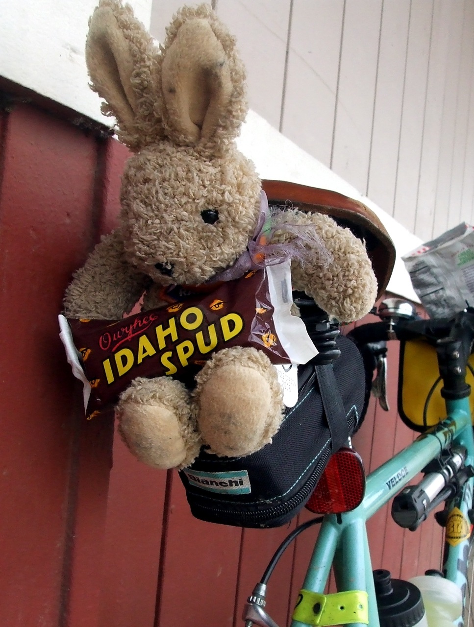
At this point we were a little more than halfway through. I felt lousy; I purchased my traditional Idaho Spud candy bar, but I didn't really enjoy it. My hot chocolate was good when I drank it, but I later regretted that, as well. Andrew had hot chocolate and french fries, a combination he, too, later regretted. We chatted with the woman at the counter and warned her that she would be seeing a lot of cyclists on Saturday. I bought a t-shirt, and it was time to go. Right on schedule, it started to rain again, and the wind changed direction, so that we had a headwind on the way back, too.

I had now moved into "grim determination" mode. Andrew said he thought I'd gotten a second wind, but it was really more of a "I need to get done with this NOW." Anyone who knows me, knows that I can find SOMETHING to enjoy about every bike ride I do, regardless of conditions, but this ride was putting that personal quality to its most severe test ever.

It was a (fairly) straight shot on Hwy 47 from Birkenfield back to Vernonia, and I spent most of that stretch noting the many different ways my bicycle seemed to be falling apart under me. There's a suspicious "You haven't lubed me properly" click in the right pedal spindle, an interesting creak in the seat post, and some definite grittiness in the crank. Oh yeah, it's time for an overhaul. I was able to hear all these interesting noises because Hwy 47 (or Mist Road, as it is called in that area), had almost no traffic on it.

Back in Vernonia, this time for an open control. We stopped at the gas station because, well, it was the first place we came to. The sun was trying to come out again, but it was now getting pretty late, so even when it came out it was still cold (38 degrees, according to the bank's reader board). We spent less time at this control than the others because we were now in a hurry to get home. We still had at least another 3 hours of riding, judging by our performance so far. Shortly after leaving the outskirts of town, Andrew realized that he had forgotten to eat, so we had an impromptu snack stop (and some more wardrobe adjustments because the sun was finally completely out and we were headed up hill).

After re-crossing Hwy 26, the climb back to Timber was the most pleasant section of the ride. It had stopped precipitating (sort of), we had a slight tailwind, and we were less than 25 miles from home. At the summit we noted that much of the snow from the morning had melted.

Timber Summit in the Late Afternoon

The road was a bit drier, and so we could take the downhill with a little less caution. Of course, the more quickly I went downhill, the colder I would be, so it was time for more wardrobe adjustments. I put on every layer I had. Andrew needed to take a nature break, and headed of into the woods. I needed a break, too, but it's not as simple a procedure for me as it is for him, so I decided to hightail it for the Glenwood control, instead. I took the downhill as fast as I could, and was a Cecil-sicle by the time I reached the intersection with Hwy 6.

Glenwood is an open control. The cue sheet suggests two possible places. The first is the Glenwood store. It is about .3 of mile down Hwy 6 from the intersection with Timber Road. It does not have a flush toilet. It has a porta-potty. The last time I tried to use that porta-potty, it had not been cleaned for, oh, maybe 100 years. The other suggested location is the Shell Station. It is actually 2.4 miles further down Hwy 6, only .5 miles from the next turn on the cue sheet back onto Gales Creek Road. It closes at 8 PM, but that is after the control closing time, anyway. It has a flush toilet, although the bathroom was somewhat, um, fragrant.

As we turned onto Gales Creek Road and entered the homestretch, I finally started to enjoy the ride. My throat was raw from coughing, and I think I had lost a few bits of lung, but it wasn't raining, snowing, sleeting, or hailing. The sky was a beautiful Maxfield Parrish pink and we had a very slight tailwind. We reached the Grand Lodge 12 hours and 7 minutes after we left, and I was beat. I was too tired even to take advantage of the soaking pool, or have a beer. I crawled into my car, drove home, crawled into the shower, and crawled into bed.

It was a great ride.

Saturday, March 29, 2008

Still Waiting, But I Hope Not in Vain . . .


Well, the countdown to the new Sweetpea continues. Apparently, there was some miscommunication with the painters, and they had not yet started their work on it at they time we thought that they had. Natalie was very sweet to be grumpy with them on my behalf! Anyhoo, it now looks like Li'l HW Jr. will be back in town sometime next week, and Dean at Bike Central has apparently been lined up for the "build" on April 7. In theory, that should give me plenty of time to shake out any kinks (and stretch out any cables) before the OrRandoThree Capes 300 on April 19. I am thinking it would be appropriate to hold a Tour de Patisseries the weekend before, including, of course, a stop at the Sweetpea vegan bakery

Sunday, March 23, 2008

Two Mad Dogs and An Englishman

The Team - Two Mad Dogs and An Englishman

This past weekend, the Oregon Randonneurs and the Seattle Int'l Randonneurs hosted a 12-Hour "Dart" event, in which teams from both clubs converged on a central point (in this case, Centralia, Washington) from various distant points (at least 180 kilometers distant) via routes designed and submitted by the individual teams. I really wanted to try a Dart this year, and when I learned that my friends Andrew and Bill were also interested, I immediately suggested we team up. We needed at least three riders for a team, but could have as many as five. We could not find anyone else to join us however, nor did the Oregon club field any other teams. As sole representatives of Or Rando, we were determined to do well. The Seattle club fielded four teams, but I think we had the best team name - because Andrew is English, and we are all a wee bit demented, Noel Coward's phrase seemed appropriate.


There are all sorts of tricky rules for a Dart. Your route has to be at least 180 kilometers in distance, and you get credit only for the shortest route between controls that is safe for cycling. So you could, in theory, design a longer route, but not get credit for all the distance. The other main rule is that your team must ride at least 25 kilometers between the tenth and twelfth hour. Andrew designed our route - a part of which I've described in earlier posts about my pre-rides of it. He promised it would not be too hilly.

We left downtown Portland at 7:17 AM, two minutes after our scheduled start time. We needed someone to sign our brevet cars, so we stopped at the nearest Starbucks (none of the non-Starbucks shops was open yet) and bought the least expensive thing we could find - the teeny, tiny vanilla bean scone.

Andrew and the World's Smallest Scone
Feeding Formerly Floyd

It was 35 degrees and very frosty, but we took that as a good sign that, after a week of rain, we were in for a clear day. We were all wearing multiple layers, and were already worrying about where we would stow all that extra clothing if we did, indeed, need to start stripping it off as (if) the day warmed up.

Our first control point was across the Columbia River in downtown Vancouver, Washington. Yet another Starbucks. Bill asked if we were going to do the Starbucks tour of Washington. A quick bathroom break and hot soy milk cocoa and we were ready to go, but then a man came out and started asking Andrew questions about his Bike Friday. Andrew politely answered his questions, and then the guy started talking about biking in general. He was a nice old guy, and we didn't want to be rude, but we were late out of the control and getting later by the minute. As Lynne would say, I was "starting to get all OCD" . . . Finally he went on his way, and we went on our way.

The sun was well up at this point, and it was obvious that it was going to be a glorious day. On to Battle Ground Safeway, and the second control. Again, this was a section of the route that I had pre-ridden, so I knew where most of the turns were well ahead of time. Nevertheless, for some reason I got confused on St. James Road, and for about 1/2 a mile was absolutely CONVINCED that we'd missed our turn. Andrew kept reassuring me that we had not, and eventually things started to look familiar again. We reached the second control in good time, but then spent more time faffing around there than we should have. Most of it was my fault - the elastic in my riding capris had come undone, and I spent at least 10 minutes fighting to get it back in place. Note to self: Next time bring a safety pin to attach to one end of the elastic.

Our next stop was the La Center Little League Field. It was not a scheduled control, but Andrew knew that it had a good restroom (always an important consideration) and it would also be a good point to make wardrobe adjustments. Given that we would be starting some serious hill climbing shortly after La Center, we wanted to pare off some of the heavier layers.

The Dancer

There were a couple of small climbs between Battle Ground and La Center (one especially nasty but short 16% pitch on J.A. Moore Road) but the first REAL climbing of the day came shortly after we passed through Woodland and turned up onto Green Mountain Road. I knew from my pre-ride that Green Mountain was steep, but now with my nifty new computer, I knew exactly how steep it was. It started at an incline of 9% and quickly ramped up - 11%, 12%, 13%, 14%, 18%!!! Most of the time it ranged between 11 and 14% - I started to look forward to those brief points when it was ONLY 9%. The view from the top, when I finally got there, was pretty nice, however.

The View from Green Mountain

The road down from the top of Green Mountain was also very steep, with many technical turns and a lot of loose gravel on the road surface. In the other words, all that climbing and no pay off. "Oh well," I thought to myself, "at least we are done climbing for the day." Silly me.

At the bottom of Green Mountain, we turned onto Cloverdale Road, which rolled gently north toward Kalama. We were surprised by a herd of deer, at least five or six head, which came bounding gracefully over the road ahead of us. Once they reached the other side of the road, they turned back, looked at us, and then bounded back the way they had come. A few stood still long enough for a photo, however.

Deer on Cloverdale

Next stop, Kelso - our third control of the day. Another Safeway for me and Andrew and, for Bill, another Starbucks. It was also lunch time. I'd packed "real" food (as in "not Clif Bars")- some potatoes, a few bananas, a couple of eggs and some baked tofu that I had covered in VERY salty Cajun-style seasonings. I had already eaten most of the bananas at the previous controls, but proceeded to make quick work of the eggs, half of the potatoes and half of the tofu. Andrew bought some pita chips and I helped him with those, as well. Some more wardrobe adjustments, and some equipment repairs, and it was time to go.

Equipment Adjustments

Once again, we pulled out of the control a few minutes behind schedule, but I figured we'd make up the time because the rest of the course was pretty flat. Right.

We were now entering that part of the route that I had not pre-ridden, and we promptly got lost. Our cue sheet directed us to turn left on a street that (1) was one-way in the wrong direction and (2) we couldn't get to, anyway. So we went to the NEXT street and turned left there. That immediately took us up onto a bridge. I looked down from the bridge, and saw a sign for the street that was the next turn listed on our cue sheet. So we turned around, went back down off the bridge, figured out how to get under it and got onto the street our cue sheet said we should be on. Sadly, there was a street by the same name on the OTHER side of the Cowlitz River (over which the bridge we had just left went) and THAT was the one we were supposed to be on. We eventually figured this out, and got back on track.

We were now on the west side of the Cowlitz River, heading north on the Westside Highway. Not the best of cycling roads, but not terrible. A little bit hilly, but mostly gentle rollers. The sun was out, it was warm, and we were making great time. We shortly turned off the Westside Highway, onto Sandy Bend Road, and I soon realized that we were not done with our climbing for the day, after all. Indeed, Green Mountain had just been the trailer for the main event, so to speak. For the next 20 miles we climbed roller after roller, each time thinking "This has to be the last of it." But the weather was still good, and the scenery beautiful, so I didn't mind the hills all that much.

Sandy Bend Falls

Bucolia

At the turn off onto Highway 506 toward our 10-Hour control, we crossed paths with one of the teams from the Seattle club. They, too, were headed toward their 10-Hour control. We chatted for a while, took each other's pictures, and headed off in opposite directions.

A Motley Crew

Our 10-Hour control was in Winlock, Washington. By Andrew's calculations, we would reach there at about 4:21 PM. We could not leave until 5:17 PM, the 10-hour mark, and so we were hoping we'd find ways to fill the 45 minutes or so. We needn't have worried. First of all, we had already proved that we could waste significant amounts of time at controls without even trying. Second of all, it turns out that Winlock offered of us all sorts of ways to waste time. For example, playing on the giant metal chickens that have been placed all along the (very short) main drag.

Hi-Ho Leghorn!

Or admiring the World's Largest Egg

The World's Largest Egg*

We also made use of the public library's very nice rest room, did some administrative work on our brevet cards, and I ate the last of my potatoes and tofu. The 10-Hour point arrived, we got ATM slips to verify where we were, and started off on the home stretch. Finally, the route WAS completely flat, we had two hours to cover less than 18 miles, and the weather was perfect. We were golden.

Uh-Oh

Whoops.

One problem with Internet mapping tools is that they don't know when a highway overpass has been washed out by a humongous flood.

Let's just say that it was a good thing Andrew had his GPS with him, as I went into full OCD panic-mode. We were 11 miles from Centralia, but I had no idea how to get there without going on the road that no longer existed. But Andrew fiddled with his little satellite receiver and soon we were headed in something that appeared to be in the right direction. Shortly thereafter we found ourselves in downtown Chehalis, and back on our original route.

Our detour ended up being less than 2 miles, but we had eaten up some time fretting about where to go, so we knew that we might be cutting it close. We picked up the pace, and pulled into the 12-Hour control (and official finish line) at the Olympic Club Hotel with 17 minutes to spare. I was starving. I checked into the hotel, carried my bike up the (very) steep stairs to my room, came back down to the bar where the other riders had gathered, and promptly ordered a beer, a veggie burger, tater tots, and another beer. Bill and Andrew came in a few minutes later, and we celebrated a ride well done.

The Team at the Finish

The next morning we all gathered for breakfast before dispersing back to our starting points. We shared our stories, and ate a few more mountains of food. I had been planning to take the train back to Portland, but my friend Susan pointed out that she had plenty of room for me, my bike and my luggage in her car and she had to go through Portland to get home, anyway. The train wasn't due for at least another two and one-half hours, and there was nowhere nice in Centralia to hang out and wait, so I took her up on her offer.

Heading Home

Ride Stats:

Total Distance: 118.59 miles/190.85 km
Total time: 11 hours, 43 minutes
Total saddle time: 8 hours, 47 minutes
Average Speed: 13.5 mph
Max Speed: 45 mph (I sense a trend here)
Min Speed: 2 mph (Green Mtn.)
Total Elevation Gain: 5465 ft
Max Elevation: 909 (Green Mtn.)
Max Incline: 18%
Average Incline: 3%
Calories burned: 5372
Calories consumed: At least that many ;-)

The rest of my pictures are here

Friday, March 21, 2008

Yay Me!


Yay Me!
Originally uploaded by cecilanne

My RUSA distance award arrived yesterday. 2000 km in sanctioned events. This year I am shooting for at least 3000 km, plus an R12 and the Super Randonneur. Only slightly amibitious . . .

Saturday, March 15, 2008

Road Trip!

I have a general rule that I do not drive my car to ride my bike. It just doesn't make sense to me to drive 5, 10, or 20 miles when I can just as easily hop on my bike, ride to the start and then ride home afterward. Of course, almost all my rides start within 20 miles of my home, so that's easy enough for me to say. Sometimes, though, I just have to suck it up and take the car. Like this weekend, for instance, when I decided to ride the Seattle Randonneurs' first 200K of the 2008 season. I decided that I just did not feel like riding my bike the 180 or so miles to Kent, Washington. So on Friday I packed up the car and headed North on I-5 for the Emerald City of Seattle. I planned to spend the night at my brother's house in North Seattle and then in the morning drive down to Kent for the ride. Friday was my mother's 76th birthday (not to mention "Pi Day" and the anniversary of Albert Einstein's birth), and she was staying with my brother (another reason I drove up, so I could bring her back to Portland with me) so we all went out for Chinese food at the very good Judy Fu's Snappy Dragon.

I set my alarm for 4:30 AM (after finally convincing Mom and bro' that I REALLY needed to go to sleep), and woke up to the sound of heavy rain on the skylights. Ugh. Oh well, I was prepared for rain - heck, I was prepared for snow, because I knew we were heading up into the foothills of Mt. Rainier.

Sasquatch S'Mittens

I was out the door by 5:15 - I had not had any tea yet, but assumed that (this being Seattle, after all) I would find a coffee house open somewhere along the 32 miles between North Seattle and Kent. Happily enough, there was a Starbucks open by the Renton IKEA - probably for those early morning bargain hunters.

I arrived at the start pretty early, but there were already at least 50 other riders there, with more arriving as the seconds passed. Over 100 riders started, I believe. And it was raining heavily. My friends Lynne and Bill had also driven up, and had scored beds in the organizer's house (which was where the ride started), so they had little to do to get ready but roll out of bed and into their clothes. Yes, I was jealous. Because it was so cold and wet, it took me a while to get all my gear together - my fingers sort of stopped working for a while. But I was almost ready when Bill and Lynne rolled up, and we were off. The ride began with a long, steep, swift downhill. I knew, of course, that meant that the ride would end with some sort of UP-hill, but I put that out of my mind for the moment.

Not too long into the ride, I realized that my new computer was not registering. Given that being able to follow the cue sheet required me to know how far I had traveled, I pulled over to figure out what was going wrong. Lynne and Bill went on ahead - I figured I'd catch up to them at some point. I spent a considerable amount of time screwing with the spoke magnet and pick-up before I figured out that I simply hadn't mounted the receiver correctly. Dur. Oh well. By this point, most of the riders had passed me by - so I hoped I'd be able to figure out where I was on the cue sheet and then do whatever math was required to figure out my actual mileage. Fortunately, I caught up with another rider at a red light - Gene, a Tacoma Wheelman on his first brevet - he knew the roads and was very friendly and great company.

We soon caught up with Lynne and Bill on the first climb of the day. Gene pulled ahead, and Bill dropped off, and Lynne and I rode together to the first control.   There we chatted a bit with Mark Thomas, who was checking our cards, and split a tasty vegan muffin I had brought from home.   Lynne demonstrated how she had customized the rain cover for her Bell Metropolis helmet.

Nothing If Not Resourceful

We caught up with Gene and his friends (as well as another Or Rando member, Paul Scherlie) in Auburn, and rode with them most of the way to the second control at the bakery in Black Diamond. We went down the main street of Auburn as a group, taking the lane - it was a biker invasion. There's a long climb just before Black Diamond, at which point our group broke up. I was ahead of Lynne - a little further ahead than I thought, and so did not realize that she missed the turn off to the control. When I had gotten there, Gene was waiting directing traffic, and I thought that Lynne was close enough behind me that he would still be there when she reached the turn. Oops. So she got a little extra mileage in. She made up for it with a giant cinnamon apple bun with cream cheese frosting.

Would You Like Some Cinnamon Roll With Your Frosting?

I helped her a little with that. The bakery was warm, friendly, and filled with soggy, hungry cyclists. On the way into Black Diamond, we had seen dozens of cyclists headed in the opposite direction, and got a little confused because we knew our route did not go back that way - it turned out that another cycling club was also out for a rain ride, and had started from the bakery (all the best rides involve bakeries).

It was a new experience to be on a long ride where I did not know ANY of the roads. Well, that's not exactly true - there was a stretch toward the end of the ride that I knew from RAMROD two years ago - but most of the route was a complete mystery to me. Lynne had looked at a map the night before, and so had a vague idea where we were going, but I was completely turned around. It was kind of fun, but also kind of disorienting. At one point we were riding along the edge of Puget Sound, and I thought it was some lake EAST of Seattle. Silly me.

It poured rain off and on for the first 84 miles, and so the scenery wasn't much to look at - mostly gray and dark and shadowy. We did get a couple good views of the sound from Dash Point, and later on we saw some nice snowy foothills around Mt. Rainier. Of course, we never saw Rainier itself. That would have been asking too much.

Obligatory Scenery Shot

The route was pretty hilly. According to my nifty new computer, the total elevation gain was just under 5800 feet. Our highest point was just over 1600 feet near Greenwater. That was also where it was 38 degrees and sleeting! Hot chocolate never tasted so good. There were only two climbs that I would consider difficult, though. The first one came at about the 45 mile point - a 1.5 mile climb with a grade between 6 and 8%. The good news was that it less than two miles from the end of that climb to the aforementioned justifiably famous Black Diamond bakery. The second tough climb was toward the end of the ride - only another mile or so in length, but this time the grade was 8 to 11%. Ouch. There was also a long slug on Hwy 410 to Greenwater, but the grade on that was gentle - no more than 2 or 3% at any given time - it just never seemed to end.

At the finish, the organizer, Greg Cox, had opened up his house for a chili feed. Vats and vats of delicious chili, cornbread, sweets, fruit, lasagna, salad, trail mix. And a shower for those who brought their own towels. Which I had. It was good to be clean.

It Feels Good to Sit On Something Other Than A Bicycle Seat

Equipment report: I was in full-on raingear mode. I wore my uber-reflective "Don't-Hit-Me Orange" Bell Metropolis helmet (sans custom rain cover), longsleeve wool jersey, Showers Pass jacket, Terry long shorts, Craft "Storm" tights, wool socks, PI Mid-Alp Gore-Tex boots, and Sugoi Resistor booties. On my hands I had my Descente "Wombats", covered by my Sasquatch S'mittens I was completely dry, head to toe, for the first five hours. Well, not completely dry. My hands were wet, but they stayed pretty warm as long as I kept moving. If we stopped for any extended period, my fingers would freeze up. At hour five, my left sock began to feel quite wet, and by hour 5.5 my right sock was wet as well. My boots weren't filled with water the way some of my other shoes can get, but there was definitely some sloshing going on down by my toes. I think that it must come up through the holes in the sole where my cleats are attached. Lynne's feet (same boots, same booties) were also wet. Fortunately, I had extra socks with me, and changed them out in Greenwater. I stuck in some chemical toe warmers for good measure. I had also brought spare dry shorts, but never needed them because the Craft tights were completely waterproof. Hooray for Swedish technology! The Sugoi booties are great, but they have one major flaw. They do not appear to be made for riders who actually stop at stop signs and put their feet down. I have had mine for less then three months, and already have shredded the toes.

Ride stats:
Total Ride Time: 11 hours 59 minutes
Saddle Time: 9 hours, 44 minutes, 5 sec
Distance 127.92 miles
Avg. Speed 13.1 mph
Max Speed 45 mph
Total Elevation Gain 5794 feet
Avg. Climb 3%
Max Climb 11%
Avg Temp 40 degrees

Did I mentioned it was muddy?

Why I Had Trouble Braking

Saturday, March 08, 2008

The Snoozeville Populaire

Okay, first things first, I KNOW that the real name is Snooseville. But this ride has been called Snoozeville since its inception, and you know how folks can be about change. . .

Anyhoo, today was the Oregon Randonneurs' first organized ride of the season. It was a "Populaire," which, according to the RUSA "glossary" is "a shorter randonneuring event usually run under the regulations and pace of a standard brevet, but being less than 200 kilometers in length. . . often 100 or 150 kilometers in length and frequently used by experienced randonneurs for training and/or socializing, as well as introducing new riders to the ways of randonneuring." Last year, we had 39 riders. This year I am guessing there were at least twice that many. I am chalking part of it up to the promising weather forecast, but I have also noted an increased interest in randonneuring on the part of many riders who are tiring of doing the same old supported rides every year.

The ride was to start at 8:00 AM, from the Cornelius Pass Roadhouse in Hillsboro, about 20 miles from home. As usual, I rode to the start, which meant leaving Ladd's at 5:30. My friend Nat decided to join me (I can always count on Nat to go the extra miles) and he showed up at my house right on time. Of course, I was still faffing around, trying to get my new computer to cooperate (more on that later), but in short order was ready to go. We were meeting Lynne (another person I can count on to go the extra miles) at the top of her hill at 6:30, and from there were going to pick up our friend Jason at his house at 6:45. Assuming all went as planned, we would get to the start in plenty of time to register, powder our noses, and (being "experienced randonneurs") socialize . . .

Climbing up through Washington Park past the Zoo to get to the Hwy 26 bike path, I began to feel seriously overdressed. It had rained all night, and I had put on rain gear just in case it started up again. I also had on a long sleeve wool jersey, leg warmers. and winter gloves. The cloud cover had kept the temperatures up, however, and so I got a little warm (especially on the 15% grade by the Rose Garden)(did I mention I have a new bike computer?). Coming DOWN from the Zoo, I appreciated all that gear, however . . .

When we got to the hill by Lynne's house, she wasn't yet there, so we headed down to meet her. With her new headlight, it wasn't difficult to see her coming up the hill toward us. Then it was off to Jason's, where he was ready and waiting. He led us to the path he takes on his daily commute - a really great route with no traffic (part of it is on a park path, the rest on low traffic streets).

We got to the start by 7:20, and there were already dozens of riders there. A lot of familiar faces, and a few that I had never seen before. A whole bunch of skinny guys in matching spandex race kit were there. They looked pretty funny mixed in with the generally wool-clad randos. Of course, once the ride started, they took off like bats out of hell and we never saw them again. I wonder if they'll show up for the longer rides . . .

Lynne and I had decided that if people were going to tease us about the fact that we were slowly morphing into each other (there had been mutterings of "Bobbsey Twins"), we should give them something to really work with. So, from the top of our "Don't Hit Me Orange"-colored helmeted heads to our Sugoi Resistor booty-covered feet, we were a matched set. Of course, Lynne's pink Road ID band was on her ankle, and mine was on my wrist, but otherwise . . . . anyway, I think we got more of a kick out of it than anyone else.

Twins

Bill gave the usual instructions and we were off.

Notices and instructions

I was riding more quickly than usual, because I needed to get back to entertain my mother who is in town, and I also had an appointment to get my hairs cut (each and every one). Of course, these days "more quickly than usual" is a relative term - I was passed by about 3/4 of the riders before I reached the first control.

The first control was Fern Flat, at the end of Dairy Creek Road. Dairy Creek road is a 7.5 mile climb disguised as a flat. It LOOKS flat, but once you turn around and head back the way you came, you realize that you'd been climbing the whole time. As I rode up to the control, the first thing I saw was a rider (male, of course) answering the call of nature off the bridge that was the info control clue. It was impossible to look for the bridge number without having to also look at what he was doing. Perhaps next time he'll rethink that strategy. It's a good thing that Bill was there to fill in my card for me - otherwise, I might have answered the question with "urine" or, perhaps, something even MORE inappropriate . . .

How do you lose a cow? Sign on Dairy Creek Road - How, exactly, does someone lose a COW?

I saw a few friends at Fern Flat that I hadn't seen at the start, met a few folks that I only knew as on-line personalities, but I didn't stay long - I was on a mission. I rode most of the way from Fern Flat to Roy with a guy named Tim, who mentioned that he'd been reading Lynne's and my blog posts about randonneuring and decided to try it. I tried to talk him into doing the Berkie Brevet next month, but he is still undecided. "How do you train for 200s and 300s?," he asked me. "I ride my ass off," I said.

From Fern Flat to the next info control at Cedar Canyon was pretty uneventful. There was a "secret" control just past Frogger Junction, and I was pleased to see that the info control at Jack Road and Cedar Canyon was new (we all knew that there were two faded green plastic strips tied to the pole - it was definitely time for a change). Today we had POM-POMs tied to the pole - very colorful!

Then it was on to Forest Grove, for the "open" control. In THEORY, we could have gotten our cards signed anywhere, but of course we all went to Maggie's Buns - great food, nice people, and a discount for cyclists! Maggie was working the register - she asked what I wanted.

Me: "A brownie, please." "

Maggie: "Do you want an Orgasm Bar?"

Me: "No, not today, thanks."

Maggie: "Are you sure?" (disappointed look).

Me: "Aw, honey, I'm in menopause; I don't get those anymore."

I thought Maggie was going bust a gut laughing. She gave me my brownie for free. It was a blackberry brownie, and quite delicious.

From Maggie's back to the roadhouse, I was pretty much on auto-pilot. My right knee had been complaining since about 9:00 AM (incipient patellar tendonitis?) and I was eager to be done. Of course, at this point I was still 35 miles from home, and there were some big hills in the middle of that 32 miles - I hoped my knee would hold out long enough to get me there. I took it easy, and stopped to take pictures of people's yards.

Yard ArtDriveway GuardianA surprising sight

Passing through Verboort, I came across the Velo race team (to be more precise, they came across me - I was waiting at the intersection of Porter and Verboort as they came flying past: "Hi, Cecil!", "Hi, Ty!"). I briefly contemplated trying to catch them, but got over it.

I was still riding as hard as I could, and was on track to complete the ride in about 4.5 hours - but then I got stuck waiting for a very long, very slow timber train at Cory Road. While I was waiting, my friend Mike, who was also doing the Velo ride (but not with the race team), and Carl (Karl?), another randonneur, rode up. The three of us rode most of the rest of the way together, until Mike peeled off for Longbottom's.

Back at the Roadhouse, Bill was signing card and handing out lapel pins - a nice touch, I thought. Of course, TRFKAF is now sporting the pin, along with all his other ride jewelry. I popped inside to powder my nose, and to check on what was suspiciously starting to feel like a saddle sore (and which proved to indeed BE a saddle sore - it's been ages since I've had one - must be time for new shorts). On the way to the rest room, I was hailed by Richard, Nance and Nat. They'd been there at least half an hour, because they already had their lunch and were well into eating it (mmm, fried things . . . ). After admiring Nat's British Commando sweater, it was time for me to be off.

The climb back up to the top of Sylvan was more painful than usual, thanks to my grumpy knee and grumpier posterior. ON the other hand, I enjoyed the descent into downtown more than usual, so it all worked out. At the end of the day, I had covered 101 miles in just over 7 hours riding, with another 1.75 hours of standing around at the start or controls (aka "faffing" time). I hadn't drunk enough water (always a problem on cooler days - I don't get as thirsty, and so don't think to drink), so I had a killer headache, but that was easily resolved with water, food and Vitamin 'I".

Total Stats (did I mention I have a new computer?)

Distance: 101.19 miles
Total Time: 9 hours
Total saddle time: 7 hours, 11 minutes, 32 seconds
Average Speed: 14 mph
Maximum Speed: 32 mph
Elevation Gain: 4048 ft
Maximum Altitude: 789 feet
Average Climb/Incline: 2%
Maximum Climb/Incline: 15% (that nasty little pitch up from the Rose Garden in Washington Park)

Friday, March 07, 2008

Rocky Mountain High/Rocky Mountain Way


Okay, folks, everyone send good "Don't Get Smashed In Shipping" vibes in the direction of Colorado Springs, because my baby's off to paint . . .


Sunday, March 02, 2008

I Want to Ride My Bicycle . . . I Want to Ride My Bike

As regular readers will recall, last December I was all set to take delivery of my new custom Sweetpea bicycle. Sadly, the "B" team at Fed Ex decided it would be fun to smoosh the bike's headtube on the way back from the powder coating plant in Colorado.

One sad telephone call later, and Natalie was busting out her fabrication tools all over again. Time passed, and the new and improved Sweetpea is almost ready to go back to the painters (this time packed in a giant lead case, no doubt . . .

If all goes well, I may be riding H.W. Jr. within a few weeks!


Saturday, March 01, 2008

2.5 times my weight in food

Usually, my obsession with exercise benefits no one but myself (and I have family members who question whether I benefit from it). This past month, however, I was able to put my obsession to good use. From February 1 through 29, Department of Justice participated in the Governor's Food Drive to benefit the Oregon Food Bank. There were many ways we could contribute, and one way was the "Fitness Challenge." The Challenge originally started as a walking fund-raiser; folks would pledge to give a certain amount for every mile walked by Challenge participants. It was later expanded to include running and swimming (each mile run or swum would equal a mile walked), and cycling (with each mile biked equaling .4 of a mile walked - complex calculations were employed to come up with that ratio). The only catch was that it had to be done before or after work, or during breaks. Anyway, because I walk just over 3 miles every day to and from my commuter bus, and because I either swim, run or ride most lunchtimes, I figured I could probably get some miles in and raise some money for the food bank.

By February 29, I had racked up 104 miles. Again using complex calculations based on the pledges made, and the amount of food those pledges would buy, my contribution equaled 326 pounds of food - or 2.5 times my body weight.

It's a good feeling.