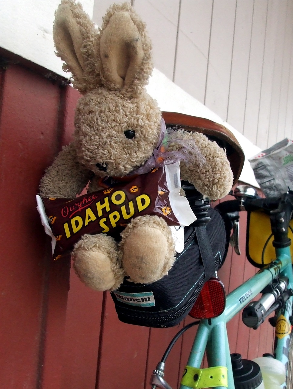
Yesterday I drove with my bike out to Battle Ground, Washington to continue testing out the route that my friend Andrew had designed for us to follow on the 180km "Dart" that we plan to ride in March. I'd done a portion of the route last week, but wanted to get a little bit further along this time. We have to submit the route for approval by March 9, and I wanted to have as much of it pre-ridden as I could by then. The section I'd chosen for Saturday's ride was from Battle Ground to Kelso, by way of LaCenter, Woodland, Kalama and Carrolls. The stretch from LaCenter to Kelso would all be new terrain for me, and I had no idea what to expect.
It was sunny, breezy and cold - 34 degrees - when I pulled into the parking lot of the Safeway in Battle Ground, my chosen start point. I had chemical hand and toe warmers with me, and decided to deploy them. I also pulled out the fleece ear warmers and wool helmet liner. I was quickly ready to ride and set off, after first checking that I had (1) locked the car, and (2) not locked my keys in it (I checked on that 4 times - because like all the cyclists I know, I am just a LITTLE bit OCD . . . )
The route from Battle Ground to LaCenter starts on a busy highway, but quickly gave over to farmland. Near Daybreak Park I turned onto the route followed by the Vancouver Bike Club's annual "Ride Around Clark County." Nice, narrow country roads with no shoulders that change their names every time they curve . . . just the kind of thing to give an anal OCD cyclist working on a cue sheet fits. Except for one steep sharp pitch on JA Moore Road, and another steep roller on Lockwood Creek, the route was very flat. I wish I could say the same for the section from LaCenter to Kelso.
I should have known there would be trouble when I was mapping the route out on Friday night and saw that I would be spending a good bit of time on "Green Mountain Road." Keyword: MOUNTAIN. It turned out to be over three miles of very steep uphill. I think that my top speed was about 5 mph, but I spent most of the time down between 3-4 mph. I had to stop THREE times because I was going so slowly that maintaining verticality was a challenge. I kept thinking, "Boy, I'd better get some awesome descent as pay-off for this!" But alas, it was not to be. The road back down (Lane Road - I kept wondering if it had a counterpart called "Road Lane" somewhere) was treacherous; very steep, with tight turns and a fine film of sand and gravel over the entire road surface. I, who rarely use my brakes on descents if I can help it, rode my brakes down the whole way. Toward the end, there is a section where the pavement was gone, and there was just hard pack dirt and gravel. It was only about 3 ft. wide, though, and passable. Whew! The rest of the route had more gentle slopes, but I was climbing for most of the segment. I spent most of my time paralleling I-5 on the old Pacific Highway (aka Cloverdale, 1st Street, Meeker, Cottonwood, Old 99 S, Kelso Drive, etc. etc. depending on what town I was in . . .). The roads were for the most part good, but had little to no shoulder. Traffic was light, though, and most of the drivers polites. I was chased by FOUR dogs at various times - one of them a large and scary Rottweiler . . . that was not so much fun.
It's just over 38 miles from Battle Ground to Kelso, and it took me 3 hours and 10 minutes to cover it, riding as hard as I could and stopping as little as possible (I stopped only to make notes for the cue sheet and to rest on Green Mountain Road). By the time I got to my designated end point, the 3 Rivers Safeway in Kelso, I was so very ready for my PB and banana sammich.
Coming home, I took Cloverdale up to Green Mountain instead of Lane. That was a mistake. The climb was even steeper than coming up the other side, and over two miles longer. At the top, the snow was deep on the ground and the sand was deep on the road. I wasn't able to really open up until I was almost to the bottom. Even so, at that point I still sustained speeds of 38 mph + the entire way down, with a top speed of 45 mph.
I stopped for another snack in LaCenter. I was virtuous and passed up the Girl Scout cookies being sold (I could have eaten an entire box and then later regretted it), and instead had some salty crackers, an orange and some more Gatorade. Back at the Battle Ground Safeway I got some very tasty chocolate soy milk and a Diet Coke, and finished off my salty crackers.
When I got home, Greg had all the ingredients set out for pizza. I quickly assembled it and shortly thereafter sat down to an eclectic but satisfying meal of a baked potato, a baked yam, two slices of pizza and salad. Greg ate the rest of the pizza, but I got his crusts . . .
Sunday, February 24, 2008

Wednesday, February 20, 2008

Saturday, February 16, 2008
Three Days, 228 miles. Not Bad For Mid-February . . .
Just when I was beginning to think I would never be able to take my fenders off the bike, the Presidents' Day weekend not only promised to be remarkably warm, sunny and dry, it followed THROUGH on that promise (unlike any actual PRESIDENT) . . . and so, like any good American, I took full advantage of the unexpected bonus, and rode my increasingly bony a** off.
Saturday, I met some friends down in Newberg to ride another 200 km (124.1 miles, give or take) "permanent" route, so as to get my February ride in for the RUSA R12 award. We chose to ride the "Three Prairies" permanent route, a relatively flat jaunt that starts and ends in Newberg (and goes back there in the middle of the ride as well!). My friends Lynne and Sal, who are both also trying for an R12, signed up to ride along with me. Our friend Andrew also tagged along but because he did not register for the ride in time, he could not get credit toward an R12. More importantly, because he was not registered, he would not be allowed to help any of us if we encountered mechanical trouble. We could help HIM, apparently (I told him 'Don't count on it. . . .") but not vice versa.
We arranged to leave Newberg at 8:00 AM - a relatively late start for a 200K, but Sal was driving up from Salem, and he likes to start at "civilized" times. I didn't mind - it meant we would be starting in daylight. Always a plus. I was up at 5:30, out the door by 6:30, but then spent 5 minutes scraping ice of my car. Hmmm. Good thing I had both hand and toe warmers packed in my bag. By mid-day, the temperature had reached 52 degrees, and I could discard the digit warmers.

I arrived in Newberg with plenty of time for a tasty soy cocoa at the Coffee Cottage, our designated meeting/start place. As we headed out, the temperature was 34 degrees, and there was frost on the ground in places. The 3 Prairies ride is just that - it loops through French, Red and Howell Prairies, with stops in Dallas and Mt. Angel, in addition with a stop in Newberg in the middle. In other words, we saw the good people at the Coffee Cottage at 7:30 AM, 1:54 PM, and 7:20 PM. More importantly, we ate their tasty baked goods at 7:30 AM, 1:54 PM, and 7:20 PM. The brownie at lunch was particularly delicious (of course, after I've been riding for 70 miles, I find that most food is delicious).
The ride itself is advertised as "amazingly flat." It nevertheless has about 3000 feet of elevation gain, but it is all in the form of long, steady grades - no rollers or sharp pitches (which, sadly, also means no screaming descents). Apart from the wine-tasting traffic hell that is the stretch between Newberg and Dayton, the roads were mostly low-traffic and rural (i.e. chip seal). LOTS of baby animals, mostly lambs.

At one point we startled a Coopers hawk that had just settled down to a nice lunch - apparently some large rodent, judging from the limp four-legged form hanging from the hawk's talons as it took off to find a less popular cafe.
Compared to Lynne's and my January 200 km ride, this one was a piece of cake - we reached all the controls well ahead of schedule (so I was not turning into an OCD mess) and we only had to ride in the dark for about an hour. I was not all that disappointed that we were still riding at sundown, because the sunset was spectacular!

We finished the ride at 7:30. Lynne's husband had called to tell her that he was cooking her a steak for dinner - for my part, I was looking forward to making the world's largest burrito. I pretty much just emptied the contents of my refrigerator into a tortilla. Some black beans, some left over baked tofu, some leftover filling from stuffed mushrooms (mushrooms, onions, garlic, TVP and spices), half an avocado, tomatoes, lettuce, lots of salsa, some plain yogurt . . . by the time I was done filling it, I couldn't fold the tortilla properly, so I made a tin foil cone to keep it from exploding.
Sunday, it was even sunnier and warmer than Saturday had been. Lynne rode over to my house, and we rode out to North Portland to meet our friend Beth for a short ride out to Smith & Bybee Lakes and then back to North Portland through St. Johns. This was most definitely a more leisurely ride - neither Lynne nor I felt like pushing it much after Saturday's adventure, and I had a 70+ mile ride planned for Monday . . . so we just meandered our way out along the Columbia Slough past Portland Meadows, PIR and the golf course to the lakes and on past on the Marine Drive bike path. At the end of the bike path we decided to skip riding into Kelly Point Park and just waved at it as we rode on past on our way to St. John's and the very fine Anna Bananas for some very tasty cheese and bread and, of course, bananas! I dropped Lynne off at a MAX stop (she didn't feel like riding up and over Sylvan again - I can't blame her) and I headed home to spend some quality time at the garden center with Greg. We needed to re-pot the two dwarf blueberries that live on our front porch before the terra cotta pots they had been in completely disintegrated. Since I can never leave the nursery without several enormous bags of compost, we also spent some quality time amending soil. By the time we were done, I was definitely ready for dinner - the first outdoor grilling of the year - piles of grilled vegetables on arugula and grilled lavash pizzas with green olives, fennel and dill . . . mmmmm
For Monday, I had set myself the task of "pre-riding" part of a route my friend Andrew had put together for us to use in a 12-hr "Dart" scheduled for March 22. We will start from Portland and end in Centralia, Washington, with stops in Vancouver, Battle Ground, Kelso and Winlock. I planned to check out the section from Portland to Battle Ground, because neither Andre nor I knew much about the roads that were in his map (he was drawing on other folks' knowledge in planning). I spent a few hours on Sunday night checking the cue sheet against gmaps, and finding that there were some very confusing parts to the directions. Mainly, all the streets seemed to have different names! Anyway, I finally figured it out (at least I hoped I had). By my calculations, the "pre-ride" would be about 40 miles, and then to get home would be another 30 or so, so I planned to leave as soon as it was light out.
As it was, I didn't make it out the door until about 7:45. By then, it was already noticeably warmer than it had been either Saturday or Sunday. But it was still cold enough that I needed leg warmers, thermal gloves and a jacket over my long-sleeved jersey. I threw some digit warmers into my bag, just in case . . .
Once I crossed over the Columbia River and into downtown Vancouver, it was noticeably chillier - there was frost on the ground and a cold wind. A hot cocoa helped me cope with that, though, and I never did need to pull out the chemical warmers. The route from Vancouver to Battle Ground was decidedly urban, but tolerable. I wouldn't want to ride some of those streets on a regular work day, though. I am guessing that they are pretty busy. On a holiday, however, they were not so bad.
All my map reading Sunday night helped me stay on track except for one section. Vancouver is one of those weird cities that has number streets AND numbered avenues, and they intersect each other in odd ways, so that if you have a number in mind but aren't sure if it is, for example "50th Street" or "50th Avenue," you can end up lost. Even if you DO have that part straight, you can still get lost because every once in a while the street numbers are out of sequence. Suffice it to say, I now know EXACTLY where to turn off St. John's Road to get to Salmon Creek.
Battle Ground is ugly. But once you get out of Battle Ground and head toward LaCenter, it gets downright pretty. It also gets hilly. And one street goes through 6 name changes. Grr. Again, however, the map reading [aid off, and I was able to figure out where to go. I reached LaCenter at lunch time, and thoroughly enjoyed my peanut butter and Ricemallow creme sammich. I also enjoyed pulling off the leg warmers and jacket for the first time this season. My knees didn't know what hit them.
Andrew's cue sheet would not help me get home from LaCenter, and I didn't want to just retrace what I had just done. Fortunately, I found a route on bikely.com that included the stretch from downtown LaCenter to downtown Vancouver (once downtown in the 'Couve, I could get home on my own). The bikely route was GREAT. It took me through some interesting rural parts of LaCenter and Ridgefield, and then through some Vancouver neighborhoods before dumping me out into downtown. Riding through the neighborhoods was interesting - there were some hidden bike pass-throughs to get from one block to the next. One "enterprising" jerk had transformed one of the bike pass-throughs into a second driveway, however.

The only part of the route that I did not like was where I had to ride on Hwy 99 for a while. That sucked. The road surface was bad, the bike lanes were full of tire-chewing debris, and the traffic was very heavy. Fortunately, that was only for about a mile, and then I peeled off onto the quieter neighborhoods just northwest of downtown. The best part of the route was climbing to the top of the "ridge" in Ridgefield, and then blasting straight downhill for what seemed like ages. The climb itself wasn't so bad, because the road I was on did it in stair-steps. Once I got to the top and turned around to see where I had come from, I was impressed by how high up I was.
Once I crossed back over the river to Oregon, I took my standard route home from Marine Drive. By the time I got to Ladd's Addition, my odometer showed 74.6 miles, so I rode arounf Ladd Circle a few times to ensure that it would read 75 by the time I got home. In the end, I could have left off one of those circuits, because the final readout in my back yard was 75.2.
Like I said, not bad for mid-February.

Saturday, I met some friends down in Newberg to ride another 200 km (124.1 miles, give or take) "permanent" route, so as to get my February ride in for the RUSA R12 award. We chose to ride the "Three Prairies" permanent route, a relatively flat jaunt that starts and ends in Newberg (and goes back there in the middle of the ride as well!). My friends Lynne and Sal, who are both also trying for an R12, signed up to ride along with me. Our friend Andrew also tagged along but because he did not register for the ride in time, he could not get credit toward an R12. More importantly, because he was not registered, he would not be allowed to help any of us if we encountered mechanical trouble. We could help HIM, apparently (I told him 'Don't count on it. . . .") but not vice versa.
We arranged to leave Newberg at 8:00 AM - a relatively late start for a 200K, but Sal was driving up from Salem, and he likes to start at "civilized" times. I didn't mind - it meant we would be starting in daylight. Always a plus. I was up at 5:30, out the door by 6:30, but then spent 5 minutes scraping ice of my car. Hmmm. Good thing I had both hand and toe warmers packed in my bag. By mid-day, the temperature had reached 52 degrees, and I could discard the digit warmers.

I arrived in Newberg with plenty of time for a tasty soy cocoa at the Coffee Cottage, our designated meeting/start place. As we headed out, the temperature was 34 degrees, and there was frost on the ground in places. The 3 Prairies ride is just that - it loops through French, Red and Howell Prairies, with stops in Dallas and Mt. Angel, in addition with a stop in Newberg in the middle. In other words, we saw the good people at the Coffee Cottage at 7:30 AM, 1:54 PM, and 7:20 PM. More importantly, we ate their tasty baked goods at 7:30 AM, 1:54 PM, and 7:20 PM. The brownie at lunch was particularly delicious (of course, after I've been riding for 70 miles, I find that most food is delicious).
The ride itself is advertised as "amazingly flat." It nevertheless has about 3000 feet of elevation gain, but it is all in the form of long, steady grades - no rollers or sharp pitches (which, sadly, also means no screaming descents). Apart from the wine-tasting traffic hell that is the stretch between Newberg and Dayton, the roads were mostly low-traffic and rural (i.e. chip seal). LOTS of baby animals, mostly lambs.
At one point we startled a Coopers hawk that had just settled down to a nice lunch - apparently some large rodent, judging from the limp four-legged form hanging from the hawk's talons as it took off to find a less popular cafe.
Compared to Lynne's and my January 200 km ride, this one was a piece of cake - we reached all the controls well ahead of schedule (so I was not turning into an OCD mess) and we only had to ride in the dark for about an hour. I was not all that disappointed that we were still riding at sundown, because the sunset was spectacular!
We finished the ride at 7:30. Lynne's husband had called to tell her that he was cooking her a steak for dinner - for my part, I was looking forward to making the world's largest burrito. I pretty much just emptied the contents of my refrigerator into a tortilla. Some black beans, some left over baked tofu, some leftover filling from stuffed mushrooms (mushrooms, onions, garlic, TVP and spices), half an avocado, tomatoes, lettuce, lots of salsa, some plain yogurt . . . by the time I was done filling it, I couldn't fold the tortilla properly, so I made a tin foil cone to keep it from exploding.
Sunday, it was even sunnier and warmer than Saturday had been. Lynne rode over to my house, and we rode out to North Portland to meet our friend Beth for a short ride out to Smith & Bybee Lakes and then back to North Portland through St. Johns. This was most definitely a more leisurely ride - neither Lynne nor I felt like pushing it much after Saturday's adventure, and I had a 70+ mile ride planned for Monday . . . so we just meandered our way out along the Columbia Slough past Portland Meadows, PIR and the golf course to the lakes and on past on the Marine Drive bike path. At the end of the bike path we decided to skip riding into Kelly Point Park and just waved at it as we rode on past on our way to St. John's and the very fine Anna Bananas for some very tasty cheese and bread and, of course, bananas! I dropped Lynne off at a MAX stop (she didn't feel like riding up and over Sylvan again - I can't blame her) and I headed home to spend some quality time at the garden center with Greg. We needed to re-pot the two dwarf blueberries that live on our front porch before the terra cotta pots they had been in completely disintegrated. Since I can never leave the nursery without several enormous bags of compost, we also spent some quality time amending soil. By the time we were done, I was definitely ready for dinner - the first outdoor grilling of the year - piles of grilled vegetables on arugula and grilled lavash pizzas with green olives, fennel and dill . . . mmmmm
For Monday, I had set myself the task of "pre-riding" part of a route my friend Andrew had put together for us to use in a 12-hr "Dart" scheduled for March 22. We will start from Portland and end in Centralia, Washington, with stops in Vancouver, Battle Ground, Kelso and Winlock. I planned to check out the section from Portland to Battle Ground, because neither Andre nor I knew much about the roads that were in his map (he was drawing on other folks' knowledge in planning). I spent a few hours on Sunday night checking the cue sheet against gmaps, and finding that there were some very confusing parts to the directions. Mainly, all the streets seemed to have different names! Anyway, I finally figured it out (at least I hoped I had). By my calculations, the "pre-ride" would be about 40 miles, and then to get home would be another 30 or so, so I planned to leave as soon as it was light out.
As it was, I didn't make it out the door until about 7:45. By then, it was already noticeably warmer than it had been either Saturday or Sunday. But it was still cold enough that I needed leg warmers, thermal gloves and a jacket over my long-sleeved jersey. I threw some digit warmers into my bag, just in case . . .
Once I crossed over the Columbia River and into downtown Vancouver, it was noticeably chillier - there was frost on the ground and a cold wind. A hot cocoa helped me cope with that, though, and I never did need to pull out the chemical warmers. The route from Vancouver to Battle Ground was decidedly urban, but tolerable. I wouldn't want to ride some of those streets on a regular work day, though. I am guessing that they are pretty busy. On a holiday, however, they were not so bad.
All my map reading Sunday night helped me stay on track except for one section. Vancouver is one of those weird cities that has number streets AND numbered avenues, and they intersect each other in odd ways, so that if you have a number in mind but aren't sure if it is, for example "50th Street" or "50th Avenue," you can end up lost. Even if you DO have that part straight, you can still get lost because every once in a while the street numbers are out of sequence. Suffice it to say, I now know EXACTLY where to turn off St. John's Road to get to Salmon Creek.
Battle Ground is ugly. But once you get out of Battle Ground and head toward LaCenter, it gets downright pretty. It also gets hilly. And one street goes through 6 name changes. Grr. Again, however, the map reading [aid off, and I was able to figure out where to go. I reached LaCenter at lunch time, and thoroughly enjoyed my peanut butter and Ricemallow creme sammich. I also enjoyed pulling off the leg warmers and jacket for the first time this season. My knees didn't know what hit them.
Andrew's cue sheet would not help me get home from LaCenter, and I didn't want to just retrace what I had just done. Fortunately, I found a route on bikely.com that included the stretch from downtown LaCenter to downtown Vancouver (once downtown in the 'Couve, I could get home on my own). The bikely route was GREAT. It took me through some interesting rural parts of LaCenter and Ridgefield, and then through some Vancouver neighborhoods before dumping me out into downtown. Riding through the neighborhoods was interesting - there were some hidden bike pass-throughs to get from one block to the next. One "enterprising" jerk had transformed one of the bike pass-throughs into a second driveway, however.
The only part of the route that I did not like was where I had to ride on Hwy 99 for a while. That sucked. The road surface was bad, the bike lanes were full of tire-chewing debris, and the traffic was very heavy. Fortunately, that was only for about a mile, and then I peeled off onto the quieter neighborhoods just northwest of downtown. The best part of the route was climbing to the top of the "ridge" in Ridgefield, and then blasting straight downhill for what seemed like ages. The climb itself wasn't so bad, because the road I was on did it in stair-steps. Once I got to the top and turned around to see where I had come from, I was impressed by how high up I was.
Once I crossed back over the river to Oregon, I took my standard route home from Marine Drive. By the time I got to Ladd's Addition, my odometer showed 74.6 miles, so I rode arounf Ladd Circle a few times to ensure that it would read 75 by the time I got home. In the end, I could have left off one of those circuits, because the final readout in my back yard was 75.2.
Like I said, not bad for mid-February.
Tuesday, January 22, 2008
An Open Letter to the Good People at Showers Pass
This is me:

These are my friends, Lynne and Jason:

This is my friend, Rickey:

We ride.
A lot.
Thousands of miles a year.
And we do it in Oregon, which means that many of those miles are in the rain.
Consequently, we have a vested interest (pun intended) in seeking out the most effective cycling rain gear.
As you can see, we have all concluded that the Showers Pass Elite jacket is the best item on the market, and have further concluded that no one who rides in the Pacific Northwest should be without one.
Which brings me to my dilemma.
This is TRFKAF.

TRFKAF is my riding buddy. Where I go, he goes. He's not the greatest stoker, but he keeps me company. Sadly, TRFKAF does not have a rain jacket, so he gets very wet and cold. He would love to have a Showers Pass jacket of his very own, but has been unable to find one in a size extra-extra-extra-extra-small.
So, dear Showers Pass people, this is our query - what are the chances of you coming up with a line of rain gear for rider's mascots? Inquiring rabbits want to know.
Because until then, it's the ignominy of the New York Times bag . . .

These are my friends, Lynne and Jason:
This is my friend, Rickey:
We ride.
A lot.
Thousands of miles a year.
And we do it in Oregon, which means that many of those miles are in the rain.
Consequently, we have a vested interest (pun intended) in seeking out the most effective cycling rain gear.
As you can see, we have all concluded that the Showers Pass Elite jacket is the best item on the market, and have further concluded that no one who rides in the Pacific Northwest should be without one.
Which brings me to my dilemma.
This is TRFKAF.
TRFKAF is my riding buddy. Where I go, he goes. He's not the greatest stoker, but he keeps me company. Sadly, TRFKAF does not have a rain jacket, so he gets very wet and cold. He would love to have a Showers Pass jacket of his very own, but has been unable to find one in a size extra-extra-extra-extra-small.
So, dear Showers Pass people, this is our query - what are the chances of you coming up with a line of rain gear for rider's mascots? Inquiring rabbits want to know.
Because until then, it's the ignominy of the New York Times bag . . .

Sunday, January 20, 2008
One Down, Eleven To Go
One of my goals for 2008 is to complete a randonneuring R-12. In order to do so, I must ride one (at least) brevet or permanent of at least 200 kilometers per month for 12 consecutive months. I was on my way to an R12 in 2007 until I blew out my left hamstring and calf, which kept me off the bike for a couple of months. But by last week I felt healed and strong enough to start the process all over again, so I recruited Lynne (never TOO difficult) and we signed up to do the Scio Covered Bridges permanent.

Two other Oregon Randonneurs, Bill Alsup and Marcello Napolitano, decided to join us and we agreed that we would leave the start in Wilsonville, Oregon at 6:30 AM on January 19.
At the beginning of the week, the weather forecast wasn't too bad; for Oregon in mid-January, that is. Partly cloudy, mid-40s. Perfectly reasonable winter riding weather. As the week progressed, the forecast deteriorated. By Thursday, the forecast was for showers, with temperatures in the upper 30s. Still reasonable, as far as I was concerned, assuming I had the proper gear. Hmm. Gear. One never really has enough gear, does one? As I pondered the state of my winter apparel, I decided that a new pair of unpadded thermal tights might be a good thing to have. I decided to call Team Estrogen and chat with one of their experts. Mind you, this was at 11:00 AM on Thursday morning and I would need the tights by Saturday at 5:30 AM, which was when I would be leaving my house for the ride . . . but TE is in Hillsboro, Oregon and in the past everything I have ordered from them has arrived at my house the next day. I was counting on that to hold true this time. As it turns out, so was Lynne. While I was busy ordering tights, she was ordering a new long-sleeve wool zip-T. Anyway, I decided to get the Craft "Storm" tights, and sure enough they were waiting for me on the porch when I got home from work on Friday.
I spent most of Friday evening making sure I had everything I needed. I knew we would be in the dark for at least an hour in the morning and possibly another 2 hours in the evening (I was estimating it would take us about 11 hours to complete the route). The bike I am currently riding isn't really designed for distance riding, and so everything was just a wee bit jury-rigged. The handlebar bag that I use for longer rides prevents me from putting headlights on my bars, so I strapped the two lights that I use the most to the front fork with pump straps, instead. One of the lights, an astonishingly bright DiNotte, has a rechargeable battery pack, which also had to be strapped to the front fork and in a way that it did not interfere with the signal for my wireless computer. It also involved working around the straps for my temporary fenders, but with a little patience I was able to make it work. Another reason that I will I be glad when the new rando-specific bike is done . . .
The next task was to make sure the bike bags were packed. In the seat bag I have bike tools, spare tubes, patch kits, first aid kit, baby wipes, extra batteries, extra lights, and a lock. In front I carried my camera, my keys, my food and some more baby wipes.
Once the bike was kitted out, I needed to make sure I was kitted out. Thermal sports bra? Check. Wool zip-T? Check. Wool Jersey? Check. Shorts with long distance chamois? Check. Thermal tights? Check. Wool socks? Check. Extra wool socks? Check. Gloves? Check. Extra gloves? Check. S'Mittens? Check. Wool beanie? Check. Reflective vest and leg bands? Check.
Reflective helmet with map-reading light? Check. Winter cycling boots and shoe covers? Check. Showers Pass rain jacket? Check.
Time for bed.
Up at 4:30 for a hearty breakfast of peanut butter and banana on a pumpernickel bagel, and out the door at 5:30 for the half hour drive to the start. I hate driving to the start of rides, but riding to and from the start would have added another 50 miles and 4 or so hours to the day, and at this time of year I wasn't quite ready for that!
Lynne was already at the official "start" (Wilsonville City Hall) when I arrived. It took me a while to unload the bike and make sure everything was in place. I spent another 10 minutes or so fighting with my new shoe covers and new riding boots. The boots have a thick lugged sole, and it is difficult to get a cover around it - but then I realized (far later than I should have realized) that because the shoe cover had an open bottom, I could slip the cover over my foot and up my calf before I put the boot on, and then pull the cover down over the top of the boot. Duh.
By this time it was 6:30, and we had not seen either Bill or Marcello. We figured that they, having a little more sense then we did, had decided to skip the ride. We saddled up and headed for the nearest Starbucks, in order to get something hot to drink and a time-stamped receipt. While we there, Bill showed up and then we were 3.
The beginning of the ride was less than fun - we had to go onto Interstate 5 to cross the Willamette River. 1.1 miles of debris-filled freeway shoulder in the dark is not my idea of a good time. It's not my idea of a good time in the light, either, but at least then I had a better view of the debris. Fortunately, we all had good lights, especially Lynne.
Once we were off the freeway, we headed east toward Canby and then turned south toward the first control in Scio - 50 miles away. At this point it was dark, and it was cold (somewhere around 32 degrees), but at least it wasn't raining. And I was so well-covered that, except for my toes, nose and cheeks, I was warm as toast. Lynne was TOO warm - she had to stop and remove one layer.
Those first 50 miles were, um, miserable. We were climbing steadily (I am questioning the route description, which claims a total elevation gain of only 3000 feet), and into a headwind. Our average speed was a sluggish 11.4 mph, and three hours into the ride I began to panic that we would not make any of the controls in time. Based on the time we left Wilsonville, we had to reach Scio by 11:51. Outside of Scio is a set of rollers that are nothing less than evil. Extremely steep, but with too much room at the base to allow you to use any of the momentum to help you up the next slope. I was ahead of Bill and Lynne and waited for them at the top of the first roller. When they pulled up, they asked if I had seen the cyclist ahead of us. I hadn't - I guess I had my head down as I struggled up the hill. The next roller was even worse. Just before the top, it pitched just a little too much for me, and I had to get off my bike and push it the last few yards. I can't think of the last time I had to walk my bike up a hill.
We reached Scio with literally no time to spare. My receipt from the market showed 11:51. As I rode up to the market, who should I see but Marcello. He had been at City Hall at 6:30, but must have been at the other side of the parking lot. He figured we weren't coming, and so he set off on his own. He had been the rider ahead of us on the rollers, and he admitted that he. too, had walked on the last one. After a short rest, we all four left Scio together. Marcello was faster than we were, however, and he quickly left us behind. It was still cold - 33 degrees- and it started to rain. Well, drizzle. The new tights were performing admirably, though, and I never felt wet.
The next timed control was in Salem. We had to get there by 3:55. The road had flattened out a bit, and we had turned out of the wind, but we again ended up getting into town with no time to spare. At this point I was very concerned that we would not make the cut-off time at the end in Wilsonville. It was still drizzling and it was getting dark - two things that would slow our already-slow pace. Add to that the difficulty in just getting the heck OUT of Salem. It is not a particularly bike-friendly city, and we had to detour around construction at one point. But we finally got to the edge of town and got our speed back up.
By this time it was very dark. Fortunately, the roads on this part of the ride were very familiar, because they are all in one ride or another that I do on a regular basis. I am not saying I can ride them with my eyes closed, but I can ride them with very little illumination . . . the rain (drizzle) finally stopped, and it seemed a little warmer, which I think helped us to pick up our pace. By my calculations, we had until 8:04 PM to reach Wilsonville (13 hours and 24 minutes after we started) and I was alternating between checking my watch and checking our mileage. We were definitely making better time and barring no mechanical issues it looked like we'd finish in time. I stopped panicking.
We had to go back on the freeway bridge to cross the river. The shoulder on this side was even worse than on the southbound side. I rode as quickly as I could to get the heck off, and waited for Bill and Lynne to catch up before heading back to the Starbucks from which we had begun the ride 12 hours and 58 minutes earlier.

All told, it was a tough ride. But on the plus side, most of the roads were lovely, and there were all sorts of cute baby animals at the various farms we passed. I was surprised to see so many lambs so early in the year, but Lynne explained that sheep are in season no matter what the season, and so lambing can take place year-round if the farmers let it. In addition to sheep, we saw many horse (some wearing raincoats), some alpaca, some pygmy goats, and one lonely emu. I'll try it again in the summer, perhaps . .
Total ride time: 12 hours 58 minutes
Saddle time: 10 hours 9 minutes 6 seconds
Distance: 127.5 miles
Avg. Speed: 12.5 mph
Calories burned: 6041
Two other Oregon Randonneurs, Bill Alsup and Marcello Napolitano, decided to join us and we agreed that we would leave the start in Wilsonville, Oregon at 6:30 AM on January 19.
At the beginning of the week, the weather forecast wasn't too bad; for Oregon in mid-January, that is. Partly cloudy, mid-40s. Perfectly reasonable winter riding weather. As the week progressed, the forecast deteriorated. By Thursday, the forecast was for showers, with temperatures in the upper 30s. Still reasonable, as far as I was concerned, assuming I had the proper gear. Hmm. Gear. One never really has enough gear, does one? As I pondered the state of my winter apparel, I decided that a new pair of unpadded thermal tights might be a good thing to have. I decided to call Team Estrogen and chat with one of their experts. Mind you, this was at 11:00 AM on Thursday morning and I would need the tights by Saturday at 5:30 AM, which was when I would be leaving my house for the ride . . . but TE is in Hillsboro, Oregon and in the past everything I have ordered from them has arrived at my house the next day. I was counting on that to hold true this time. As it turns out, so was Lynne. While I was busy ordering tights, she was ordering a new long-sleeve wool zip-T. Anyway, I decided to get the Craft "Storm" tights, and sure enough they were waiting for me on the porch when I got home from work on Friday.
I spent most of Friday evening making sure I had everything I needed. I knew we would be in the dark for at least an hour in the morning and possibly another 2 hours in the evening (I was estimating it would take us about 11 hours to complete the route). The bike I am currently riding isn't really designed for distance riding, and so everything was just a wee bit jury-rigged. The handlebar bag that I use for longer rides prevents me from putting headlights on my bars, so I strapped the two lights that I use the most to the front fork with pump straps, instead. One of the lights, an astonishingly bright DiNotte, has a rechargeable battery pack, which also had to be strapped to the front fork and in a way that it did not interfere with the signal for my wireless computer. It also involved working around the straps for my temporary fenders, but with a little patience I was able to make it work. Another reason that I will I be glad when the new rando-specific bike is done . . .
The next task was to make sure the bike bags were packed. In the seat bag I have bike tools, spare tubes, patch kits, first aid kit, baby wipes, extra batteries, extra lights, and a lock. In front I carried my camera, my keys, my food and some more baby wipes.
Once the bike was kitted out, I needed to make sure I was kitted out. Thermal sports bra? Check. Wool zip-T? Check. Wool Jersey? Check. Shorts with long distance chamois? Check. Thermal tights? Check. Wool socks? Check. Extra wool socks? Check. Gloves? Check. Extra gloves? Check. S'Mittens? Check. Wool beanie? Check. Reflective vest and leg bands? Check.
Reflective helmet with map-reading light? Check. Winter cycling boots and shoe covers? Check. Showers Pass rain jacket? Check.
Time for bed.
Up at 4:30 for a hearty breakfast of peanut butter and banana on a pumpernickel bagel, and out the door at 5:30 for the half hour drive to the start. I hate driving to the start of rides, but riding to and from the start would have added another 50 miles and 4 or so hours to the day, and at this time of year I wasn't quite ready for that!
Lynne was already at the official "start" (Wilsonville City Hall) when I arrived. It took me a while to unload the bike and make sure everything was in place. I spent another 10 minutes or so fighting with my new shoe covers and new riding boots. The boots have a thick lugged sole, and it is difficult to get a cover around it - but then I realized (far later than I should have realized) that because the shoe cover had an open bottom, I could slip the cover over my foot and up my calf before I put the boot on, and then pull the cover down over the top of the boot. Duh.
By this time it was 6:30, and we had not seen either Bill or Marcello. We figured that they, having a little more sense then we did, had decided to skip the ride. We saddled up and headed for the nearest Starbucks, in order to get something hot to drink and a time-stamped receipt. While we there, Bill showed up and then we were 3.
The beginning of the ride was less than fun - we had to go onto Interstate 5 to cross the Willamette River. 1.1 miles of debris-filled freeway shoulder in the dark is not my idea of a good time. It's not my idea of a good time in the light, either, but at least then I had a better view of the debris. Fortunately, we all had good lights, especially Lynne.
Once we were off the freeway, we headed east toward Canby and then turned south toward the first control in Scio - 50 miles away. At this point it was dark, and it was cold (somewhere around 32 degrees), but at least it wasn't raining. And I was so well-covered that, except for my toes, nose and cheeks, I was warm as toast. Lynne was TOO warm - she had to stop and remove one layer.
Those first 50 miles were, um, miserable. We were climbing steadily (I am questioning the route description, which claims a total elevation gain of only 3000 feet), and into a headwind. Our average speed was a sluggish 11.4 mph, and three hours into the ride I began to panic that we would not make any of the controls in time. Based on the time we left Wilsonville, we had to reach Scio by 11:51. Outside of Scio is a set of rollers that are nothing less than evil. Extremely steep, but with too much room at the base to allow you to use any of the momentum to help you up the next slope. I was ahead of Bill and Lynne and waited for them at the top of the first roller. When they pulled up, they asked if I had seen the cyclist ahead of us. I hadn't - I guess I had my head down as I struggled up the hill. The next roller was even worse. Just before the top, it pitched just a little too much for me, and I had to get off my bike and push it the last few yards. I can't think of the last time I had to walk my bike up a hill.
We reached Scio with literally no time to spare. My receipt from the market showed 11:51. As I rode up to the market, who should I see but Marcello. He had been at City Hall at 6:30, but must have been at the other side of the parking lot. He figured we weren't coming, and so he set off on his own. He had been the rider ahead of us on the rollers, and he admitted that he. too, had walked on the last one. After a short rest, we all four left Scio together. Marcello was faster than we were, however, and he quickly left us behind. It was still cold - 33 degrees- and it started to rain. Well, drizzle. The new tights were performing admirably, though, and I never felt wet.
The next timed control was in Salem. We had to get there by 3:55. The road had flattened out a bit, and we had turned out of the wind, but we again ended up getting into town with no time to spare. At this point I was very concerned that we would not make the cut-off time at the end in Wilsonville. It was still drizzling and it was getting dark - two things that would slow our already-slow pace. Add to that the difficulty in just getting the heck OUT of Salem. It is not a particularly bike-friendly city, and we had to detour around construction at one point. But we finally got to the edge of town and got our speed back up.
By this time it was very dark. Fortunately, the roads on this part of the ride were very familiar, because they are all in one ride or another that I do on a regular basis. I am not saying I can ride them with my eyes closed, but I can ride them with very little illumination . . . the rain (drizzle) finally stopped, and it seemed a little warmer, which I think helped us to pick up our pace. By my calculations, we had until 8:04 PM to reach Wilsonville (13 hours and 24 minutes after we started) and I was alternating between checking my watch and checking our mileage. We were definitely making better time and barring no mechanical issues it looked like we'd finish in time. I stopped panicking.
We had to go back on the freeway bridge to cross the river. The shoulder on this side was even worse than on the southbound side. I rode as quickly as I could to get the heck off, and waited for Bill and Lynne to catch up before heading back to the Starbucks from which we had begun the ride 12 hours and 58 minutes earlier.
All told, it was a tough ride. But on the plus side, most of the roads were lovely, and there were all sorts of cute baby animals at the various farms we passed. I was surprised to see so many lambs so early in the year, but Lynne explained that sheep are in season no matter what the season, and so lambing can take place year-round if the farmers let it. In addition to sheep, we saw many horse (some wearing raincoats), some alpaca, some pygmy goats, and one lonely emu. I'll try it again in the summer, perhaps . .
Total ride time: 12 hours 58 minutes
Saddle time: 10 hours 9 minutes 6 seconds
Distance: 127.5 miles
Avg. Speed: 12.5 mph
Calories burned: 6041
Sunday, December 23, 2007
Beefeaters, Big Ben, and a Bulldog.

Meet the newest addition to my stable - a single-speed Specialized Langster "London." It is a truly ridiculous bike, from the red-rimmed wheels to the white-painted chain, but I think it will be pretty fun to ride. It has a flip-flop rear hub, so I can run it as either a fixed-gear or freewheel, depending on how much work I feel like doing.
A local newspaper held an eBay auction to benefit a local charity called Sisters of the Road, which provides services to Portland's homeless population. The Langster was one of the auction items, and because I had been contemplating getting a fixie for lunchtime rides in flat, flat Salem, I decided to bid on it.
I did not bid very high, because I don't really NEED another bike, but I still managed to win the auction. I had the option of paying a little more than my bid to get the "London" ediiton, and it made me laugh so much when I saw it that I just had to go for it.

Sunday, December 09, 2007
Getting Better All the Time
This weekend I rode both Saturday and Sunday, about 35 miles each day. Still no long climbs, yet, but I am definitely getting back into gear. Literally.
Wastelands and Wetlands
Today Lynne came over to my side of the river for a ride. Sort of like the country mouse cyclist comes to the big city, she said, after I nearly gave her a heart attack with an abrupt turn through a bicycle pass-through she didn't realize existed . . .
Anyway, we got a late start because we wanted to let the temps rise high enough so that black ice wouldn't be a problem. Little did we realize that the temps weren't likely to rise much at all. . . Right when Lynne was about to leave her house for mine, it started snowing.

I called her:
"Um, Lynne - it's snowing at my house."
"Yeah, it's snowing at my house, too!"
"I still want to ride."
"I still want to ride, too!"
45 minutes later, my doorbell rang, and there she was, in one of her second-warmest jerseys. A Hanukkah present, I believe. Pink, of course.
And we were off.
I am still not ready to ride up "real" hills, so I chose another of the flattest routes I could find. This one wound through North Portland to a multi-use path called The Peninsula Crossing Trail.

It links Willamette and Columbia Boulevards, and then continues on past Columbia Boulevard to some really interesting wetlands, and finally to the Smith & Bybee Lakes wetlands.

From there, we rode along Marine Drive to Kelly Point Park, the westernmost part of the City of Portland, which is at the confluence of the Willamette and Columbia Rivers.


From Kelly Point Park, we rode through an industrial wasteland characterized by freight shipping terminals, back through North Portland and then through the Alameda district (Stately Mansions "R" Us) to Hollywood.
We stopped for hot cocoa and grilled cheese at the Daily Market,

and then we went searching for the Hollywood Max stop so Lynne could get back over the hill to home. It turned out to be all of about 6 blocks from the cafe. By this time it had started sprinkling again, so it was a good time to end the ride and head home!
After a hot bath and a hot cup of tea, I was thawed out enough to make dinner - Roasted Butternut Squash Soup from the Vegan With A Vengeance Cookbook, and whole wheat "no knead" bread.
Mmmmmm.
Anyway, we got a late start because we wanted to let the temps rise high enough so that black ice wouldn't be a problem. Little did we realize that the temps weren't likely to rise much at all. . . Right when Lynne was about to leave her house for mine, it started snowing.
I called her:
"Um, Lynne - it's snowing at my house."
"Yeah, it's snowing at my house, too!"
"I still want to ride."
"I still want to ride, too!"
45 minutes later, my doorbell rang, and there she was, in one of her second-warmest jerseys. A Hanukkah present, I believe. Pink, of course.
And we were off.
I am still not ready to ride up "real" hills, so I chose another of the flattest routes I could find. This one wound through North Portland to a multi-use path called The Peninsula Crossing Trail.
It links Willamette and Columbia Boulevards, and then continues on past Columbia Boulevard to some really interesting wetlands, and finally to the Smith & Bybee Lakes wetlands.
From there, we rode along Marine Drive to Kelly Point Park, the westernmost part of the City of Portland, which is at the confluence of the Willamette and Columbia Rivers.
From Kelly Point Park, we rode through an industrial wasteland characterized by freight shipping terminals, back through North Portland and then through the Alameda district (Stately Mansions "R" Us) to Hollywood.
We stopped for hot cocoa and grilled cheese at the Daily Market,
and then we went searching for the Hollywood Max stop so Lynne could get back over the hill to home. It turned out to be all of about 6 blocks from the cafe. By this time it had started sprinkling again, so it was a good time to end the ride and head home!
After a hot bath and a hot cup of tea, I was thawed out enough to make dinner - Roasted Butternut Squash Soup from the Vegan With A Vengeance Cookbook, and whole wheat "no knead" bread.
Mmmmmm.
Saturday, December 08, 2007
Can't Hardly Wait!
There's a rumour going round that a certain frame is next in line for powder-coating and a certain kandy-kolored heliotrope streamline baby may be coming home next week . . . . .
Saturday, December 01, 2007
On the (Slow) Road to Recovery
I'm baaaaaaaaaack.
Well, sort of.
Let's put it this way - by the time I take delivery of the Heliotrope Wonder, I will be ready to ride it. I may not be ready to ride it more than 30 miles, and those would have to be flat, but at least I won't be forced to sit and stare at it with unrequited longing.
Anyway, today I went out for my first REAL bike ride in 5 weeks. I had done 30 minutes on a stationary bike on Thursday with no ill effect, and so figured I was ready to try something short and flat. I considered going out to Hillsboro for the Velo ride, but the forecast was for snow above 500 feet and I didn't feel like driving my car over the SW hills with all the Portland numbskulls who don't know how to drive in snow. Yes, my years of living in Illinois and Vermont DO make me feel a tad bit superior in that arena, thank you very much . . . .
Plus, I know myself too well - if I rode with a group I would kill myself to keep up, even if my leg were screaming at me to stop. So I decided to take a solo ride on the flattest course I know, the
Springwater Corridor, a local Rails to Trails project. My goal was to go to Gresham and then turn around and come back, but I stopped at Paesano Park, or whatever it's called (where the Barlow Century starts) because it was starting to snow and I was getting a headache from bouncing on the chipseal (my favorite part of the Springwater is when it crosses the city line into Gresham and the pavement turns to nice, smooth asphalt . . .). On the way home, the snow started falling fairly heavily, but the ground was far too warm for it to stick. It didn't snow for long, but it sure was pretty while it did - nice, big fluffy flakes.
I decided not to go all the way home on the trail - out and back rides are SO boring - and so turned off about halfway back and took city streets the rest of the way home - it snowed again briefly, but there was very little traffic, so I was not worried. What WAS worrying me was that my hands had suddenly gone completely stiff and numb. I have Raynaud's and cold weather does a number on the circulation to my extremities, and I have yet to find the perfect glove - I had on my warmest, Descente Wombats, but they were not doing the trick. Braking and shifting suddenly became a much more difficult proposition . . .and there was one pretty steep downhill on the way back. Yes, I managed to pick a route with no climbing, yet still got to go downhill fast - my kind of ride!
Checked my stats when I got home - I was out for just under 2 hours and rode 27 miles. Kind of slow, but I expected that - the chipseal certainly didn't help my pace. My leg felt okay. I made sure to stretch well once I got back, and it still feels okay - the torn calf muscle is sore, but not extremely so, and the hamstring seems fine. Of course, the pain in my hands when the blood finally started flowing back into my fingers may have masked any pain in the leg!
Well, sort of.
Let's put it this way - by the time I take delivery of the Heliotrope Wonder, I will be ready to ride it. I may not be ready to ride it more than 30 miles, and those would have to be flat, but at least I won't be forced to sit and stare at it with unrequited longing.
Anyway, today I went out for my first REAL bike ride in 5 weeks. I had done 30 minutes on a stationary bike on Thursday with no ill effect, and so figured I was ready to try something short and flat. I considered going out to Hillsboro for the Velo ride, but the forecast was for snow above 500 feet and I didn't feel like driving my car over the SW hills with all the Portland numbskulls who don't know how to drive in snow. Yes, my years of living in Illinois and Vermont DO make me feel a tad bit superior in that arena, thank you very much . . . .
Plus, I know myself too well - if I rode with a group I would kill myself to keep up, even if my leg were screaming at me to stop. So I decided to take a solo ride on the flattest course I know, the
Springwater Corridor, a local Rails to Trails project. My goal was to go to Gresham and then turn around and come back, but I stopped at Paesano Park, or whatever it's called (where the Barlow Century starts) because it was starting to snow and I was getting a headache from bouncing on the chipseal (my favorite part of the Springwater is when it crosses the city line into Gresham and the pavement turns to nice, smooth asphalt . . .). On the way home, the snow started falling fairly heavily, but the ground was far too warm for it to stick. It didn't snow for long, but it sure was pretty while it did - nice, big fluffy flakes.
I decided not to go all the way home on the trail - out and back rides are SO boring - and so turned off about halfway back and took city streets the rest of the way home - it snowed again briefly, but there was very little traffic, so I was not worried. What WAS worrying me was that my hands had suddenly gone completely stiff and numb. I have Raynaud's and cold weather does a number on the circulation to my extremities, and I have yet to find the perfect glove - I had on my warmest, Descente Wombats, but they were not doing the trick. Braking and shifting suddenly became a much more difficult proposition . . .and there was one pretty steep downhill on the way back. Yes, I managed to pick a route with no climbing, yet still got to go downhill fast - my kind of ride!
Checked my stats when I got home - I was out for just under 2 hours and rode 27 miles. Kind of slow, but I expected that - the chipseal certainly didn't help my pace. My leg felt okay. I made sure to stretch well once I got back, and it still feels okay - the torn calf muscle is sore, but not extremely so, and the hamstring seems fine. Of course, the pain in my hands when the blood finally started flowing back into my fingers may have masked any pain in the leg!
Sunday, November 25, 2007

Sunday, November 11, 2007
The Waiting Is The Hardest Part . . . .
After more than 35 years of riding "off-the-rack" bikes, I finally decided it was time to plunk down some of my hard-earned cash for a bike built specifically for me and my riding needs. But it couldn't be just any bike - I wanted something very special. Something I could potentially take to Paris in 2001 for PBP (hey, a girl can dream). I had heard about a woman in town that made bikes just for women - so this past February, I looked her up . . . .
Meet Natalie Ramsland. . . .

Natalie (and her hubby Austin) are Sweetpea Bicycles. From the moment I met Natalie, I knew I had found my builder - and it was time to order a bike . . . .
Natalie worked with a local bike fitter to get all the necessary measurements, and came up with some drawings . . . .

Then I chose components: Brooks saddle (of course), rear rack with built in bottle opener, generator hub with front rack-mounted dual headlights, gearing that can climb telephone poles, couplers so I could take it apart for that trip to Paris (or Connecticut) - the usual stuff . . . .
Now all I have to do was wait. I am not good at waiting.
Meet Natalie Ramsland. . . .
Natalie (and her hubby Austin) are Sweetpea Bicycles. From the moment I met Natalie, I knew I had found my builder - and it was time to order a bike . . . .
Natalie worked with a local bike fitter to get all the necessary measurements, and came up with some drawings . . . .

Then I chose components: Brooks saddle (of course), rear rack with built in bottle opener, generator hub with front rack-mounted dual headlights, gearing that can climb telephone poles, couplers so I could take it apart for that trip to Paris (or Connecticut) - the usual stuff . . . .
Now all I have to do was wait. I am not good at waiting.
Saturday, November 03, 2007
Volunteering Vor the Verboort
[Click on any photo to go to my Flickr page]
Today was the annual Oregon Randonneurs Verboort Sausage Populaire. Bill Alsup and I had volunteered to staff the first control at Longbottom and then to set up the final control at the Sausage & Kraut fest and hold that fort until Susan could take over. My plan had been to ride out to Longbottom and then over to Verboort and then home, but a false step in aerobics class nixed that plan. Ah well.

Instead, I started the day by driving out to the Grand Lodge in Forest Grove to meet the other volunteers for breakfast and discuss our plans. In addition to me and Bill, volunteers included our RBA, Susan France, my friend Andrew Black, and Barb Oliver, whose husband, Ray, would be riding. Andrew was helping with registration at the start and then staffing the Snooseville control with Susan. Barb was in charge of bulk sausage buys. Last year some riders got to the end too late to get sausage, so this year we had a designated buyer.

The weather forecast was promising, and the ride had been talked up on a few listservs, so we had a pretty large group -- many of whom had never done a brevet before. Lots of folks on recumbents and tandems, lots of very nice custom touring bikes.


Susan took special care to make sure everyone heard the final instructions.

The ride started off cold. Waiting around for the start was inducing some serious shivers in folks dressed to ride. Lynne had brought her very cool insulated bottle, in which she had hot Gatorade "tea." It fits in a water bottle cage and has a pop-top like a regular cycling water bottle. I am jealous.

After 100km of riding, and a lot of bright sunshine, however, most riders were down to the bare essentials.

The scene in Verboort was, well, a scene. If I had been there to check in riders, I would have stayed very far away - lots of very big people driving very big trucks in search of very big sausages.

I arrived in Verboort at about 11:00 - I expected the first riders (who I assumed would be Michael W., Del and Sam) to arrive around noon. I spent the next half hour looking for a place to park that wouldn't require me to navigate a rutted dirt field on my crutches while trying to carry the control sign. I wanted to be near the dedicated bicycle parking, so I asked every festival worker I saw where that parking was. NO ONE KNEW! It was advertised on their website, yet two different workers asked if I had called ahead to make special arrangements. AAARGH! I finally gave up, and with the help of my friends Richard and Nance who rode up at about 11:30, I simply staked out a place by the road. About 15 minutes later, I spied something hidden behind a wall of blue rooms that looked like it MIGHT be a bike corral. I hobbled over to confirm, and then asked a random stranger to help me move the sign to better indicate the location. As it ended up, the blue rooms so concealed the control that we had to stand out by the road to direct riders in. Bill had ridden up shortly after I discovered the bike parking and he and I took turns waving people in. Eventually, he took over control duties and I stood lookout. Susan arrived sometime around 2:00 or 2:30, and it was finally time for me to drag myself home.
It wasn't nearly as much fun as riding (nothing ever is), but it was fun.
Today was the annual Oregon Randonneurs Verboort Sausage Populaire. Bill Alsup and I had volunteered to staff the first control at Longbottom and then to set up the final control at the Sausage & Kraut fest and hold that fort until Susan could take over. My plan had been to ride out to Longbottom and then over to Verboort and then home, but a false step in aerobics class nixed that plan. Ah well.
Instead, I started the day by driving out to the Grand Lodge in Forest Grove to meet the other volunteers for breakfast and discuss our plans. In addition to me and Bill, volunteers included our RBA, Susan France, my friend Andrew Black, and Barb Oliver, whose husband, Ray, would be riding. Andrew was helping with registration at the start and then staffing the Snooseville control with Susan. Barb was in charge of bulk sausage buys. Last year some riders got to the end too late to get sausage, so this year we had a designated buyer.
The weather forecast was promising, and the ride had been talked up on a few listservs, so we had a pretty large group -- many of whom had never done a brevet before. Lots of folks on recumbents and tandems, lots of very nice custom touring bikes.
Susan took special care to make sure everyone heard the final instructions.
The ride started off cold. Waiting around for the start was inducing some serious shivers in folks dressed to ride. Lynne had brought her very cool insulated bottle, in which she had hot Gatorade "tea." It fits in a water bottle cage and has a pop-top like a regular cycling water bottle. I am jealous.
After 100km of riding, and a lot of bright sunshine, however, most riders were down to the bare essentials.
The scene in Verboort was, well, a scene. If I had been there to check in riders, I would have stayed very far away - lots of very big people driving very big trucks in search of very big sausages.
I arrived in Verboort at about 11:00 - I expected the first riders (who I assumed would be Michael W., Del and Sam) to arrive around noon. I spent the next half hour looking for a place to park that wouldn't require me to navigate a rutted dirt field on my crutches while trying to carry the control sign. I wanted to be near the dedicated bicycle parking, so I asked every festival worker I saw where that parking was. NO ONE KNEW! It was advertised on their website, yet two different workers asked if I had called ahead to make special arrangements. AAARGH! I finally gave up, and with the help of my friends Richard and Nance who rode up at about 11:30, I simply staked out a place by the road. About 15 minutes later, I spied something hidden behind a wall of blue rooms that looked like it MIGHT be a bike corral. I hobbled over to confirm, and then asked a random stranger to help me move the sign to better indicate the location. As it ended up, the blue rooms so concealed the control that we had to stand out by the road to direct riders in. Bill had ridden up shortly after I discovered the bike parking and he and I took turns waving people in. Eventually, he took over control duties and I stood lookout. Susan arrived sometime around 2:00 or 2:30, and it was finally time for me to drag myself home.
It wasn't nearly as much fun as riding (nothing ever is), but it was fun.
Tuesday, October 30, 2007
So Much For That R12

So Much For That R12
Originally uploaded by cecilanne
I'm told my severely strained hamstring will heal enough so that I'll be able to ride again sometime in December. Whether that means I'll be able to ride 200K or more at a stretch remains an open question. It doesn't feel THAT bad. Except, of course, when I try to walk without dragging my left foot behind me like Marty Feldman in "Young Frankenstein."
It didn't help when the doctor said "This is the kind of injury that keeps a ball player out for the season." At least he didn't say career-ending. . . .
The REALLY depressing thing? I can't even claim a spectacular bike crash as the cause. Nope, just sheer over-enthusiasm during the "rapid repeat lunge" sequence in gym class . . . .
Sunday, October 28, 2007
Verboort, The Pre-Ride
Next Saturday, November 3, 2007, is the Oregon Randonneurs' Verboort Sausage Populaire. Our fearless leader, Susan France, had put out a call for volunteers to staff the first "control," which would be at Longbottom Coffee in Hillsboro, and to pre-ride the course.
I considered the following factors: (1) the weather on October 27, the day set for a pre-ride, was supposed to be sunny and dry; (2) it was not guaranteed the weather on November 3 would ALSO be sunny (last year the ride took place in monsoon conditions); (3) I don't eat sausage; and (4) I do eat scones, and those at Longbottom are gigantic and delicious. Let's just say the decision to volunteer was not a tough one.
Bill Alsup also volunteered, and he and I agreed to set out from the start point at the Grand Lodge in Forest Grove at 8:30 AM on Saturday. My friend Steve asked if he could tag along.

The three of us got to the Grand Lodge in plenty of time for the 8:30 start, but then Steve starting having second thoughts about his rear tire. As well he should have:

After Bill and I stopped laughing, Bill offered Steve a tire off a spare wheel he had in his car. A new tire, some air (hurray for the Topeak Road Morph!) and we were ready to go and only 10 minutes behind schedule.
It was COLD COLD COLD at 8:40, but bright enough for sunglasses. I hadn't bothered to put on or bring sunscreen - I paid for that later. I started off the ride wearing tights under riding knickers, a wool jersey, arm warmers, my Showers Pass jacket, a wool skull cap, wool socks, and Descente "Wombat" gloves. That combination was just right until about 10 AM, at which point I stripped of the arm warmers. By the end of the ride I had unzipped my jacket, but was never too cold or too warm.
The first section of the ride took us from Forest Grove to Hillsboro. It's a left turn out of the parking lot onto Highway 47, which can sometimes take some time to negotiate - traffic there is a bit unpredictable. The route follows 47 for just a few blocks and then turns right onto Martin. Martin is a good road, but heavily traveled. There are two roundabouts on it, which are always fun. After the second roundabout, we ended up on Cornelius-Schefflin Road, which can also be pretty busy. There's a left turn off C-S into Long Road, which is not too difficult, but I get nervous making it now because a member of my cycling club was killed by a reckless driver making that turn last spring.

Long Road itself is quite pleasant. Pretty and quiet, especially in the early morning, with decent chip-seal. A few turns onto a couple more quiet roads, and then a fairly long stretch on Evergreen to the first control at Longbottom Coffee. Evergreen is busy, and there are a couple of intersections where I would advise taking the lane to avoid a right hook, but the bike lane is wide and usually pretty clean. I love Longbottom, but the counter service can be sort of slow when you are on a timed ride. Hence the value of a staffed control. On the other hand, the scones are well worth the wait in line . . . .
From Longbottom, we headed out toward the town of North Plains (if you haven't been to the North Plains market recently, it's worth a stop to just to see its amazing makeover), and then on to Dairy Creek Road. Dairy Creek Road is a really lovely cycling road. There's just the smallest of an uphill grade - just enough to make you wonder if you have a flat tire because the road LOOKS flat, but you sure are going slowly.

My only gripe about Dairy Creek is that for a road that eventually dead ends, there is an awful lot of large truck traffic on it. On Saturday, we were almost smooshed by a semi when its driver decided to swing out wide to pass the group of cyclists in his lane. It was nice of him to give them room, except for the fact that he almost killed us in the process of swinging into OUR lane.
At the end of Dairy Creek Road is Snoozeville, or "Snooseville" as a poster to one of my listservs insists. (See the comment below as well and let the debate begin!) The route goes left there onto Fern Flat Road for about half a mile, to the second control. There's a rumour that there will be hot drinks and edible goodies there on the 3rd . . . Fern Flat is also quite pretty.


After stopping for pictures at Fern Flat, we turned around and headed back down (and it really is down) Dairy Creek to Mountaindale, where we turned right and headed on to the town of Banks and the third control at Cedar Canyon, crossing Hwy 26 at "Frogger Junction" along the way. Heading into Banks, the route again follows Hwy 47 for a short stretch, but the shoulders are wide enough that the heavy traffic is not too scary. Turning left to get to Cedar Canyon can be a bit tricky, though.
Cedar Canyon is another one of my favorite cycling roads. A nice gentle climb, followed by some minor rollers for about 3 miles. The trees are in full leaf-peeper fall foliage mode.

The Cedar Canyon info control (and no, I am not giving away the answer) is the last one before the end. Question answered, riders will make a left turn onto Hwy 6, which again can be pretty tricky. Fortunately, the right turn onto Stafford is only about a mile away. After the turn onto Stafford, the route goes uphill for about half a mile, followed by a really fun (at least I think so) descent, with lots of wide corners and hairpins. In dry weather it's a hoot. In wet weather, not so much. Finally, the route once again crosses Hwy 47 and, less than a mile later, ends at Visitation Parish in Verboort, where it will be a sausage free-for-all (okay $15-for-all). Of course, a week before the festival, they were still busy stuffing the sausage so we didn't see any . . . .
Need more info about the Populaire?
OrRando Populaire
Need more info about the Sausage & Kraut Dinner?
Verboort Sausage Mania
I considered the following factors: (1) the weather on October 27, the day set for a pre-ride, was supposed to be sunny and dry; (2) it was not guaranteed the weather on November 3 would ALSO be sunny (last year the ride took place in monsoon conditions); (3) I don't eat sausage; and (4) I do eat scones, and those at Longbottom are gigantic and delicious. Let's just say the decision to volunteer was not a tough one.
Bill Alsup also volunteered, and he and I agreed to set out from the start point at the Grand Lodge in Forest Grove at 8:30 AM on Saturday. My friend Steve asked if he could tag along.
The three of us got to the Grand Lodge in plenty of time for the 8:30 start, but then Steve starting having second thoughts about his rear tire. As well he should have:
After Bill and I stopped laughing, Bill offered Steve a tire off a spare wheel he had in his car. A new tire, some air (hurray for the Topeak Road Morph!) and we were ready to go and only 10 minutes behind schedule.
It was COLD COLD COLD at 8:40, but bright enough for sunglasses. I hadn't bothered to put on or bring sunscreen - I paid for that later. I started off the ride wearing tights under riding knickers, a wool jersey, arm warmers, my Showers Pass jacket, a wool skull cap, wool socks, and Descente "Wombat" gloves. That combination was just right until about 10 AM, at which point I stripped of the arm warmers. By the end of the ride I had unzipped my jacket, but was never too cold or too warm.
The first section of the ride took us from Forest Grove to Hillsboro. It's a left turn out of the parking lot onto Highway 47, which can sometimes take some time to negotiate - traffic there is a bit unpredictable. The route follows 47 for just a few blocks and then turns right onto Martin. Martin is a good road, but heavily traveled. There are two roundabouts on it, which are always fun. After the second roundabout, we ended up on Cornelius-Schefflin Road, which can also be pretty busy. There's a left turn off C-S into Long Road, which is not too difficult, but I get nervous making it now because a member of my cycling club was killed by a reckless driver making that turn last spring.
Long Road itself is quite pleasant. Pretty and quiet, especially in the early morning, with decent chip-seal. A few turns onto a couple more quiet roads, and then a fairly long stretch on Evergreen to the first control at Longbottom Coffee. Evergreen is busy, and there are a couple of intersections where I would advise taking the lane to avoid a right hook, but the bike lane is wide and usually pretty clean. I love Longbottom, but the counter service can be sort of slow when you are on a timed ride. Hence the value of a staffed control. On the other hand, the scones are well worth the wait in line . . . .
From Longbottom, we headed out toward the town of North Plains (if you haven't been to the North Plains market recently, it's worth a stop to just to see its amazing makeover), and then on to Dairy Creek Road. Dairy Creek Road is a really lovely cycling road. There's just the smallest of an uphill grade - just enough to make you wonder if you have a flat tire because the road LOOKS flat, but you sure are going slowly.
My only gripe about Dairy Creek is that for a road that eventually dead ends, there is an awful lot of large truck traffic on it. On Saturday, we were almost smooshed by a semi when its driver decided to swing out wide to pass the group of cyclists in his lane. It was nice of him to give them room, except for the fact that he almost killed us in the process of swinging into OUR lane.
At the end of Dairy Creek Road is Snoozeville, or "Snooseville" as a poster to one of my listservs insists. (See the comment below as well and let the debate begin!) The route goes left there onto Fern Flat Road for about half a mile, to the second control. There's a rumour that there will be hot drinks and edible goodies there on the 3rd . . . Fern Flat is also quite pretty.
After stopping for pictures at Fern Flat, we turned around and headed back down (and it really is down) Dairy Creek to Mountaindale, where we turned right and headed on to the town of Banks and the third control at Cedar Canyon, crossing Hwy 26 at "Frogger Junction" along the way. Heading into Banks, the route again follows Hwy 47 for a short stretch, but the shoulders are wide enough that the heavy traffic is not too scary. Turning left to get to Cedar Canyon can be a bit tricky, though.
Cedar Canyon is another one of my favorite cycling roads. A nice gentle climb, followed by some minor rollers for about 3 miles. The trees are in full leaf-peeper fall foliage mode.
The Cedar Canyon info control (and no, I am not giving away the answer) is the last one before the end. Question answered, riders will make a left turn onto Hwy 6, which again can be pretty tricky. Fortunately, the right turn onto Stafford is only about a mile away. After the turn onto Stafford, the route goes uphill for about half a mile, followed by a really fun (at least I think so) descent, with lots of wide corners and hairpins. In dry weather it's a hoot. In wet weather, not so much. Finally, the route once again crosses Hwy 47 and, less than a mile later, ends at Visitation Parish in Verboort, where it will be a sausage free-for-all (okay $15-for-all). Of course, a week before the festival, they were still busy stuffing the sausage so we didn't see any . . . .
Need more info about the Populaire?
OrRando Populaire
Need more info about the Sausage & Kraut Dinner?
Verboort Sausage Mania
Sunday, October 21, 2007
It Helps To Have Gills

Ah, Oregon - they say that if we were to let a little rain stop us from riding, we'd never ride. Okay, we would ride, but not nearly as much.

These guys wimped out (all Mike G., who Lynne and I shamed into riding . . . ). Someone suggested to John that they ought to change their name to "Summer Velo."
Sunday, October 07, 2007
Bingen Bikenfest Blow-Me-Down
[click on any picture to go to my Flickr photset of the ride]
Welcome to the Fall riding season in the Great Pacific Northwest. If it is not raining, the winds are howling - but usually it is a little of both. Yesterday was the annual Bingen Bikenfest 200 KM brevet and we came expecting rain. Well, to be precise, everyone but me came expecting rain. Cock-eyed optimist that I am, I had read the weather report, which indicated a SLIGHT chance of rain, to mean NO chance of rain. So, apart from my jacket, which I brought more for warmth and visibility than to fend off water, I did not bring any rain equipage (okay, to be entirely precise, I forgot to bring my fenders). Rickey, on the other hand, was so sure of rain that he brought the "rain bike."
I no longer even try to count how many bikes Rickey has. . . .
The ride started at 8:00 AM in the hamlet of Bingen, Washington - just across the Columbia River from Hood River, Oregon. It's about an hour and a half drive from my home in SE Portland, so I left home just before 6:00 AM to make sure I got there in time to faff around getting my card, checking my tires, etc.
About 5 miles from home, I remembered my fenders. Or, again, to be more precise, realized I had forgotten them. "Oh, well," I thought, "it's not supposed to rain today." Right. As I headed east in I-84, rain started splattering my windshield. I tried to ignore it, but I eventually had to admit it was happening and turn on the windshield wipers. Drat. I briefly pondered turning about to get the fenders, but then managed to convince myself that the rain would pass, even if I had to make it pass by sheer force of will. By the time I reached Cascade Locks, the rain had stopped. Chalk one up for willpower. Or at least slow moving weather systems. In any event, I decided that today I was going to go for speed - I figured the faster I went, the less time I would spend in the seemingly-inevitable rain.
I arrived in Bingen at about 7:20 AM and found the park where the ride was to start. There was no one there, which caused me some concern, but then another couple drove up - they, too, had been to the park and, finding no one there, gone driving around to see if maybe there was ANOTHER park. We finally decided that we had been right the first time (Bingen really isn't big enough for two parks, anyway) and shortly other folks started arriving. Turns out that some of them had been early and had gone to McDonald's for coffee and warmth. By 7:55, everyone had arrived and checked in and it was time for the last pre-ride instructions . . .

Of all the brevets I have done (and this being my first year, that isn't all that many), this one had the shortest cue sheet. With less than 10 turns in just over 125 miles, it was pretty nigh impossible to get lost. I am really good at getting lost, and even I didn't miss any turns. We started with a 34-mile run east on State Highway 14, which runs right along the Columbia River - water on one side, bluffs on the other. We were east of the Cascades by this point, so the terrain was very different from the lush greenery we usually ride through. Here, the predominant color is brown. Many different shades of brown, however, and beautiful in its own way . . .

Highway 14 is a major trucking route, and we were passed by some major trucks.

Fortunately, the highway shoulders were very wide and, even better, very clean. I was impressed by how little debris there was - just the occasional bit of tire or torn truck tie-on. I wish Oregon roads were so clean. I was also pleased that every single driver that passed us on the whole route was polite and gave us lots of room. Of course, it helps that Washington law requires them to do so . . .
The first 35 miles were a blur - not much climbing and a terrific tailwind. There's a lot to be said about coasting uphill at 20 MPH. Of course, that part of me that still remembers the terror of Sunday School couldn't help but think "This is too good - we are going to pay for this later." And pay we did. At mile 35 or so, we turned north off of 14 onto Hwy 97 and that wind that had been our friend became our enemy. It did not help that we were also beginning a 10-mile climb at that point. My average speed dropped from about 18 MPH to about 7 MPH. Maintaining vertical integrity became a priority. It helped to stop and take pictures. A lot of stopping, a lot of pictures.


I began to doubt my chances of outrunning any rain that might be coming our way. By this time, I was riding with my friend Andrew, having either passed or been passed by everyone else. Except for running into folks at controls, and the occasional passing pick-up truck, Andrew and I were alone for about 80% of the time.
The first control was Goldendale. In a cruel test of my vow never to set foot in a Dairy Queen again, the stop was a combination DQ/Subway/Minimart. I went in the mini-mart side to get my card signed, but was dismayed to see that I might have to cross the invisible line to the DQ to get to the restroom. Rickey stood there pointing at the DQ and daring me to try. Pressing myself against the far wall, I sidled down the hall to the bathroom . . . whew! Okay, not really - I just held my hand to the side of my face so I couldn't see the Dairy Queen and ran for the bathroom chanting "I can't see you . . ."
From Goldendale, we turned northwest and headed for the second control in Glenwood. The wind was still against us and we were still going uphill. In fact, this would be the case for the next 40 miles or so. There was a brief respite from climbing in the form of a thrilling downhill to the Klickitat River. Or, rather, it would have been thrilling were it not for the diesel mini-van in front of me riding its brakes and puffing out fumes . . .or the truck in front of it that just came to a dead halt in the middle of the road for no apparent reason. Brakes are a good thing but not when you use them for no reason. Especially when you are already being tailgated by an impatient cyclist eager for her downhill payday.
Control #2 was at abut mile 82, at the Shade Tree Inn in Glenwood. Andrew was making noises about wanting to sit down and eat real food, but I was intent on pressing forward - still no sign of rain - just lots of cold wind - but the sky was looking more and more ominous. With less than 45 miles to go, I was in a hurry . . . I gave Andrew 10 minutes. To his credit, he was ready to go before I was (although he was still looking yearningly at the cafe stools . . .)
From Glenwood we finally started to do more descending than climbing. Sadly, because the wind was still in our face, it was about the same amount of work. Finally, at about mile 95, we turned out of the wind onto Sunnyside Road and headed toward the information control at Trout Lake Farm. The question seemed simple enough: What is the third plant on the list of crops. As it turned out, the question required more agricultural knowledge than I had.

What the hell is Nurtilite, anyway? And "purpurea" sounds like some nasty tropical skin disease, if you ask me . . . something both scabby and oozy at the same time, perhaps.
From the farm, the cue sheet directed us back uphill, and back into the wind, to the next control at the Trout Lake store. This was an out-and-back spur, and on our way in Andrew and I were passed by two riders headed home, with big smiles on their faces. A customer asked us about the ride and we described the route; he just shook his head and laughed. When we mentioned the wind in Goldendale, he said that he used to live there and sold his house because he got sick of the constant wind. I could relate. When it became out turn to head back out of Trout Lake, we quickly understood why the two riders that passed us were so happy - we finally had both a downhill AND a tailwind. Life was good. As we headed home, we passed Rickey, Lynne and Sal headed up to Trout Lake - later Lynne would say, "We wondered why you looked so happy - then when we turned around, we realized why."
The 25 miles from Trout Lake to White Salmon is almost all downhill. Almost. Again, my Sunday School training to anticipate that every good thing will have a really bad consequence was proven true by the cruel, cruel climb at Husum. My quads, which until that point had been merely tired, announced that this was it, they had had it, and I was on my own from now on. I convinced them that I couldn't very well leave them lying by the side of the road, no matter how inviting that seemed at the time, and they grudgingly agreed to keep going.
Starting somewhere between Goldendale and Glenwood, Andrew had been keeping tabs on our elevation - noting every once in a while that we must have reached maximum, only to shortly declare that NOW we had reached it, and so on. A particularly cruel series of rollers had us ascending 100 feet, descending 80, ascending another 100, descending another 80, etc. We finally topped out at something over 2200 feet, I think . . . anyway, heading into the town of White Salmon we still had about 420 feet to drop and a shorter and shorter distance in which to do so. I began looking forward to a precipitous fall through town to the river. For once, my anticipation was rewarded in a good way: not only did we have a steep downhill, but it was relatively straight, the road was wide, and there was very little traffic. Well, there was that one ambulance in my way . . . but it turned off at the hospital. At the bottom of the hill, Andrew observed that for someone who insists on coming to a full stop at stop signs, I seemed to have no qualms about exceeding the posted speed limit of 35 MPH. Guilty as charged.
We pulled into the end control at almost exactly 6:00 PM (by my watch, at least - I don't know what out "official" time was). At just about 10 hours it wasn't my fastest overall 200K, but given the terrain and the wind we battled, I was pleased.
And best of all, it didn't rain!
I drove home through Stevenson, rewarded myself with a pint of Barefoot Brown Ale and some tasty carrot-ginger soup at Walking Man, and looked back on what was, all in all, another beautiful day on my bike.

Here's the ride profile - did I mention there was some climbing?

Welcome to the Fall riding season in the Great Pacific Northwest. If it is not raining, the winds are howling - but usually it is a little of both. Yesterday was the annual Bingen Bikenfest 200 KM brevet and we came expecting rain. Well, to be precise, everyone but me came expecting rain. Cock-eyed optimist that I am, I had read the weather report, which indicated a SLIGHT chance of rain, to mean NO chance of rain. So, apart from my jacket, which I brought more for warmth and visibility than to fend off water, I did not bring any rain equipage (okay, to be entirely precise, I forgot to bring my fenders). Rickey, on the other hand, was so sure of rain that he brought the "rain bike."
I no longer even try to count how many bikes Rickey has. . . .
The ride started at 8:00 AM in the hamlet of Bingen, Washington - just across the Columbia River from Hood River, Oregon. It's about an hour and a half drive from my home in SE Portland, so I left home just before 6:00 AM to make sure I got there in time to faff around getting my card, checking my tires, etc.
About 5 miles from home, I remembered my fenders. Or, again, to be more precise, realized I had forgotten them. "Oh, well," I thought, "it's not supposed to rain today." Right. As I headed east in I-84, rain started splattering my windshield. I tried to ignore it, but I eventually had to admit it was happening and turn on the windshield wipers. Drat. I briefly pondered turning about to get the fenders, but then managed to convince myself that the rain would pass, even if I had to make it pass by sheer force of will. By the time I reached Cascade Locks, the rain had stopped. Chalk one up for willpower. Or at least slow moving weather systems. In any event, I decided that today I was going to go for speed - I figured the faster I went, the less time I would spend in the seemingly-inevitable rain.
I arrived in Bingen at about 7:20 AM and found the park where the ride was to start. There was no one there, which caused me some concern, but then another couple drove up - they, too, had been to the park and, finding no one there, gone driving around to see if maybe there was ANOTHER park. We finally decided that we had been right the first time (Bingen really isn't big enough for two parks, anyway) and shortly other folks started arriving. Turns out that some of them had been early and had gone to McDonald's for coffee and warmth. By 7:55, everyone had arrived and checked in and it was time for the last pre-ride instructions . . .
Of all the brevets I have done (and this being my first year, that isn't all that many), this one had the shortest cue sheet. With less than 10 turns in just over 125 miles, it was pretty nigh impossible to get lost. I am really good at getting lost, and even I didn't miss any turns. We started with a 34-mile run east on State Highway 14, which runs right along the Columbia River - water on one side, bluffs on the other. We were east of the Cascades by this point, so the terrain was very different from the lush greenery we usually ride through. Here, the predominant color is brown. Many different shades of brown, however, and beautiful in its own way . . .
Highway 14 is a major trucking route, and we were passed by some major trucks.
Fortunately, the highway shoulders were very wide and, even better, very clean. I was impressed by how little debris there was - just the occasional bit of tire or torn truck tie-on. I wish Oregon roads were so clean. I was also pleased that every single driver that passed us on the whole route was polite and gave us lots of room. Of course, it helps that Washington law requires them to do so . . .
The first 35 miles were a blur - not much climbing and a terrific tailwind. There's a lot to be said about coasting uphill at 20 MPH. Of course, that part of me that still remembers the terror of Sunday School couldn't help but think "This is too good - we are going to pay for this later." And pay we did. At mile 35 or so, we turned north off of 14 onto Hwy 97 and that wind that had been our friend became our enemy. It did not help that we were also beginning a 10-mile climb at that point. My average speed dropped from about 18 MPH to about 7 MPH. Maintaining vertical integrity became a priority. It helped to stop and take pictures. A lot of stopping, a lot of pictures.
I began to doubt my chances of outrunning any rain that might be coming our way. By this time, I was riding with my friend Andrew, having either passed or been passed by everyone else. Except for running into folks at controls, and the occasional passing pick-up truck, Andrew and I were alone for about 80% of the time.
The first control was Goldendale. In a cruel test of my vow never to set foot in a Dairy Queen again, the stop was a combination DQ/Subway/Minimart. I went in the mini-mart side to get my card signed, but was dismayed to see that I might have to cross the invisible line to the DQ to get to the restroom. Rickey stood there pointing at the DQ and daring me to try. Pressing myself against the far wall, I sidled down the hall to the bathroom . . . whew! Okay, not really - I just held my hand to the side of my face so I couldn't see the Dairy Queen and ran for the bathroom chanting "I can't see you . . ."
From Goldendale, we turned northwest and headed for the second control in Glenwood. The wind was still against us and we were still going uphill. In fact, this would be the case for the next 40 miles or so. There was a brief respite from climbing in the form of a thrilling downhill to the Klickitat River. Or, rather, it would have been thrilling were it not for the diesel mini-van in front of me riding its brakes and puffing out fumes . . .or the truck in front of it that just came to a dead halt in the middle of the road for no apparent reason. Brakes are a good thing but not when you use them for no reason. Especially when you are already being tailgated by an impatient cyclist eager for her downhill payday.
Control #2 was at abut mile 82, at the Shade Tree Inn in Glenwood. Andrew was making noises about wanting to sit down and eat real food, but I was intent on pressing forward - still no sign of rain - just lots of cold wind - but the sky was looking more and more ominous. With less than 45 miles to go, I was in a hurry . . . I gave Andrew 10 minutes. To his credit, he was ready to go before I was (although he was still looking yearningly at the cafe stools . . .)
From Glenwood we finally started to do more descending than climbing. Sadly, because the wind was still in our face, it was about the same amount of work. Finally, at about mile 95, we turned out of the wind onto Sunnyside Road and headed toward the information control at Trout Lake Farm. The question seemed simple enough: What is the third plant on the list of crops. As it turned out, the question required more agricultural knowledge than I had.
What the hell is Nurtilite, anyway? And "purpurea" sounds like some nasty tropical skin disease, if you ask me . . . something both scabby and oozy at the same time, perhaps.
From the farm, the cue sheet directed us back uphill, and back into the wind, to the next control at the Trout Lake store. This was an out-and-back spur, and on our way in Andrew and I were passed by two riders headed home, with big smiles on their faces. A customer asked us about the ride and we described the route; he just shook his head and laughed. When we mentioned the wind in Goldendale, he said that he used to live there and sold his house because he got sick of the constant wind. I could relate. When it became out turn to head back out of Trout Lake, we quickly understood why the two riders that passed us were so happy - we finally had both a downhill AND a tailwind. Life was good. As we headed home, we passed Rickey, Lynne and Sal headed up to Trout Lake - later Lynne would say, "We wondered why you looked so happy - then when we turned around, we realized why."
The 25 miles from Trout Lake to White Salmon is almost all downhill. Almost. Again, my Sunday School training to anticipate that every good thing will have a really bad consequence was proven true by the cruel, cruel climb at Husum. My quads, which until that point had been merely tired, announced that this was it, they had had it, and I was on my own from now on. I convinced them that I couldn't very well leave them lying by the side of the road, no matter how inviting that seemed at the time, and they grudgingly agreed to keep going.
Starting somewhere between Goldendale and Glenwood, Andrew had been keeping tabs on our elevation - noting every once in a while that we must have reached maximum, only to shortly declare that NOW we had reached it, and so on. A particularly cruel series of rollers had us ascending 100 feet, descending 80, ascending another 100, descending another 80, etc. We finally topped out at something over 2200 feet, I think . . . anyway, heading into the town of White Salmon we still had about 420 feet to drop and a shorter and shorter distance in which to do so. I began looking forward to a precipitous fall through town to the river. For once, my anticipation was rewarded in a good way: not only did we have a steep downhill, but it was relatively straight, the road was wide, and there was very little traffic. Well, there was that one ambulance in my way . . . but it turned off at the hospital. At the bottom of the hill, Andrew observed that for someone who insists on coming to a full stop at stop signs, I seemed to have no qualms about exceeding the posted speed limit of 35 MPH. Guilty as charged.
We pulled into the end control at almost exactly 6:00 PM (by my watch, at least - I don't know what out "official" time was). At just about 10 hours it wasn't my fastest overall 200K, but given the terrain and the wind we battled, I was pleased.
And best of all, it didn't rain!
I drove home through Stevenson, rewarded myself with a pint of Barefoot Brown Ale and some tasty carrot-ginger soup at Walking Man, and looked back on what was, all in all, another beautiful day on my bike.
Here's the ride profile - did I mention there was some climbing?

Subscribe to:
Posts (Atom)