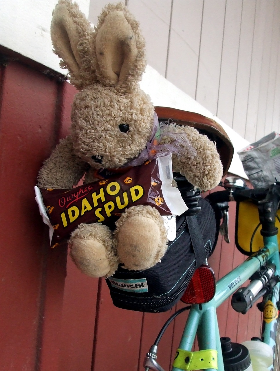
This meant that we would ride the same course as the Challenge participants but we would carry tools, extra inner tubes, and extra water in order to be able to assist anyone who needed help. We would also be making sure that riders rode safely, took off their headphones and obeyed traffic laws. At least we would ask them to ride safely, obey the traffic laws and take out their headphones -- sadly I was not allowed to arrest an iPod-people, as much as I wanted to. In addition to providing course marshals, PV would be running the final rest stop of the day.
In order to add some pizazz to our duty, the club volunteer coordinators came up with a "Top Gun" theme. We were divided up into "squadrons" based on the route we had chosen and our average pace. Lynne, Jason and I rode together (surprise!) as "Iota Squadron." We would be toward the end of the 70-mile group. In addition to our squadron names, we were each assigned a call name. Lynne was "Betty," Jason was "Tomcat," and I was "Chipper." They told me it was a reference to my cheery disposition, but I knew better.
The ride started at Nike World HQ in Beaverton - about 15 miles from my house in SE Portland. Lynne's house was on the way, so once again we arranged to meet there for the ride in to the start. Our friend Beth was signed up for the 70-mile course, and she spent Saturday night at Lynne's in order to ride in with us. We had to be at Nike by 6:45, and we would first be stopping by Jason's house to fetch him, so I told Lynne to expect me at her house at 5:50. That meant leaving MY house at 4:50. Joy. I had done a long, hot ride on Saturday, and then was not able to sleep much because of the heat, so when my alarm went off at 4:00 I was less than enthused about getting up . . .but get up I did, and after a cool shower I felt much better. I got myself together, saddled up and went over the hill to Lynne's house.
Because we would need to be carrying a lot of extra cargo, I rode Lil' Hw Jr., Lynne rode Bleriot and Jason rode his Sekine. We figured we would have the heaviest bikes in the field. We would also probably be the most comfortable riders in the field. In my pannier I packed a bunch of extra inner tubes in a few sizes, some patch kits, a multi-tool, baby powder, chamois cream and a small first aid kit. Later on I would add a few filled water bottles.
Just like last year, we spent almost an hour hanging around the parking lot waiting for the ride to start. Although they had tried to group the different course riders separately, so as to allow for staggered starts, everyone got a little too eager and lemminged up to the front, causing a fair bit of kerfuffle. We got stuck in with a lot of 40-mile course riders and so had to do some tricky maneuvering (and a little cross-country riding) to get back with the 70-mile riders. As a result, we were the tail end of the 70-mile group.
It was not nearly as hot as it had been the day before, and we had a slight tailwind. Even though we were pretty loaded down, Jason and I were setting a pretty brisk pace. Mainly because I couldn't control myself and because Jason was feeling competitive. After dropping Lynne a few too many times, we slowed down and rode at a more sensible pace. Lynne wanted to know if we planned on riding like super-heroes much longer and pointed out that we still had a long day ahead of us. Point taken.
The LiveStrong Challenge is notable for two things (at least as far as I am concerned). One, it is IMPOSSIBLE to get lost on the course (at least I thought it was - more about that later) because every turn is marked with very large yellow signs and almost every turn has a volunteer standing at it telling the riders where to go. Two, there is a rest stop every 10 miles. We stopped at the first one, skipped the second one, and stopped at all the rest. We stayed at the last stop for over an hour (again, more on that later). In other words, we spent as much time at rest stops as we did riding.
The 70-mile course was almost the same as last year - from Beaverton we rode out through Hillsboro and Forest Grove to Hagg Lake, around Hagg Lake, back through the outskirts of Hillsboro to North Plains and then back to Beaverton. The only difference was that this year we went around Hagg Lake counter-clockwise, so as to avoid having riders turning left in front of other riders speeding down the hills. This meant, of course, that we started off the Hagg Lake section with a steep climb.
Halfway around Hagg Lake was another rest stop. It had pirates. Last year it had hot soup. This year there was no need for that.
Up to this point, we hadn't really done much "marshaling." We'd told a few folks to "single up" so cars could get past, and I'd told one rider to take out his headphones. He ignored me. He probably couldn't hear me. But on the back side of Hagg Lake we had our first "real" test. A woman had stopped by the side of the road, and was looking quizzically at her tire. Jason stopped to talk to her, and as I rolled up she was showing him a very interesting lump about 1.5 inches long that had developed on her tire. It didn't look good. We decided surgery was required and removed her wheel.
After deflating and removing the inner tube from the tire, I started to run my fingers along the inside of her tire where the lump had been. "Hmm, that feels interesting. Hey, look! Her tire is totally falling apart!" I turned the tire inside out so she could see where the rubber was delaminating from the casing. Needless to say, she was not happy. While we were working on her bike, a Sag Vehicle slowed down to see if we were okay. "Do you have a tire in there?" Nope-they were medical support. They had Power Bars, if we wanted those. Nah. The driver radioed in for a "mechanical" Sag; it would come in about 15 minutes, he said. So we sat down to wait. We figured it wouldn't be cool to leave her to sit all by her lonesome.
About 15 or 20 minutes later, the van appeared. As they loaded her bike on top, we said good-bye and headed out on our way. Just after we left the lake, we came upon our next distressed rider. A man and his wife were standing by the side of the road; she had a flat tire. I could tell just by looking at them as we rode up that they had never changed a flat before. They had no extra tubes, patch kit or tire irons, but strangely enough they did have a CO2 tire inflator. It had been used, and was lying on the ground next to the bike. I am pretty sure they tried to just re-inflate the tire after it went flat. I am also pretty sure that one reason it did not work was the GIANT staple that I pulled out of her tire and tube. While we were helping her, the SRAM support car drove up. I was being particularly inept trying to reinstall new tube and tire, so gladly turned that task over to the mechanic. And we were off once again.
And now, remember how I mentioned a bit earlier that it was IMPOSSIBLE to get lost on this ride? Well, almost. About 5 minutes later, as Lynne, Jason and I slowed to make the next turn, we watched in amazement as a hammerhead passed us and blew right past the turn. The EXTREMELY WELL- MARKED turn. BIG yellow signs and everything. Jason yelled after him "Hey! Do you WANT to be off course?" No response. "Hey! HEY! YOU MISSED THE TURN!" Oh crap. The way the roads go out in that neck of the woods, it could take him miles to figure out what he did wrong. Good thing I'd been reserving some energy, because it was time to sprint. I chased him for about 1/2 a mile. Yelling the whole time. When I finally caught him, I saw why he hadn't heard us. He had on GIANT headphones, and when he pulled them off to find out what I wanted, I could hear heavy metal blasting out. I should have let him get lost. As it was, I gently explained that he had missed the turn, and guided him back. He asked if I was an "official" rider, and I said I was a ride marshal. "What do ride marshals do?" "Oh, you know, help people with flat tires, chase down lost people, TELL THEM NOT TO WEAR HEADPHONES." He so totally did not get it.
Back at the Fern Hill rest stop, we met up with our friend Beth. She was on her way back from Hagg Lake, but was in a lot of pain from an old knee injury. She was determined not to sag, however; and was on her way to get some Bio_Freeze from the medic. I later learned that she ended up having to sag after all, because of heat exhaustion. But she'd at least gotten to Hagg Lake, which was something she had really wanted to accomplish.
In addition to being course marshals, the three of us had volunteered to be "wingmen" ("wingpersons"?). This meant that we would hang out at the final rest stop until all riders had passed the second-to-last rest stop. We would then slowly ride the remaining 10 or so miles with those last rider, to make sure everyone got in okay. The final rest stop also happened to be the one staffed by Portland Velo members, and the club had gone all out to make it the best stop of the day.
There was a garden house for overheated riders to get a quick cool-down, and a kiddie pool filled with ice in which to soak our hot and swollen feet.
We spent at least an hour at the stop, cooling off, chatting with other marshals, and listening to the hilarious Portland Pep Band (big band versions of heavy metal songs). Finally it was time to head out for the last stretch. While we were waiting, however, storm clouds had started to roll in. As I looked toward the West Hills, which I would have to go over to get home, I could see that in some places it was already raining. At this point we were on West Union Road. If I kept going straight, I would be able to get home in less than an hour and a half. If I continued on to the end of the Livestrong course, I knew that it could be much longer than that before I finally made it home. By now, almost all the riders had completed the course, so I knew that I would not be needed for any further marshaling duties. I decided that I should just go home, and told Lynne and Jason that I would be doing so. I gave Lynne my reflective Sam Brown belt (I really wanted to keep it for brevets, but it was not mine to keep) and waved good-bye to them at the turn.
And then it was deja-vu all over again; I was climbing the same hill that I had climbed less than 24 hours earlier. This time it was much cooler however; it was only about 90 degrees, maybe even cooler than that. There were a couple of points near the top of the hill where I felt some rain drops, but it never came to anything. I sped down the hill and through NW Portland toward home. As I entered my neighborhood, I felt the first real drops of rain. Big, fat, heavy drops - the kind you can almost ride in between. I was less than two minutes from home - could I make it without getting wet? I was sheltered by trees until I got to the alley that runs behind my house, and so it was only the last stretch down the alley that I worried about. I turned into the alley, poured it on, and got to my garden gate just as the clouds burst. Exquisite timing on both our parts.
Ahem, that's TEAM Bag Balm and TEAM Estrogen. TBB is a very loosely organized riding group to which I belong, and TE is an internet vendor of women's cycling, swimming and running gear that is owned and operated by a fellow TBB member. On Saturday, June 28, there was a rare confluence of the two, when TE held a parking lot sale and barbecue at its World Headquarters in Hillsboro and a few of us decided to combine some shopping with a group ride. Our friend Don sent out the call, and after a few e-mails back and forth to coordinate times and distances (did I mention that we were LOOSELY organized?), the plan was in place. We would meet at TE at 9:00 AM, browse the sale racks for a bit and then roll out by 9:30 for a 40 or 50 mile ramble before heading back to TE for some more shopping and lunch.
As usual, I rode out to Lynne's and we rode together to the start. A heat wave had started two days earlier, and Saturday was forecast to be the hottest day of the week, with temperatures predicted to rise to over 100 degrees. When I left home at 7:00 AM, it was already over 70 degrees and the sun was very bright. Because I was riding with TBB for the first time in a long time, I decided to haul out my TBB jersey, even though it is a little less "breathable" than some (it makes up for that in pure style - it gets more "Cool jersey!" comments than any of my others).
Because I needed to get up and over the hills between my house and Lynne's quickly, and because I wanted to cut down as much as possible on my cargo-carrying capacity so as not to go nuts at the sale, I rode the Bianchi - my "fast" bike. Fast being a relative term, of course. Between that and a tail wind that helped propel me up the hill through Washington Park, I arrived at Lynne's house 10 minutes early. She was almost ready, and I took advantage of the time to use her bathroom. I knew she would understand.
Lynne was on her fast bike, too, and she was also flying the TBB colors.
She had also cut down on cargo-carrying capacity, but only because she was counting on her husband, Fitz, coming by the sale later in the car to carry home her purchases. She reminded me that I could have him do the same for me . . .
On the way over to TE, we rode by Jason's house where he was outside waiting for us. He too, was representing TBB. We had ourselves a herdlet. We wove our way through some parks and side streets, with a brief period on busier streets like Evergreen and Cornelius Pass Road (we took the sidewalk on CP - it's just too scary), and arrived at TE shortly after 9:00. The sale was well in progress, and we quickly spotted our friends Don, Laura and Diane in their herd gear. Our friend Linda was there, too, but she was traveling incognito in a possibly more sensible sleeveless red number.
Although the plan had been to roll out no later than 9:30, it was difficult to tear ourselves away from the bargains. And my carefully thought out plan of forced frugality was dashed when my friend Slug, whose wife Edna works at TE and who was helping out at the sale, mentioned that he could drop any packages off at my house for me on his way home. Thus, by the time we finally rolled out, I had picked up a new pair of summer gloves and a completely frivolous hoodie. I knew that I would probably add to the pile after the ride - they had an enormous selection of Smartwool socks on sale and I can always use more socks. But the temperature was rising and the riders were getting restless. On the way out, I ran into the fabulous Natalie and Austin from Sweetpea; Natalie had a feeling we'd run into each other at the sale and she'd brought me the extra key for the Pitlock on my generator hub (they'd had to order it from Germany). I passed the box off to Slug, apologized to N & A for not being able to chat, and hurried to catch up with the herd. It was about 9:45, so we weren't TOO far off schedule. Especially by TBB standards, which must always be adjusted for faffing times.
The plan was to do a route that included two different "out and back" components - Dairy Creek and Pumpkin Ridge. After some discussion, we decided to go out to Dairy Creek first, because on the way back from Dairy Creek and over to Pumpkin Ridge we would pass a water source. The temperature was already into the 90s at this point, and hydration was a key consideration.
Our little group quickly separated as the speed demons Don, Jason and Linda bolted ahead. Laura and I were setting a fairly brisk pace ourselves, but I could not keep up with her for long. Diane and Lynne were not far behind, and had caught up with me and Laura by the time we reached the 4-way stop outside of North Plains. There we decided to turn right to go up to North Avenue to cut through town, instead of staying on the main drag, because the pavement was smoother and there was rumor of a blue room at the school on that street.
There was no blue room at the school, but there was one at a nearby construction site. We spent a little time taking care of business and then continued on our way. We were in no hurry-we figured the speedsters had already zipped through town and were well on their way to Mountaindale, and maybe we'd catch up with them there. Suddenly Lynne's back pocket started singing. It was her cellphone. Jason was calling. They were sitting out in front of the market on the main street of North Plains and were wondering where in the heck we were. Whoops. So we stopped at the intersection of North and Gordon and waited for them to catch up. They caught up, and then quickly outdistanced us again. Oh well.
I really like the ride out to Dairy Creek. It's relatively flat until you get to the turn off onto Dairy Creek Road itself and none of the roads are heavily traveled. Once you are on Dairy Creek, the road takes just the slightest of inclines - no more than 2% at any time. Just enough to make you wonder if you have a flat tire or rubbing brakes, because you shouldn't be going so slowly on what LOOKS like a flat road.
It was QUITE warm at this point and Lynne and I were ambling along at a sensible pace. In other words, we were well behind the rest of the pack. I slowed us down even more when I spied some adorable alpacas with poodle cuts in a field to our left. (At the time I identified them as llamas - I do know the difference, but sometimes still mix them up). Anyway, I felt obliged to stop and talk to them.
As soon as I pulled my bike over to the fence surrounding their pasture, three alpacas came running over. I think they thought I might have some sort of tasty alpaca treat for them. Sadly, all that I had was a camera. I wasted a significant amount of time getting extreme close-ups.
Lynne finally pried me away from my Peruvian pals and we rode on to meet the rest of the gang at the end of the road, where they were taking advantage of the shade to rest, re-hydrate, and apply sunscreen. At this point it was close to 11:00 and really hot and none of us seemed to be in any hurry to get back on our bikes. But we were less than 1/3 of the way into our planned route, and after some discussion Lynne, Jason, Don and I decided to head back for TE from there and skip the rest of the ride. Linda, Laura and Diane rode back with us as far as North Plains. After some more time hanging out in the shade at the North Plains market, downing sport drinks and eating salty snacks, we split up, with the four of us heading back to TE and the other three off to tackle Pumpkin Ridge.
We rolled back into the TE lot at about noon. Jeff had fired up the grill, and called out to us "beef or veggie?" "Veggie, please." "Cheese?" "Oh, yes, definitely." In addition to the burgers, there were coolers filled with ice cold water and pop. Aah, now that's how to have a parking lot sale.
One Boca burger and two ice cold Diet Cokes later, I was ready to do a little more shopping before heading for home. Over the next half hour I collected a new pair of running shorts (uh-oh, that's not a good sign), a NON-frivolous hoodie, and a whole lot of socks. I handed the bag off to Slug, refilled my water bottles, said goodbye to the gang and rolled out for the last leg of the day. TE is just off West Union Road, which if you follow it long enough turns into Thompson Road which goes up and over the West Hills into town. It's one of the easier ways back over the hill - about 4 miles at a 4% grade. Not bad, given some of the alternatives.
At this point it was astonishingly hot. Throughout the day as we were riding I had watched as the temperature gauge on my cyclometer ticked up, each time thinking, "Okay, that's it, that's as hot as it can't get." Each time it got hotter, until by the time I was about to start the steepest climb of the day, it was showing 106 degrees.
In my experience, accounting for radiant heat that it picks up from the road this particular cyclometer has a margin of error of less than 4 degrees, so I figured that it was really only about 102 degrees. Not that that really made a difference. I bailed down to my lowest gear and spun my way up the hill. 31 minutes later and 700-plus feet higher, the air temperature had fallen six degrees. Not that I could tell. But I was about to take advantage of the "poor man's air conditioner" - nothing like a steep decent at high speed to cool oneself down after a hard climb. One more long drink of water (very HOT water by this point), and I pointed myself down the hill and toward home. 20 minutes later I was home. 22 minutes later I was standing in a cold shower, tasting the salt and sunscreen as it rolled off my face and down the drain.
All told, I did 73 miles with an average speed of 14 mph. Not bad considering the heat and the climbing. The rest of my pictures are here. Lynne' pictures are here.
The other day I sent my husband an e-mail, asking if he would mind if I did a 300 kilometer ride on our 9th wedding anniversary. Fortunately for the prospects of having a 10th anniversary, I realized the folly of such a query as soon as I hit "Send." (Yes, it perhaps would have been better if I had realized it BEFORE I hit "Send," but I am not in THAT much control of my obsession). Anyway, I immediately followed up with a "What was I thinking, never mind . . ." e-mail. He seemed to accept that I was momentarily insane.
The St. Andrew Legal Clinic "Race for Justice" is two weeks from tomorrow, and I am only halfway to my fundraising goal of $1,000. I have been training hard - -well, as hard as I can train, given that it seems as if I have spent every non-working waking hour for the last month on my bicycle -- and I am confident that I can get through the race with only minor permanent injuries. There's still time to sponsor me in this foolish attempt to support a very worthy cause - CLICK HERE, and and when the donation page pops up choose the radio button next to 'Sponsor a participant" (the second choice). There's a box next to the button in which you can fill in my name as the runner that you are sponsoring - "Cecil" is enough, there are no other Cecils running in the race . . .
As I mentioned in my last series of posts, I have been working my way toward a Super Randonneur award from Randonneuring USA. I had to ride a series of brevets in one season in lengths of 200, 300, 400 and 600 kilometers. After completing the Kings Valley 600 on Memorial Day weekend, all I had left to do was a 400. I planned to take care of that with the Oregon Randonneurs Covered Bridges 400, scheduled for June 14.
Although I have pretty good recovery powers, I was a little nervous about doing the 400 on the 14th, because I am running in a fundraising 5K on June 21 (sponsor me now!), and I was not sure my muscles would recover enough over week's time to do the run. My friend Andrew came to the rescue by suggesting that he and I do a "workers' ride" of the course on June 7, instead. He had a scheduling conflict for the 14th and so the only way he could get credit for the ride would be by doing a workers' ride. It's always better to have company on such a ride, and he asked me because we ride together often and have compatible styles (except he always has to pee more often than I do). Because neither Andrew nor I had completed a 400 before, Susan, our RBA, suggested that we find someone to go with us who had done one. We pondered with whom we would want to spend at least 24 sleepless hours of riding, and decided to ask John Henry Maurice.
John Henry had not ridden a 400 km brevet before, but he is a very experienced endurance racer, having competed in events like the Furnace Creek 508 and Race Across Oregon. We figured he'd know how to stay awake, or at least know how to sleep and pedal at the same time.
Although the "official" ride will start at 6:00 AM, we could start our ride at any time. I lobbied hard for an 8:00 AM start, so that I would not have to get up at some ridiculous hour (not that I don't always get up at some ridiculous hour, thanks to the early-rising corgis). John Henry would have preferred a dawn start, but he gave in to my whining. As it was, we ended up starting a little late, because one of Andrew's gear bags exploded, and he need to do some quick repacking.
. It was sort of like "Bicycle Part 52 Pick Up."
After getting our cards signed by the hotel desk clerk, we rolled out at 8:03 and headed east into the prairies. On our way past Champoeg Park, we saw quite a few cyclists riding in the other direction. They were the vanguard of the short-course riders on the Pioneer Century. One rider that we waved to expressed his concern that we were "going in the wrong direction." We assured him we were on a different ride.
The official ride information page describes the course as "relatively flat." The word in that phrase to focus on is "relatively." It's no Torture 10K, but it's no pancake, either. More like an aebleskiver, perhaps. But without the lingonberry sauce. The overall elevation gain for the course was only 7038 vertical feet over 400 km, and maximum altitude is barely over 1100 feet, so on paper at least it IS relatively flat. And, to be honest, there really are not that many climbs, it's just that the few climbs that are there are significant. The first part of the course, from Newberg to Silverton was indeed pretty flat and, I must admit, not too scenic. Or maybe I have just become too accustomed to beautiful views on Oregon rides.
Our first stop would be the Gallon House Bridge between Mt. Angel and Silverton. It would be the first of seven covered bridges we would visit that day, each of which was to be the subject of an "information control." Information controls are a way of ensuring that riders do not take shortcuts when there are no nearby businesses to serve as regular controls. One of our tasks on the ride was to come up with the question (and answer) for the information controls. This slowed us down fairly significantly, because each time we stopped we took the opportunity to waste time on things like picture taking, eating, and generally just standing around.
From Gallon House Bridge we turned south toward Silverton, Sublimity, Stayton, Scio, Sweet Home and beyond (for a while it seemed we would be only going only to towns that started with "S"). Starting in Silverton, we began climbing very gradually; just enough to slow us down, but not enough to raise our heart rates. The low heart rate problem was resolved by our encounter with Cole School Road outside of Scio - 2 rollers, one of which clocked in at about 15%, the second at 18%. The last time I was on that road, I had to walk the last few yards to the top of the second hill; this time I made it, but I had to rest at the top for a while. Andrew and John Henry were behind me; when they reached the top, Andrew once again questioned my choice of gear ratios (he has been telling me since he first saw my bike's specs that I don't have low enough gearing). I felt obligated to point out to him that (1) I made it to the top, didn't I?; and (2) I made to the top before he did . . .
Outside of Sublimity we rolled past a dairy farm. We rode past many dairy farms on the route, in fact, but I remember this particular dairy farm because of the dead cow lying in the field near the road. It must have died not too long before we rode past, because it looked intact and didn't smell bad - in fact, were it not for the very interested buzzards encircling it, one would have thought it was only sleeping. Nature red in tooth and claw, and all that jazz.
We rolled into Scio at 1:30 PM. We were supposed to go to the Covered Bridge Cafe for our control there, but the cafe is now closed on weekends. We made a note of that for the organizer. As we approached the cafe, we saw someone with a familiar face standing on the street pointing a camera at us. It was our friend and fellow randonneur, Nate Armbrust, who happened to be in town visiting his family (Scio is his home town). They had been out driving and had seen us on Cole School Road; he calculated when we'd be reaching town and was there to meet us (he and his family had just finished eating at the restaurant across the road). He signed our cards for us and took our picture as further proof of our presence.
After the Scio rollers, the course flattened out again (relatively). We would have no more intense climbs, but there were two or three of the long, boring, grinding low-grade climbs that I find even more annoying than the steep, nausea-inducing variety (nausea passes, boredom doesn't). As we groaned our way up one such climb, we heard popping sounds up ahead. I figured we were coming up on a rifle range; they're plentiful out in the Oregon boonies, As we turned the corner, however, we came upon two men busily bulldozing an old drive-through espresso hut into a roaring bonfire. Of course we had to stop and watch (and take pictures).
At abut 5:30 we stopped for dinner in Sweet Home. The Thriftway there is another control, and they have a deli at which you can purchase enormous sandwiches and they come conveniently packed in a sturdy zip-lock bag. We each ate half a sandwich and saved the other half for later.
From Sweet Home we continued on south toward Mohawk, which was the southernmost point of our route. The store there was another control; we reached it right at closing time. We purchased a few more snacks and water and got our cards signed. The sun was setting, so we donned our reflective gear, turned on our head and tail lights, and turned northwest toward home. At this point we had been on the road for over 13 hours and had gone just over 136 miles. We had another 112 or so miles left to go before we were done, and less than 14 hours left on the clock. We had a very slight headwind, and we would inevitably be slowed down a little by the difficulties of riding after dark, so time management would be the key to success. That, and luck. If the weather held, and if we didn't have any breakdowns (mechanical or nervous) or flats, we would have no trouble getting in on time, if not a little early. I tried not to think too positively though. Hubris and all that . . .
All day the weather had been good; slightly overcast and pleasant temperatures. By nightfall the sky had cleared completely, though, and the temperature quickly fell into the low 40s. We had all brought some warm layering clothes, and we stopped to put them all on. I probably could have used one more layer, because every time we stopped pedaling I would start shivering, but as long as we were moving I was okay. We had left all the covered bridges far behind, and it was too dark to really see much of anything. As we rode along McKenzie View Drive toward Coburg, I could hear the McKenzie River off to my left, but never saw it. We stopped in Coburg so Andrew could take a nature break. While we were waiting, a guy drove up and stopped to chat. He had seen our taillights from a distance and could not figure out what kind of vehicles were ahead of him. He asked where we were riding to, and was duly impressed when we told him where we had come from and where we were going.
The next control was in Harrisburg. We arrived there after 11:00 PM and the sidewalks and been rolled up for hours. Fortunately, there was an ATM where we could get receipts to show we had been there. From Harrisburg we turned onto Peoria Road and headed for Albany. Peoria Road is long; we were on it for a t least an hour and a half. I kept asking John Henry if that was Albany I could see in the distance. "No." "No." "No." "No." "No." I was starting to get anxious. I was beginning to feel a slight pressure in my bladder, and I knew from the fleche that there were no public restrooms (or random blue rooms) in Albany. Then I had found a secluded spot in Bryant Park, but I was hoping that there might be something less exposed somewhere on Peoria Road. John Henry and Andrew both thought there was a wayside park somewhere en route, but there was no guarantee it would have facilities. When we finally came upon it, I was thrilled to see that there was a blue room there (it's not that often that I am thrilled by the sight of a port-a-potty, but these were desperate times). I also took the opportunity to pull on a second pair of wool socks; I was wearing my cycling sandals and my toes were a wee bit numb. I had stuck chemical hand warmers in the wind pouch of my gloves, so my fingers were plenty toasty. While we were stopped, a sheriff's deputy drove up to make sure that we were okay - he wanted to know if there were more of us out there that he should be checking up on. He did not think it was at all odd that we should be riding hundreds of miles in the dark without any ride support. After ensuring that we had everything we needed, he drove off and we turned toward Albany.
Andrew was almost out of water and was beginning to wonder where we might find services. Our route would take us through the part of downtown Albany that shuts down early - I knew of one bar off of 2nd Street, but everything else would be off-route out by the highway. It was already about 2:10 when we reached the outskirts of town, so if we were going to get to the bar before it closed, we would have to pedal a little faster. We followed the sound of drunken hubbub, and got to the bar just as they were kicking everyone out.
I pleaded with the bouncer to let us in to fill our water bottles and he obliged after another round of "You're riding how far?? You're crazy!" John Henry then had the good sense to ask the bartender if he knew of any 24-hr restaurants nearby. "Well, there's Pop's - it's open. Just go down this street about a mile, then turn right on Madison and go another half mile."
Although skeptical of his mileage estimates, we decided to try to find it. We were tired and hungry and, as John Henry pointed out, all those drunk people that were leaving the bar were headed for their cars and perhaps it might be a good idea for us to be off the road for awhile. As it turns out, some of those drunk people were at the restaurant with us. Two girls with somewhat vacant eyes approached the table and asked us how far we were riding and the just stood there saying "You're crazy" over and over.
Pop's may not be haute cuisine, but the servings were large, the service friendly, and the bathrooms clean and warm. After 19 hours of riding, that was good enough for me. I was starting to get pretty punchy, and Andrew was falling asleep on the cushioned bench.
We finished our breakfasts--well, I finished mine and also ate most of Andrew's pancakes and some of John Henry's hash browns; they just picked at theirs -- and it was once again time to hit the road. Our next stop, and our last control before Newberg, was Independence, 18 miles away. Again, there was an ATM that we could use to record our time, but we assumed that there would be no shops open for services. I was not worried because I figured we could get water from the tap in the public restroom on Main Street. When we rolled into town shortly after 5:00 AM we discovered, however, that the bathrooms were locked. Rats. Not only were we short on water, but I once again was feeling a little pressured in the region of my bladder. Fortunately, the guys discovered a set of blue rooms down by the river on the other side of the park. Whew. As an extra treat, the sun was rising over the river and the view from the blue rooms was lovely.
We had been able to offload water, but we still had none to replace what we'd offloaded. I remembered that there was a Plaid Pantry on River Road between Independence and Salem, just south of Minto Brown Park. I figured that it was either a 24-hr market or, at the very least, would be open by 6:00 AM. I estimated that we were about 7 miles away from it, so that either way it would be open by the time we got there. So we backtracked down Main Street to the bridge, crossed over the Willamette and headed north toward Salem. The sun was rising quickly, and it was beginning to warm up. The Plaid Pantry was indeed open, and we spent a little bit more time there then I would have liked. I harped at Andrew to hurry up with his tea so we could go; he ended up pouring most of it out. Then, just as we started to pull out, Andrew realized his tire was flat. On the one hand, it couldn't have happened at a better time - the sun was up, he could see, and the PP parking lot was a safe place to work. On the other hand, it couldn't have happened at a worse time - -we still had about 35 miles to go, we were exhausted, and our time was beginning to tick away. John Henry and I decided that we would ride on into Salem and stop at The Beanery for more breakfast foods, and wait for Andrew there. We arrived at the coffee shop at 6:55; it opened at 7:00. Andrew showed up about 15 minutes later, and ordered his own breakfast. We finally got back on the road at about 7:35 or so. We had 28 miles to go, and I told the guys that we weren't making any more long stops until the end. I knew we had plenty of time, but I didn't know whether we would run into anymore mechanical problems. Plus, I was so exhausted by this point that I was not able to pedal very quickly at all. I knew for sure that I would not be able to replicate the sprint from St. Paul to Newberg that I had done at the end of the 600 two weeks earlier . . .
The last stretch from Salem to Newberg was as flat as the first stretch the day before. The sun was well up, and we eventually had to stop after all, so that we could divest ourselves of our arm and leg warmers. And then it really was time for the final gallop for home. We were 9 miles from the end and on track to get to Newberg by 10:00 AM, an hour before our deadline. I was losing steam, and the guys pulled pretty far ahead of me. I made a brief effort to catch up to them and realized it was not going to happen. Plus, I once again had to pee, and I knew from experience that there would be no blue rooms or discrete stand of trees on our route; so when I saw a woman out in front of her house dead-heading her roses, I swallowed my embarrassment and asked if I could use her bathroom. She was very nice and readily agreed. She asked where we were riding at such an early hour and, after I explained our trek, responded with the now predictable "You're crazy!"
I got back on my bike and continued up the road. I saw that John Henry and Andrew had stopped. I thought that they were waiting for me, but John Henry explained that they had really stopped because he had caught himself falling asleep on his bike, and figured he should take a little break. Once we were sure that we were all awake, we set off. We reached the Travelodge at 9:57 AM, 25 hours and 57 minutes after our start. After loading our cars and changing into non-riding clothes, we sat on the grass and chatted until we were sure that we were all okay to drive home safely.
My plan was to go home, take a shower, and take a nap. And that is what I SHOULD have done. But the weather was so nice, and my garden needed weeding. And then the dogs needed walking. And then I found other chores that needed doing. And then we decided to walk over to Hopworks Urban Brewery for beer and pretzels. And then it was time to make dinner. I finally went to bed at about 10:30 PM, at which time I had been awake for 41 hours. I still haven't caught up that sleep. Maybe next Sunday . . . but probably not - I think we're going snowshoeing.
Chapter the Third: In Which I Enjoy Some Instant Karma, Resign Myself to Walking Up A Hill, And Rely On My Intimate Knowledge of the Mid-Willamette Valley So As to Go Off Course Only Once.
Sunday morning came down on me like a 16-ton weight on a man armed with a banana. It seemed as though I had barely closed my eyes when the alarm went off. The temptation to hit the snooze button was strong, but I had already set the alarm as late as I dared; I had no margin of sleep error. Opening my eyes was much harder than closing my eyes had been, partly because they were swollen from exhaustion. As my favorite Irving Berlin tune ran in my head, I groped my way toward the sink, where I ran cold water and stuck my head under the flow. . . . .
Thus "refreshed," I began to call roll on my various body parts: Head? Still there, and not hurting (although my higher reasoning functions were contemplating calling in sick). Shoulders and back? Present, and not hurting. Quads, knees, calves and ankles? Again all present and again surprisingly limber and pain-free. Nether regions? As well as could be expected after 218 or so miles. Actually, better than expected, and here's why: BABY POWDER. Yes, my friends, I said baby powder. Not Bag Balm, not chamois cream of some variety or other, not Desitin. After years of using various lubricants or going without anything in my shorts, I decided to try a "dry" protectant. To be specific, Burt's Bees Baby Dusting Powder. A few shakes in the shorts at the beginning, and a couple times later in the ride, and I completed the ride without any abrasions, chafing or boils. I will, of course, need to repeat the experiment on the 400 to rule out the chance of an anomalous result . . . and I am not sure how well it would work in the rain. But I digress....
Having confirmed that mens and corpore were both sana, I dressed, prepared my snacks for the day (more PB and Nanner sammiches, more raisins, another energy bar, another muffin), packed a clean pair of shorts into my pannier, gathered up the rest of my gear and headed downstairs to check out and roll out.
It was sometime around 5:30 A.M. at this point, and other riders were up and moving around. Lesli was taking pictures, and captured me in full zombie mode:
The hotel owner had opened the breakfast room early, and I grabbed a hard-boiled egg and a handful of cherries. I was not very hungry, because I had eaten quite a bit of food before going to bed less than three hours earlier. I figured I'd stop and eat my muffin after riding for a little while. After loading my excess gear in the car and checking out, I was ready to roll. I headed out at 6:09 A.M. I had briefly reviewed the cue sheet and was happy to see that I had, at one time or other, ridden on almost every road listed. There were a few street names I did not recognize, but for the most part it appeared I would be in familiar territory. Indeed, because the territory was so familiar to me, I did not really notice on that first glance that there were a few, um, "errors" on the cue sheet. More on that a bit later . . . .
As on Saturday, Sunday started off with perfect cycling weather. Slightly overcast, cool without being chilly, and very little wind. I had over four hours in which to travel the 40 miles to the first control in Independence, so I was taking it easy. As I rode down River Road toward St. Paul, I noticed a number of hot air balloons taking off. I assumed it was some sort of Memorial Day event. I recalled that there was a similar balloon event going on at the same time as last year's 600(of which I only did half).
About 12 miles into the ride, I realized that I had somehow changed my bike computer's mode to "Wheel Size 2." which is the setting for my other bike, which has a different tire size, thus skewing the distances. Dang! I switched back over to WS 1, but my daily stats would be somewhat questionable. I was not too worried about not being able to match distances on the cue sheet, because I knew most of the roads and the turns and because I had a "navigator" function I could use to measure individual "legs," but I was kind of bummed that my post-ride stats would be inaccurate. It's that OCD thing, again.
I stopped in St. Paul to eat my muffin and check out the rodeo grounds. It was a very large muffin, and took some time to finish, but I was in no hurry. The final control closed at 11:00 P.M., and I fully expected to be pulling into it at 10:59. But having finished my muffin and taken the requisite "I was here" photo, it was time to move on. The bustling metropoli of Keizer and Salem awaited.
River Road through Keizer is a wide, busy commercial street, lined with strip malls and medium-box stores. It has two lines in either direction, as well as a center "safety" turn lane. As I rode merrily along in the bike lane (which appears in fits and spurts along the length of River Road - sometimes it's marked for bikes, sometimes it's just a shoulder), a true patriot (I know because he had a yellow ribbon) in a Lincoln Navigator passed me at a high rate of speed with less than 6 inches to spare (possibly even less than 4 inches - it was scary close). Having made his point, he then moved into the other lane. Grumble grumble grumble. About one mile later, as I entered Salem, I noticed the flashing lights of a motorcycle police officer on a side street over to the left. I glanced over to see that said officer was in the process of writing a ticket to Navigator-Dude (for speeding, I presume). I yelled out "Hooray!," and the officer looked over at me. I called out to him that Navigator-Dude had just minutes earlier passed me unsafely. The officer smiled and turned back to have a little chat with Navigator-Dude.
At this point, I was assuming that I was the very last rider to be passing through Salem. I had started late, I was riding slowly, and I was stopping a lot to take pictures, eat, and mess with my computer. I work in Salem, and so was not paying a lot of attention to the cue sheet. I knew where I had to go, and I went there. Consequently, it was not until I had gone through downtown Salem that I noticed that the cue sheet had a few, um, problems. Problem #1 being that it told riders to take Liberty Street south. Liberty Street is a one-way street, northbound. Oops. That should have been COMMERCIAL Street, which is the southbound component of that particular one-way couplet. Problem #2? The cue sheet indicated a distance of 1.4 miles from the turn onto Liberty (aka Commercial) to the next turn, a right on Owens. That should have read 2.8 miles. Oops again. Problem #3? According to the cue sheet, almost immediately after turning onto Owens (.3 miles to be precise), riders were to "cross bridge to Independence." Yeah, well. Here's the thing. There's no bridge there. Instead, the bridge to Independence is another 10 or so miles further south. Like I said, I know Salem, and up to that point had not been misled by the errors, but even I was taken aback by that last cue - I even did a little back-tracking to check that I had simply never noticed a bridge in all the times I had ridden through that section. But as I was backtracking, I saw John Henry ride by in the direction that I had believed to be correct. John Henry not only works in Salem, he LIVES in Salem, so I figured he knew what he was doing. So I turned around and rode back in my original direction. 10 miles later, River Road led onto a bridge over the Willamette and into downtown Independence. It was about 9:30, and I had made it to the first control with an hour to spare. I noted a few of the faster riders pulling out of town as I rode in, and was surprised that they were not further ahead.
The last time I had been in Independence was on the Fleche. Then it was in the wee hours of the morning and there was nothing open except a bar, so I had to get an ATM receipt to prove I had been there. At 9:30 on a Sunday morning I had more options. I stopped at the market to get my card signed and purchase a second (third?) breakfast. After confirming that all the "hot case" offerings contained meat (except for the jojos, which did not appeal to me), I hit up the dairy and produce cases for an eclectic combination of yogurt, a banana and a microwave bean burrito. By this time I had been in Independence for a least 10, if not 15, minutes - maybe more - but as I came out of the public restroom I ran into Lesli, who had only just arrived. When I expressed shock over this, she explained that she, Peg and Jennifer had gotten lost in Salem and had ended up taking the wrong bridge across the Willamette. They then followed SR 22 to the Independence turn-off, and came into town from there, adding a few extra miles to their tally along the way. While we were discussing the matter, Mike Johnson rode up, having done the same thing. For all I know, John Henry and I may have been the only ones who came over the River Road bridge! After assuring them that they were all where they needed to be and making sure they all knew where they needed to go next, I rolled out.
The next control of the day was in Waterloo, another town that I had previously visited on the Fleche. I hoped that this time the store would be open so that I would not have to knock on someone's door to get my card signed. To get to Waterloo I first had to take the Buena Vista ferry back across the Willamette. The ferry did not begin to run until 9:00 A.M., so faster riders had to take an alternate route back over the River Road bridge. I much preferred the ferry. In fact, a ferry ride makes any bike trip infinitely more fun, whether it is the ferry from Cleggen to Inishbofin or just a short domestic hop across the lazy Willamette.
I had to wait some time for the ferry to slowly make its way across the river to me, and I assumed that the riders I had left in Independence would soon be catching up to me. But they had not arrived by the time the ferry reached my side of the river, and I crossed over alone.
(Yes, I had many songs running through my head this day . . . one of the joys of riding alone is that I can sing to myself with no one to complain about my musical choices or ability. But again I digress . . .)
The weather had been holding fair, but as I pedaled into Talbot I could smell the rain coming, and some drops plopped on my helmet. It had been warm enough when I left the hotel to go without a jacket or limb warmers, but I decided that I should suit up, just in case the rain got heavy. I pulled over in front of the Talbot fire station to unpack my rain gear. I was in the process of pulling on my leggings when Susan, our RBA, drove up. She had been out scouting the course for the upcoming Covered Bridges 400. We chatted for a few minutes, and I warned her that she may be getting an earful from some disgruntled lost riders. She said she'd already gotten some phone calls, but that everyone had eventually worked everything out. I mentioned that I had expected the riders I had left in Independence to have caught up with me, and she said she was going in that direction and would check up on them. We parted ways and I continued on toward Waterloo, still more than 30 miles away.
I knew that I would have to take a rest break before Waterloo, and noted that the route would pass through Jefferson. There is a very nice market in Jefferson, with a clean toilet and a functioning hot cocoa machine (after 275 miles of cycling, my standards for "very nice" are quite low). The threatened rain had never really materialized, but it was still cool enough that hot cocoa really hit the spot. As I sat on a bench outside the market sipping my cocoa, it occurred to me that I should call Greg and let him know my status. I had forgotten to call him on Saturday, and realized that he might be a tad bit anxious about my well-being. It was coming on noon, so I figured he'd be awake. He was happy to hear from me, and even happier to hear that I was not calling to ask him to come get me. Not that he could have done so even if I had asked, because I had left the car in Newberg. Having finished my cocoa and phone call, I had no good reason to delay getting back on the bike. Despite all the time I had wasted, I still had seen neither hide nor hair of the other women or Mike. I was beginning to get a little concerned. I knew that Lesli had been having mechanical problems off and on, and that both she and Jennifer were nursing bruises from their brief encounter with the railroad tracks the night before. I hoped that they weren't having more problems.
As I rode from Jefferson to Lebanon, through Gilkey and Crabtree, I could tell that sometime earlier than had been some torrential cloudbursts - the roads and fields were soaked, and there was a lot of standing water. The day was warming up and it was getting humid. I crossed my fingers and hoped that I had missed the rain entirely, and then quickly uncrossed them because it is hard to shift with crossed fingers.
The route from Jefferson to Lebanon is meandering, to put it mildly. To make matters more interesting, some new cue sheet "issues" arose. The directions called for a left turn off of State Route 226 onto Tennessee Road. Tennessee Road is not well-marked. At the intersection with 226, the road to the left is Tennessee, and the road to the right is something like "Old Bridge." The only visible sign, however, is for Old Bridge. The sign for Tennessee is hidden by a tree. Fortunately, I had been there before, and knew where to turn. There was also a small sign under the Old Bridge Road sign that indicated that "Tennessee School" was to the left. Once I turned, I was able to see the road sign that had been hidden from view, and confirmed that I was on course.
If getting on Tennessee (School) Road was difficult, staying on it was even more difficult. Over the course of 8.5 miles, I encountered three "T" intersections, none of which was very well-marked. Each time, I guessed which way to turn, based on my knowledge of the direction I eventually needed to go. I soldiered on, and was relieved when I finally ended up in Lebanon and could once again count on the roads being marked. Mike Johnson finally caught up with me in Lebanon; he and the women had taken a wrong turn on the way to the ferry, and had once again collected a few extra miles. He said they weren't far behind. We rode together into Waterloo, where we once again encountered some faster riders on their way out of town. The store was open, and I got my card signed and purchased a large bag of potato chips and some string cheese to go with my sandwich. A few minutes later, Peg, Lesli and Jennifer rolled in and purchased similarly healthy food stuffs. Susan drove up while we were hanging around eating, and passed out cans of V-8 juice (mmmm, SALT!) and more bananas (mmm, POTASSIUM!)
I finished my lunch and headed out for the next control in Scio. This was the shortest leg of the day, only 19 miles, but for me it was the most difficult. I had stayed in Waterloo too long, and my leg muscles had declared a wildcat strike. This was a particularly bad time for labor unrest, given that the only true climbs of the day were on this leg. I was struggling to keep my speed above 12 mph, and the other women quickly caught up to me before too long. We rode together for a while, but then we hit the "real" hills, and I was done for.
I have it from a reliable source that in the local Native American dialect, "Scio" means "land of impossible rollers." Okay, I made that up. But I am not making up the rollers. They are impossible. The problem with the rollers in Scio is that they are not the fun kind where you can use your momentum from a descent to carry you (for a way, at least) up the next climb. Instead, the hills are spaced just widely enough apart that all your momentum is dissipated in the trough before you start climbing again. In particular, there are two roads in Scio that I would pay good money not to have to ride up. One is Cole School Road, the other is Richardson Gap. Sadly, both those roads are repeat offenders on Or Rando brevets and permanents and I have struggled up (and sailed down) both of them. On this particular day, the evildoer was Richardson Gap. Up to now, I had been keeping pace with the other women, but I lost them on the Gap. When the incline hit 15%, I decided that there was no shame in walking, especially when the alternative was to fall sideways into a ditch. So I dismounted, walked a few meters, got back on and pedaled a few meters, dismounted and walked, got back on and pedaled, dismounted and walked, got back on and pedaled . . . you get the picture. By the time I got to the top, the others were well ahead of me but had slowed down enough that I caught up with them by the time we all rode into Scio proper.
The Scio Market is interesting. The last time I had been there was on a permanent earlier in the year. At that time we had ridden into the control with only moments to spare, and then waited in what seemed like an interminable check-out line to get our cards signed. That same line was there this time around. I was determined not to spend as long at this stop as I had at Waterloo, but at the same time I was definitely feeling the strain of the ride and needed to rest. I got some more hot chocolate, ate my second sandwich and prayed for a second wind.
(photo by Lesli Larson)
To be perfectly honest, though, I felt pretty damned good considering that I had ridden more than 320 miles at this point and had only had 2 hours of real sleep in the last 36 or so . . . but that didn't stop me from feeling a wee pang of dread at the thought of the 55 miles I still had to go. I took comfort in the fact that the next section consisted of roads that I have ridden on fairly regular basis in the past years, either on brevets, permanents, or the many supported rides that take place in the Valley throughout the summer. I knew that the biggest challenge was going to be the 15 mile slog on Howell Prairie Road. But if I could just get through that, I'd be doing okay.
It was closing in on 5:00 P.M. at this point, and I was starting to calculate how long it would take me to finish. I had to consider the fact that I was now stopping to rest on a fairly regular basis. I also had to factor in the inevitable decrease in my speed once it became dark. But even so, I figured I could get back by 9:30 P.M. if I didn't have any mechanical trouble or flats (or fall in a ditch or get hit by a car). I had lost sight of Peg, Lesli, and Jennifer somewhere around Aumsville or Shaw. MIke had left us all behind in Waterloo, and I was now convinced that I was the last rider. But I was still going to get in with an hour and a half to spare (at least I hoped to) and so was on the whole fairly pleased with my performance so far.
The stretch from Shaw to St. Paul is - how can I put this nicely? - boring as hell. Flat farmland, with only the occasional wrecked car or guard llama to perk a rider's interest.
I pedaled along, singing to myself, and concentrated on keeping a sensible pace. The sun was setting, but I held off turning on my lights as long as possible. The drag from my SON hub is minimal, but I was so tired at this point that any drag would be too much. Susan had been through earlier and had marked a left turn on Keene Road that I would otherwise have missed (my intimate knowledge of the Valley having been surpassed by my extreme exhaustion) and shortly after the turn, I came across Susan herself. I figured she was out looking for me, the lone straggler, and I assured her that I was just fine. I mentioned something abut being the last rider, and she said that she had not yet seen the other women, or John Vincent. I was shocked. I had assumed that John had gotten ahead of me in Salem, because I had not seen him since then, and I KNEW the women were well ahead of me. Susan wondered if perhaps they had missed the turn on Keene, and set off looking for them. I pressed on, and turned right onto River Road. I had checked to cue sheet, and noted that I would take River Road to State Route 219, which would take me back into Newberg. I pedaled happily along until I reached an intersection with 219, and turned in the direction of Newberg (there was a helpful sign). Up ahead, I saw Susan's truck again. She waved me over and I asked if she'd found the others. "Yes," she said, "they'd gone off course." Oh. Okay. "You do know that you're off course, too, don't you?" Um, no, I didn't know that. I pointed out that I was on 219 and I was headed toward Newberg. True enough, Susan said, but you're a lot further east on 219 than you would have been if you had taken a dogleg on River Road about 5 miles back. Oops - I skipped right past THAT line on the cue sheet. So much for feeling smug. So instead of being 5 miles from Newberg at this point, I was closer to 8 miles out. Rats. It was almost 9:00 P.M. If I was going to finish by 9:30, I was going to have to find some reserves and sprint. "Sprint" being a relative term, of course. I merely had to average 16 mph for the next half hour. Piece of cake.
So I sprinted. A few miles ahead of me, I could just make out a blinking red light. Susan pulled up beside me (again!) and I asked if that was Lesli's tail light. Yes, it was. Okay. I now had a rabbit to chase. And boy howdy, did I chase that rabbit. Mile after mile, I closed the distance between us, and finally caught up with them at the west end of the bridge over the Willamette, two miles outside of Newberg. We rode into the finish as a group. I felt bad because I had not had a chance to switch my tail light out of "there's no one behind me so I can be bright and flashing" mode, and I was sure that I was giving Peg seizures, but they were gracious about letting me pretend that I had been able to keep up with them all along.
Because neither Jennifer nor I had completed a 600 before, Peg told us that we should ride into the finish ahead of her and Lesli. Jennifer appeared to have as much energy at the end as she had Saturday morning, and was darting around like a hummingbird. At one point she mistook an office building for the Travelodge, and darted into its driveway. That would have been okay, except she darted straight across my path in a classic right hook. Fortunately, I still had some reflexes left, and managed to turn out of her way in the nick of time. After that we all called out the directions at her to make sure she went the right way. We rolled into the final control at 9:25 P.M., 38 hours and 25 minutes after we first rolled out.
We signed our cards and turned them in; I ate some chips, loaded my bike on the car, washed up and changed into my clean, fleecey, non-spandex post-ride clothes, bummed a beer off of Scott Peterson (to be drunk after I got home) and hit the road - this time in my car. Greg was waiting for me at home with more beer and a giant greasy pizza.
Mission accomplished.
Statistics:
Day One:
Miles 222.51(I am not sure where the extra 4 miles came from) Saddle Time 15:56:29 Total Elapsed Time 19:02:00 Avg Pedaling Speed 13.9 mph Max Speed 37 mph Total Elevation Gain 8051 ft. Max Elevation 723 ft. (Logsden Summit?) Avg Climb 2% Max Climb 11% (somewhere on Slab Creek Road) Calories expended 10,036
Day 2:
160 miles (extra miles somewhere on SR 219) Saddle Time 11:56:28 Total Elapsed Time 15:16:00 Avg Pedaling Speed 13.3 mph Max Speed 31.5 mph Total Elevation Gain 2490 ft. Max Elevation 503 ft. Average Climb 2% Max Climb 15% (Richardson Gap) Calories expended 6,000
Fuel (not counting post-ride binging):
2 large muffins 2 hard boiled eggs 4 peanut butter and banana sandwiches 1 Rice Krispie Treat 1 Great Harvest "Trek" Bar 3 bags potato chips 36 oz hot chocolate Subway veggie "wrap" Payday Bar 1 packet Ritz cheese and cracker sandwiches 3 small boxes of raisins 1 burrito 5 small cans V-8 4 bananas 1 Paley Bar 1 peach yogurt 1 packet Jelly Belly "sport beans" 1 package string cheese 4 20 oz bottles Sobe "Life Water" (pomegranate/cherry - basically a fancy-pants Kool-Aid)
PROLOGUE: What the Aitch Eee Double Toothpicks Was I Thinking?
Each year I set new cycling goals. I used to just set a mileage goal, increasing the total with each passing year. But lately I have added specific event goals. For example, in 2006, I decided that I would do Cycle Oregon. In 2007, I started riding brevets, and decided to try for an R-12. I was halfway toward that goal when I got sidelined, so that is back on this year's plate. But that was an old goal; I needed to add something for this year. Overachiever that I am, I added TWO new goals. First, the fleche. I chalked that up last month. Second, I decided to try for a Super Randonneur medal.
To achieve SR status, I would have to ride at least one brevet each of 200, 300, 400, and 600 kilometers in length. I was not worried about the 200 and 300 km brevets. I have done quite a few of those in the last couple of years. The 400 and 600, on the other hand, would definitely be a challenge. The fleche was "only" 360 km, after all, and I was pretty dang miserable toward the end of that ride. But in for a penny, in for a pound ( I guess now that would be a Euro) - I had announced my goals and I had already done the 200 and 300. I had no choice but to follow through with the 400 and 600.
Most randonneuring clubs schedule their brevet series in order: 200, 300, 400, 600. Our club administrator decided to schedule the 400 and 600 out of order, though, because she believes that the 600 is actually easier than the 400, because there's more opportunity for down (as in sleep) time. So last weekend I rode the ORR Kings Valley 600 km brevet.
CHAPTER THE FIRST: In Which I Prepare for the Inevitable
My ride really began on Wednesday, when I began to organize my clothing and supplies. I wanted to be sure that I had everything I could possibly need, but at the same time I didn't want to be hauling too heavy a load. I would have two bags on the bike: a small front bag for those items to which I would need quick and easy access (snacks, camera, money, first aid kit and sunscreen), and a small pannier on the rear rack for spare inner tubes, a patch kit, a multi-tool, and mini tire pump. The pannier would also be the repository for my reflective vest, spare batteries, spare socks and gloves, and a second pair of shorts. I have found that after 120 miles, it really helps to change shorts. I would keep my all-important brevet card in a sealed plastic bag in the rear pocket of my jersey. I had bungee cords on the rear rack to strap in my rain jacket and arm/leg warmers for when I was not wearing them. As usual, TRFKAF was also strapped to the back. Finally I installed my new taillight, which Greg had given me for my birthday. He worries about me riding alone at night in the dark. Now he's not so worried. This is the low setting:
Because the ride was designed as a double loop, I knew that I could leave supplies for the second day at the hotel that we were using as a base camp. So I made two piles, one for each day, of clothes and accessories. Each pile then went in its own plastic carrier bag. In a third bag I put clothes to change into after the ride was over. Loose, soft, fleecy clothes with zero spandex content. In yet another bag, I put my food: a loaf of bread, a jar of peanut butter and some bananas with which to make PB & Nanner sammiches, three small boxes of raisins, two small packs of jelly beans and a couple of fancy-schmancy energy bars. Although I knew that there would be any number of places to stop for food along the way, I did not want to risk bonking out in the middle of nowhere in the middle of the night. The clothing and food bags all then went into my giant blue IKEA reusable shopping bag, along with my helmet, cycling sandals and water bottles. My ride preparation also included a visit with Michael Sylvester, the professional bike fitter who worked with Natalie to design my bike. Because the bike had been fit to my measurements from the get-go, Michael did not need to make many changes, but he did need to adjust the seat that I had put out of whack when I switched out saddles for my ride to the coast on the old bike the week before. In the process, Michael noted that the bike's handlebars were slightly higher than called for by the original specs, but because I had been riding comfortably with them in that position we decided to leave them where they were.
The ride started in Newberg, Oregon, which is about halfway between my home in Portland and my job in Salem, so I decided to spend Friday night at the hotel so as to get as much sleep as possible before the ride. I also reserved a room for Saturday night, so that I could shower and nap in privacy in the two or three hours of down time I anticipated having (or at least hoped to have) between the two loops of the ride. That meant driving to work instead of taking my usual commuter bus, so Friday morning I loaded my gear in the car, strapped the bike to the rack, fed the dogs, kissed Greg good-bye and headed out. Friday evening I drove to Newberg, checked into the hotel, unloaded the car, walked downtown for a burrito dinner, went back to the hotel, popped a couple valerian capsules and went to bed. After first yelling at the kids in the hall way to shut the f*** up. Twice.
The annual "Reach the Beach" century was held this past Saturday (May 17). It is a fundraising ride for the American Lung Association. There were five routes to choose from, starting in various cities in the state and ranging in length from a 25-mile mountain bike ride to a 103-mile "century." All five routes ended at Cape Kiwanda, in Pacific City. The sponsors advertise it as a "season opener." Yeah, right. That assumes my riding season closed at some point. For most participants, however, it IS a season opener; I must have overheard at least 40 conversations that included the words "first time I've been on my bike since September." I am guessing that by the end of the day at least some of those folks were wishing they'd put in just a few more miles in the saddle the week or two before.
Lynne, Jason and I decided to ride the 103-mile route, which started at an elementary school in Beaverton. Our plan was to then spend the night in Pacific City and Lynne and I would ride home the next day. Jason's wife and daughter would drive out to join us for the night, and then Jason would drive home with them. Jason hasn't been riding much lately, and so was content with one day of riding. I am training for a 40-hour, 600 kilometer ride this coming weekend, and so needed as much saddle time as possible. Lynne has wisely decided NOT to attempt the 600, but she nevertheless was willing to spend another full day in the saddle.
The ride started at 7:30 Saturday morning. Lynne lives about 5 miles from the start, so I spent Friday night at her house. We took our overnight gear to Jason's house, so that his wife could bring it to the beach (and back!) in their car, thus allowing us to ride the non-rando (as in "faster") bikes since we would not have to carry luggage. Or at least more luggage than could be carried on the fast bike.
Saturday morning, we were up early. Lynne had cooked a big pot of steel-cut oats the night before and I had brought some left-over fruit salad from home, so breakfast was easy and quick. We had prepped our bikes the night before, and so that part was also easy. Our plan was to meet Jason somewhere on Murray Road and ride with him through the neighborhoods to the start. This involved Lynne giving me a little tour of the less-odious parts of Beaverton (houses, schools, some businesses, but only skirting one mega-mall). The weather was forecast to be hot and sunny, with highs in the 90s; at 6:30 it was already 60 degrees and we were all wearing the bare minimum of clothing necessary to cycle comfortably yet remain presentable (to the extent anyone is EVER presentable in Spandex or Lycra-based clothing). It was the first time I'd set out this year without arm warmers, leg warmers, a rain jacket and long-fingered gloves. I did have socks on under my cycling sandals and I would eventually remove even those (with dire consequences to be revealed later -- cue ominous music).
A lot of Oregon riders wait until the last minute to register for rides in order not to sign up for a ride and then not do it because of bad weather. The simple solution, of course, would be to acquire the proper equipment to allow riding in any weather . . . Anyway, that meant that the packet pick-up line was very long. I had picked my packet up at a pre-ride event last month, but Lynne and Jason had to wait in line.
I took advantage of the time to eat my second breakfast (a giant vegan muffin from Black Sheep Bakery by way of New Seasons) and visit the "blue rooms."
Once Lynne and Jason had their packets and had fastened their ride numbers to the jerseys and bikes, it was time to leave. In past years the first part of the ride was a rather unpleasant trek on Highway 99W, a busy roadway with bad shoulders. Last year they wised up and introduced a new route. I skipped the ride last year, so this was my first experience with the change. It was a definite improvement; following a number of my favorite hilly back roads through Sherwood. The only problem was that there are some fairly technical descents on those roads, and there were a lot of inexperienced riders - I saw one guy run off the road on a steep hairpin (he was okay) and witnessed a whole lot of near misses when inexperienced riders took up the middle of the road and then hit their brakes. I just did my best to hold my line and avoid the wobblies.
After having spent the last few months doing only unsupported randonnees, it was odd to be on a ride that was not only supported, but supported to a ridiculous extreme. There were 7 rest stops between Beaverton and the beach, averaging out to about one every 15 miles. Each rest stop was extremely well-stocked with food and fairly well-stocked with water. Water was the primary concern for everyone, though, because it was already well into the 80s by mid-morning. The line for water at the third rest stop, which we reached at about 11:00 AM was about four times as long as the line for the blue rooms.
Lunch was in Amity, about 45 miles into the ride. There was a sandwich "bar" at which riders could make their own enormous deli sandwiches. I wasn't all that hungry, so just made myself a small peanut butter and banana sandwich and chased it down with some chocolate pudding. By this point it was very warm and my feet were starting to overheat. So I decided to take off my socks. I had been slathering on the sunscreen all day, but forgot to add my newly naked feet to the sunscreened territory. That was a mistake.
Earlier in the ride we had enjoyed a very slight tailwind. After Amity, however, we "enjoyed" a brutal headwind and we "enjoyed" it all the way to the beach. Fun times. The temperatures continued to climb, and by the time we got to Sheridan I had a headache. Another rider kindly gave me some of her ibuprofen, which helped. It also helped to stand under the water mister that the volunteers had erected, at least until the water made the sunscreen on my forehead run into my eyes. Ow! What helped the most, however, was the seemingly endless supply of watermelon at that rest stop. I read somewhere that eating watermelon helps to cool overheated bodies; I believe it.
The stretch from Sheridan to Grande Ronde is the most unpleasant portion of the ride. It's not very pretty and the route forced us to ride on the shoulder of Highway 18, a very busy road, for an extended period of time. The shoulder there is narrow, and bordered by very deep rumble strips. Hitting one of those the wrong way on a bike can have disastrous consequences. As it was, I hit one while holding my camera. My camera went flying and hit the road with an ugly thud. "Good thing I bought that damage insurance," I thought to myself. Wonder of wonders (miracle of miracles), the camera survived the fall. I am assuming, of course, that had I NOT purchased that insurance the camera would have been destroyed. The funny thing is that there is a perfectly LOVELY road that parallels Highway 18 that we could have taken instead, but to get there would require crossing the highway and I guess the ride organizers were concerned about holding up (or dodging) traffic. We would take that road on the way back Sunday . . .
At Grande Ronde I was finally hungry. Fortunately, this was the second "lunch" stop, and so they had baked potatoes and veggie chili.
They also had cookies. Lots of cookies.
The last 25 miles (or so) from Grande Ronde to the beach were the prettiest part of the ride, as we climbed over Sourgrass Summit of the Coast Range and into the Siuslaw Forest on Little Nestucca River Road. We finally reached Cape Kiwanda at about 5:00 PM, just in time for one beer in the beer garden before we needed to meet Jason's wife at the beach house we were renting.
Our friends Diane and Ron were also staying at the house. Ron had social plans for the evening, and Jason went out for dinner with his family, so Lynne, Diane and I ordered a pizza. We soaked in the hot tub for a while and then it was time for bed; we had another ride in the morning, after all.
Morning arrived much sooner than any of us would have wanted, and we once again prepared to ride. It was cool and misty, but we were pretty sure that it would warm up before long, so we wore only light layers that could easily be shed. We met up with two of Diane's friends, Tess and Martin, for the ride back.
We retraced our route from Saturday with a couple of significant changes. First, we avoided the ugly part of Highway 18 between Grande Ronde and Sheridan by taking Yamhill River Road instead. This is a great road, and has recently been repaved, making it even better. We could see a rider on Highway 18 who clearly didn't know about this "secret" route. We felt sorry for him.
We reached Amity at noon and stopped for lunch, getting sandwiches at the deli and lounging in the park. It was pretty hot at this point, and it felt good to sit in the shade for a while. We still had at least 50 miles to go, however, and so we reapplied our sunscreen (this time I remembered my feet) topped off our water bottles, and headed out. We retraced Saturday's route as far as North Valley Road, but then veered off towards Hillsboro, thus avoiding some of the climbing that we had done at the beginning of Saturday's ride. Temps were in the upper 90s at this point, and water was at a premium. We had topped off in Lafayette, but then had a good 30 mile stretch of no services. By the time we reached the Forest Hills golf course, we were parched.
Shortly after leaving the golf course, our group split up. Tess and Martin were headed southeast to the start point of Saturday's ride to pick up Martin's car, and Lynne, Diane and I were headed northeast to Lynne's house. Either way, we all had about 20 more miles to go, and exhaustion was setting in. The last stretch before Lynne's house required navigating some very busy roads in Hillsboro and Beaverton, but Lynne knows those roads well and showed us the safest ways to get where we needed to go. We reached her house just about 11.5 hours after we started; hot, tired, and happy to be (almost) home. Diane and I threw our gear in my car, loaded the bikes on the rack and headed back to Portland. I dropped Diane off at her house, came home and ate the world's biggest burrito, drank a well-earned beer, and went to bed.
Saturday's stats:
107 miles Saddle Time 6:58:54 Total Ride Time 9:52:52 Avg Speed 14.6 mph Max Speed 41 mph Total Elevation 3297 feet Max Elevation 966 feet Average incline 2% Max incline 11% High temp 99 degrees
Sunday's stats:
114 miles Saddle Time 7:58:17 Total Ride Time 11:22:55 Avg Speed 14.3 mph Max Speed 38 mph Total Elevation 2711 feet Max Elevation 680 feet Average incline 1% Max incline 7% High temp 94 degrees
The rest of my pictures are here Lynne's pictures are here Lynne's write-up is here
Here's the thing. The 5K run is for a really good cause. The purpose is to raise money to help fund Portland's St. Andrew Legal Clinic. The clinic provides much-needed legal services for families who would otherwise have to navigate the difficult waters of Oregon domestic relations law without assistance.
Here's the other thing. Judging by my fund-raising results last year, people will PAY to see (or at least learn about) me hurt myself. Yes, it's true, the possibility that I might permanently injure myself encouraged a LOT of people to donate a LOT of money. Now, they all swore, of course, that seeing me in pain was NOT the reason they sponsored me, but I am pretty sure that at least some of them had their fingers crossed behind their back when they said that.
Which leads me to my point. Members of the Oregon State Bar Leadership College have put together a team to run in this years race on June 21. As a 2008 "Fellow" (or "feller," as I prefer to put it), I kind of sort of let myself get talked into doing the run again. Clearly I need to up my meds . . .
So here's your chance. You too can encourage me in my foolishness, and support a truly good cause at the same time. it's a win-win. To sponsor me on-line, follow this here link
Click on the "Sponsor a participant in the Race for Justice" radio button, and enter my name "Cecil Reniche-Smith" in the box. Click "Continue" and follow the payment instructions. Thank you for your support!
(And, yes, I know that I don't HAVE to RUN the 5K. If you know me at all, however, you will also know that when everyone else starts running I will feel the need to beat at least some of them to the finish line. Call it a sickness.)