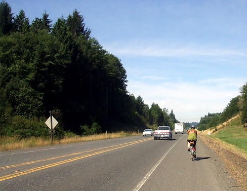
When I worked in downtown Portland, it was easy for me to commute to work on my bicycle. After all, I lived less than two miles from my office and the only hill on the route was the entrance to the building's parking garage. In order to make it a little more interesting, I had worked out several "detours" that would ensure that I got some mileage (and some hills) in before work. These detours ranged from 12 to 25 miles one-way, and they were without doubt the best part of my working day.
But then I got my dream job. The problem is, my dream job is in Salem. I toyed with the idea of a round-trip commute, at least every once in a while, but a dry run proved that unless I wanted to ride the whole way there on the shoulder of Interstate 5, it was at least a 4-hour ride each way (and that was on my "fast" bike with no panniers - not exactly how I would be set up for an actual commute). On my long-haul bike, with fully-loaded panniers, going the safe and scenic route, a more realistic estimate would be 5 hours. So I resigned myself to taking the bus. Sigh. There's a stop about a mile and one half from my house, and so for the first 9 months of my new job I walked to that stop every morning, and walked back home every evening. BORING.
The bus I take is not your average rapid transit vehicle, however. It's one of those charter buses like the ones old people take to the casinos. And starting around May, I noticed that one rider was loading his bike into a cargo bay beneath the bus. I'd thought about those bays, but was concerned that there was nothing to keep my precious Sweetpea from sliding around in there and getting damaged. So I asked him about that, and he said that once the bike is in, and on its side, it really doesn't move. Hmmmm. I began to consider the feasibility of an occasional one-way commute; take the bus to Salem in the morning, with the bike in cargo, and ride home after work
In the interim, a friend at work had scored a secure bike box at the Barbur Transit Center. My bus made a stop there, as well, and so we arranged for me to use that box on the days he had to drive for his carpool. So now I was getting in at least 18 miles a day, which made me a little happier. But I still thought a one-way commute might be fun. So starting about a month ago, I decided that on those weeks in which I did not have a brevet or other long (100+ miles) ride scheduled for the weekend, I would take my bike down to Salem on Friday, and ride home.
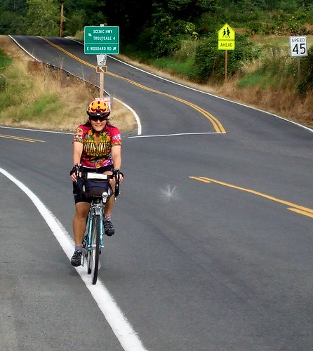
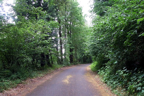
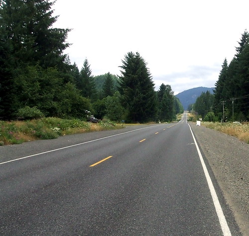
I take fairly quiet back roads, and the route is essentially flat until the last 25 miles, when I hit the rollers outside of Canby, and then a couple of long climbs in Oregon City and Gladstone. If I leave the office at 5:15 PM, and if I am not doing battle with the infamous Willamette Valley headwind, I can make it home by 10:00 (if there is wind, we're talking a little closer to 11:00). I've done it 4 times so far - and hope to do it at least twice a month as long as the weather is decent (not raining and above 40 degrees). It helps to have an awesome lighting system.
Here are some more of the sights I get to see while making that trek . . . .
A little personal history is in order. My tendency to just jump on my bike and ride it for miles in directions unknown dates back to high school, when I would go out riding with my friends Judy and Stacy. Sometimes we knew where we were going and, more importantly, knew how to get home. Sometimes, though, the getting home part got a little tricky. Like the time Judy and I ended up lost in Bostonia, which back in the mid-70's was a very rural area east of El Cajon, California, and we had to call Judy's dad to come pick us up (like the rest of Southeast San Diego County, Bostonia is now very much not-rural). Anyway, on one such ride (and I frankly can't remember if it was the Bostonia adventure or not), we were singing Paul Simon's "Me & Julio Down by the Schoolyard." Except we couldn't remember anything but the line "See you, me and Julio, down by the schoolyard." Over and over again.
Why is that relevant today? Because yesterday (and very early this morning) I rode the Oregon Randonneurs "Nehalem 400" and during the approximately 2/3 of that ride in which I was riding alone, I was singing "Me & Julio Down by the Schoolyard" at the top of my lungs. This time the line I could not help repeating was where Paul sings "Well, I'm on my way/I don't know where I'm going/I'm on my way/I'm taking my time but I don't know where . . . "
But, as usual, I digress. I wanted to tell you about yesterday's ride. There's a certain faction in the randonneuring community that holds that the 400 kilometer brevet is the most difficult of the traditional 200-300-400-600 brevet series. Riders have 27 hours to complete the 400 kilometers (which, for the metrically-challenged out there, is roughly 250 miles). Once you factor in the time spent at controls, that does not allow for a whole heck of a lot of resting time unless you are an incredibly strong rider. The 200 and 300 are more reasonable distances, and the 600 allows for even a middling-strong rider like me to get a couple of hours of sleep between legs (in theory, a particularly strong rider can get a full night's hours of sleep on a 600).
I had already done one 400 this season, on a relatively flat course in the Willamette Valley. Even so, I finished in barely under 26 hours, and was exhausted afterward. This second 400 was shaping to be a far more daunting endeavor. For one thing it was designed by Michael "Ain't No Mountain High Enough" Wolfe. Consequently, it was guaranteed to feature significant opportunities to test out the limits of my granny gears. Second, unlike some of our longer rides, it did not let up all that much in difficulty factor between the first 200K and the second (I know that Michael will disagree with me, but he is young and strong - not an old lady like me). But glutton for punishment, and obsessive-compulsive, that I am, I signed up. My plan was to stick to my friend Rickey's "12 miles per hour/100 km per 5 hours" model, even though I knew that with the terrain that would be merely a goal, and not a given.
The ride started from Forest Grove, as many of our rides do, but it did not start from our traditional venue at the Grand Lodge. Apparently there were no rooms available there, and we need one for Sunday morning so that incoming riders could rest and shower before heading home. So, instead, we started at the Forest Grove Inn. I decided to get a room at the Inn myself for Friday night because even though I live only about an hour from Forest Grove, that's an extra hour of sleep I could use before the ride. So I arranged to leave work a bit early on Friday, and spent a couple of hours preparing the bike and packing my pannier before heading off to the hotel. I was worried that I might run out of food on the 80-plus mile stretch between Tillamook and the finish, but I did not want to carry too much extra weight in the form of food. I settled on two peanut butter and banana sandwiches, three snack size packets of Papa G's seasoned tofu (mmmm, salty!), a large faux-Rice Krispies Treat from New Seasons, and a Clif bar for when I got truly desperate. Half the stash went into the Li'l Loafer on my front rack, the other half went into my pannier along with my tools, tubes, extra tire, extra (empty) water bottle, and spare pair of shorts (I have found that I simply must change shorts every 200K or so . . .). While I was at New Seasons I picked up a sandwich and a bottle of my current favorite beer for dinner - Ninkasi Total Domination IPA. I finally got out to Forest Grove at about 8:00 PM, checked in to the hotel (which had all the comforts of home, if your idea of a comfortable home is one that reeks of Febreze), ate my dinner, drank my beer, popped a couple Valerian, and hit the sack.
The ride was to start at 6:00 AM, and riders started to gather at about 5:30. As of 5:59, we were still short 3 of the 12 pre-registered riders. We had a sneaking suspicion that they hadn't paid close enough attention to the ride information page and had gone to the Grand Lodge, where they were no doubt wondering where the heck everyone was. Oh well, getting to the right start on time is all part of the fun of a brevet, right? We figured that, if anything else, we rode past the Grand Lodge on the way out of town, and if we saw them there we direct them back to where Susan was waiting at the Inn. But when we passed by the Lodge, there was no sign of them. Hmmm.
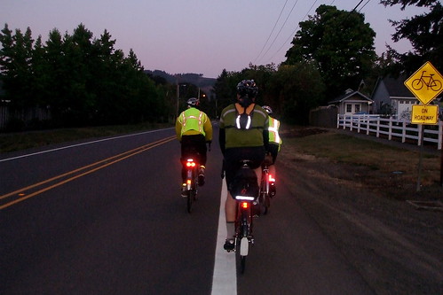
As with most of our rides out of Forest Grove, we started out by riding through town on Pacific Avenue and from there turned onto Gales Creek Road toward Highway 6. Because it was the beginning of the ride, we were all somewhat close together. The sun had not yet risen, and we were in full reflective gear mode.
We turned west on Highway 6 (busy, but with nice wide shoulders), and about three miles later turned right onto Timber Road for our first climb of the day. By this time Gary Smith had caught up with us; he had indeed gone to the Grand Lodge. Once he realized no one was there, he had gone on the Internet to figure out where he was supposed to be. He mentioned seeing another rider who "looked Rando, and slightly confused." After some further physical description, we decided it had to be Marcello. No one had seen Greg Olson yet, but Greg is almost always late, and he is so fast that even when he starts an hour late, he's till among the first ones in. In fact, I am beginning to think he does it on purpose.
The last time I had ridden to Timber Summit, it was covered in snow. It was slightly warmer this time. But only slightly. It was still chilly enough that my hands were stiff and numb by the time we had completed the descent, and shifting was a bit difficult. I began to fantasize about cocoa in Vernonia, more for the hot cup around which to wrap my hands than for anything else.
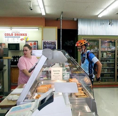
Our first control was in Vernonia. There's a "real" coffee shop there, but I always go to the Shell Station quicki-mart. It has everything I need, but is not so comfortable that I want to dawdle there. The woman that works there are getting used to seeing randonneurs and she already had her pen out to sign my card when I reached the register with my cocoa and Gatorade.
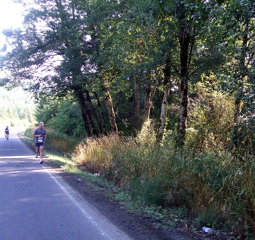
Shortly after we left Vernonia, our route turned onto Apiary Road, which we would follow North-ish for about 20 miles toward the Columbia River. I had never ridden on Apiary Road before, and it was a pleasant surprise. The road was very well-paved (which is unusual for Oregon country roads, which are renowned for their chip-seal) and climbed ever so gently through woods and meadows. I am guessing that on most days Apiary Road is not very busy, but on this particular day we did have to share the road with some unusual traffic: the Hood to Coast Relay.
Not only did we have to contend with runners, but we needed to watch out for their support vehicles, which were all vans and SUVs. Fortunately, the runners were all pretty well spread apart and the van drivers that I encountered were all driving very well and politely, so it turned out to be a non-issue. At the "summit" of Apiary Road we left the H to C route behind. We would cross the route again later in the day, but Apiary Road was the last I would see of any runners.
From Apiary Road we turned, very briefly, onto Old Rainier Road (aka Old Highway 30). That road was under construction, so we had to turn off it and onto the "New" Highway 30, but again that was only for a short while. Highway 30 is busy, but it has very wide shoulders, so I do not mind riding on it. On the other hand, if there is an option that does not involve Highway 30, I will take it, so I was happy to turn off it.
After turning off Highway 30, we followed Alston-Mayger Road for a little under 6 miles to the next info control at the Mayger-Downing Community Church. We were riding along the Columbia River at this point, but were several hundred feet above the water line. As a result, we were treated to some fantastic view of the river and surrounding valley, including a Kodak Moment perfect view of Mt. Rainier. But I was still riding with Ray and RB, so did not stop to take a picture.
When we got to the church, Gary and Thomas (who had come up from California for the ride) were already there. We all took some time writing down the answer to the control question, and then I decided that I needed to take off my leg warmers, apply more sunscreen, and eat something. I am trying to be more sensible about what I eat, and when, while riding so as not to repeat the Timothy 200 famine event. Especially because this time I would not have Lynne around to feed me. While I chewed on a bit of a sandwich, everyone but RB headed off for the shops of Clatskanie. A few minutes later, RB and I were ready to leave as well. It was another 6 mils or so to Clatskanie, but halfway there I spotted a lonely looking little grocery store and decided that I would stop there for some water and a bathroom break.
Between eating, drinking, and fooling around with the timer function on my camera, I took longer than I probably should have. When I finally got back on my bike and rolled into Clatskanie, everyone else had already pulled out, except for Gary, who was just leaving as I arrived. So Gary and I rode through Clatskanie toward the turn-off onto Highway 47 and the climb up Clatskanie Mountain. We had a somewhat close encounter with car when we tried to make the left turn onto the highway. There were cars approaching from the rear, but they were far enough back that we signaled and started to move over to the turn lane. Well, the (I am assuming) very-poorly-endowed-and-therefore-overcompensating-man in the Corvette who had been well behind us at that point would have none of THAT. he hit the gas and headed straight toward us. We quickly pulled back over to the right and he blew past. I guess there's nothing like intimidating a couple of cyclists to make you feel like a real man.
Once we managed to making the turn, we started the second big climb of the day. I had ridden this section of the route only once before, on a supported ride back in 2003. I could not for the life of me remember if I had thought the climb was hard back then. I am guessing I did, because I thought it was hard THIS time, and I've been doing a lot more mountain riding since then. Of course, in 2003 there were water and food stops along the way, I was riding a lightweight aluminum bike and I wasn't packing luggage . . .
Gary stayed with me for the first couple miles, but we eventually got separated by my ridiculous slowness. I would not see another rider for about 160 miles. Because I was riding alone I did not feel bad about stopping to take pictures, however, and so I started documenting the ride much more regularly. The fact that stopping to take pictures also meant stopping to rest was not lost on me.
The climb up from Clatskanie was tough, no doubt about it. At one point my altimeter went a little haywire and showed a rapid succession of incline percentages ranging from 8 to 20%. I do not believe it ever really got steeper than 9 or 10%, though, because I never dropped below 6 MPH, and I know I can't maintain 6 MPH on a 20% grade. I can barely stay vertical on a 20% grade, let alone move forward. But it was definitely steep at points. The descent into Mist was great, however. Technical, but not too technical, with a pretty clean and smooth road surface. And for once there was no mist in Mist to obscure my sight lines.
From Mist, I turned onto Highway 202 toward Jewell. Once again, the route crossed paths with the Hood to Coast relay route, but by this time of the day all the runners had all passed through. All that was left were the road markings and the Porta-Potty workers, busily emptying out and gathering up the Honey Buckets. Now THERE's a fun job on a hot summer day.
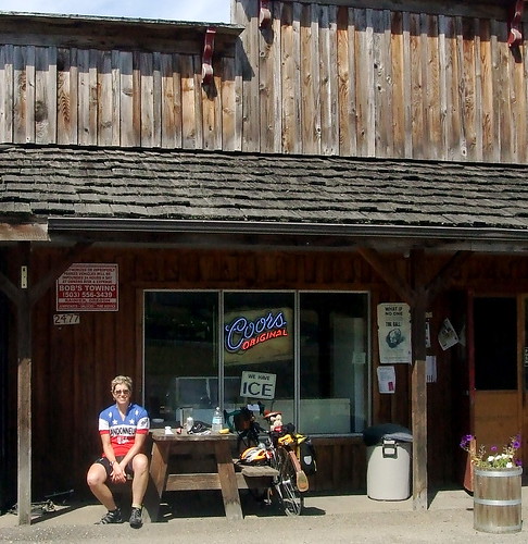
I stopped at the Birkenfeld store to top off my water bottles, and decided to celebrate completing the first 100 miles of the course by indulging in an ice cream bar. Thomas Russell rode up to the store only minutes after I did. He must have stopped somewhere else along the route, because I could have sworn he was ahead of me. He and I chatted for a few minutes while I ate my ice cream and he ate potato chips - topics of conversation included Michael Wolfe's speediness and mountain identification. Thomas then took off while I took yet another bathroom break. I had been as far as Birkenfeld on the 202, but this was the first time I had continued on past. Like (almost) every other road that Michael had directed us down, it was quite pleasant. At Jewell I turned left onto the Fishhawk Falls Highway, which is yet another glorious road! Just under 9 miles of beautiful smooth pavement that rolls through a notch between two steep mountains that i did not have to climb. My kind of fun.
The fun stopped 9 miles later, though, when I turned left off of Fishhawk Falls and onto Highway 26, where I would spend the next 12.4 miles. Highway 26 is the main connecting highway between Portland and the Coast, and on a sunny Saturday it is a bit, well, busy. Beehive busy, except that the "bees" are ginormous SUVs, motor homes and tour buses, all of are being driven well above the posted speed limits. That, combined with a practically non-existent shoulder for the first 8 miles or so (including 4 miles of climbing in which passing vehicles refused to move over into the passing lane for a mere bicycle) made for a less than stellar cycling experience. Too make matters worse, I had reached the sell-by date on Shorts Pair #1 and was beginning to feel the first of what promised to be a thousand cuts. Trying to stave off damage by dumping baby powder into my shorts turned out to be a terrible idea - it simply soaked up my salty sweat and held said salt directly against that "cut." Fortunately, there are several turn-offs into timber properties along the highway, and one offered sufficient shelter for me to perform a quick change without risking arrest for public indecency. Another crisis averted. Whew! Shortly (pun intended) thereafter, I reached the summit.
The last four-plus miles of Highway 26 were marginally better: I was going downhill and had a much wider shoulder. The traffic was still bad, but I no longer feared that I would be sideswiped by a bus. I was developing a headache, however, and so I was thrilled to reach the turn-off onto Highway 53 at Necanicum Junction (try saying THAT three times fast!), even if I did have to cross the highway to get there.
The market at Necanicum Junction was the next control. I was craving salt by this time and so plunked for a huge bag of Fritos. I also got MORE gatorade, a Diet Coke (Mars Needs Caffeine!), and 800 mg of Advil.
I sat around at the Junction for a while, decompressing from the Highway 26 experience and waiting for the Advil to take effect. A woman drove up in a truck and said, "You're the one I saw on the highway - I was yelling, 'Go, Wonder Woman, Go!'" That made me smile. It didn't make me want to ride that highway again, but it did make me feel better about having done it once.
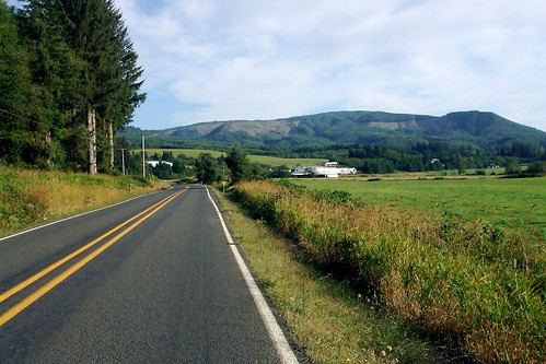
My head began to feel less Gumby-like, and time was moving on even if I wasn't, so I gathered myself together and headed out onto Highway 53. What a lovely road! Smooth pavement, mostly downhill, soothing bucolic scenery, NO TRAFFIC. Aaahh, yes, I remember now, THIS is why I do this. After about 15 miles on the 53, I turned onto the Miami River/Foley Creek Road (Oregon has a penchant for giving roads multiple names; I think it is in order to confuse non-natives), another lovely, low-traffic road. I had entered Tillamook County by this point, and dairy farms were plentiful. As was that fragrant dairy air. Aah, bucolia.
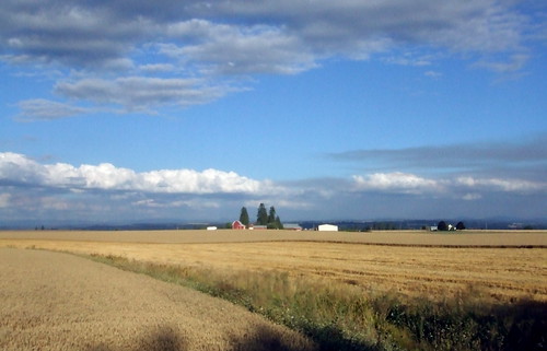
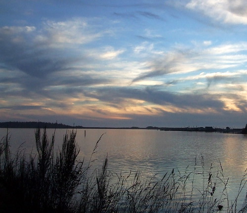
Another 12 miles, and I was at the coast--two hours ahead of schedule, and just in time for a spectacular sunset. I stopped to take many pictures, and then headed south on 101 through Bay City toward Tillamook. Traffic on 101 was not bad; I had a wide shoulder and all the cars gave me a wide berth. I rode past many tourist attractions like the cheese factory and various seafood and/or beef jerky huts, and pondered how many oysters died to make the gigantic shell middens outside of Pacific Seafoods.
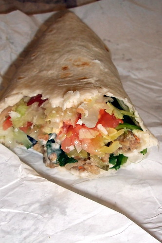
I was starving (again) and so I stopped at the Subway on 101 for a real sit-down-on-a-chair dinner. The gal at the counter (who looked just like Parker Posey's character in "Waiting for Guffman," except she had a Subway visor on, and not a DQ one) let me bring my bike inside because I was not carrying a lock. I tried their faux-Gardenburger wrap - it was pretty tasty, I have to admit.
I continued on the 101 through "downtown" Tillamook and further on south to the next control at Beaver. It was getting late, and I was not going to be passing any more open markets, but I had filled up my extra water bottle in Tillamook and I still had a PB/Banana sandwich and a bag of potato chips. I also knew that Ken Mattina, a fellow Rando, was going to be waiting for riders at a campground about 15 miles up the road from Beaver with more food and water. So I was not worried about running out of food. I was also no longer worried about running out of time. Even though I was no longer on track for Rickey's 5 hours per 100K plan, I was still well ahead of my self-imposed schedule for a 24-hour completion time. I was even beginning to entertain fantasies of a 22-hour completion time. Yeah, well, the Nestucca River Road took care of THAT fantasy.
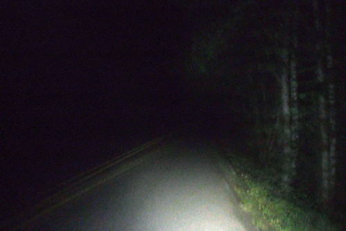
Ah, the Nestucca River Road. Friends had been telling me about this mythic pass to the coast from Carlton to Beaver; rumors of quiet, low traffic route with beautiful scenery. Here was my chance to see if the stories were true. Well, I guess "see" isn't such a good word choice. In the middle of the night, there was not a whole lot of "seeing" going on.
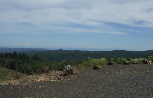
The Nestucca River Road (or "the Big Nestucca," to differentiate it from the far-easier-to-climb Little Nestucca River Road south of Pacific City) is a 34-plus mile climb through the forest. Michael "my sense of proportion is skewed" Wolfe, the route designer once described the grade as "almost imperceptible." Yeah, right. If by "almost imperceptible," you mean "relentless." He later admitted to me that he did drop into his granny gear at one point just before the summit. That made me feel a little better. He was probably lying.
Apart from being a long slog, the road is (mostly) pretty nice. There was no traffic on it whatsoever, which is pretty good because I was spending most of the time smack-dab in the middle of the road. To my right I could hear the river rushing downhill to the ocean, but otherwise the only sound was my breathing and grunting. About 7 miles in, the road got bad. REALLY bad. MIchael had warned us that there was a 4-mile stretch of construction and had warned us it would be bad. Boy, was it. Even in daylight it would have been tough to navigate; at night it was treacherous. Several times I got off and walked through the worst bits. I was too tired to try to fight to maintain balance in deep gravel. My nerves were well-wracked by the time I reached the end of the road work.
Eventually I reached the campground where Ken was waiting with food, water and encouragement. Some yahoo had stolen his RUSA/OrRando sign, so he had attached a blinkie to the campground sign. He saw my lights as I rode up and came out to guide me in. He had water, cookies, fruit, eggs and his deservedly famous roasted rosemary-garlic potatoes. The temptation to just stay and eat was enormous. I asked Ken how far behind the other riders I was, and he said that Thomas had left about 10 minutes before I arrived, and that Ray and RB had left about 45 minutes before that. I was surprised, I had assumed that everyone was HOURS ahead of me by this point. The only rider we were not sure about was Marcello; he had gotten a late start, and I had never seen him. We did not know if he was still on the road or not. Ken decided that after I left he would pack up and start driving toward Tillamook, to see if might come across Marcello on the way.
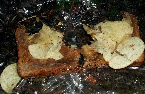
I finished my last potato, topped off my water, and headed back out for the final bit. Ken told me that the next unpaved section was coming up soon, and the descent would start shortly after that. Well, he was right about the first part; I did hit the next unpaved section shortly thereafter. But the descent was still MILES ahead of me. I was beginning to despair. I was exhausted; so exhausted that I was afraid I was going to tumble off my bike. At points, I simply had to dismount and walk. I figured falling down while walking would do a lot less damage than falling off the bike. I decided that maybe I needed more calories, so I dug out my last PB/Banana sandwich and that bag of potato chips. I was alternating bites of sandwich with bites of chip when it occurred to me that there was a much more efficient way to go about it.
Elvis, eat your heart out.
Finally, I could see that the road was beginning to top out. As I reached the summit and rode along the edge of the reservoir, I could see the valley lights spread out before me. I soon turned away from those lights, however, and began the long drop into Carlton. In daylight, the descent to Carlton is probably a lot of fun, if a bit technical. In the wee hours of the morning, however, I could not risk crashing and so took it slowly. I rolled into Carlton sometime around 3:00 AM, I think. It's all a blur at this point. From Carlton to the finish in Forest Grove was an 18-mile straight shot down Highway 47. Needing some incentive at this point, I set my "navigator" function to 0 and began to watch as it ticked away the last miles.
About 11 miles outside of Forest Grove, I saw a blinking red bike light ahead of me. As I got closer, I saw that there were two sets of red bike lights. I got closer still, and realized that it was Ray and RB. I caught up with them and called out that I thought that they would have been done already. Ray said he thought so too, but that his stomach had started acting up and that they had to stop and nap a little. Ray and I rode together for a while, but then he dropped back and I caught up with RB and rode in to the finish on his slipstream.
Michael was waiting for us at the hotel, pen in hand to sign our cards. Thomas had arrived about 10 minutes earlier, and was still hanging out to greet us. Michael congratulated me on the finish, and noted that I had shaved more than two hours off my previous 400. After getting my card signed, I took a much needed shower, changed into loose clothes and lay down for a nap. I was going to give Michael a ride home to Portland, but told him that he would have to wait for me to get some sleep, otherwise I might be crashing the car . . .
I woke up about an hour later, feeling chipper enough to drive. By this time Marcello had arrived, and so all the riders were in. Michael and I packed up the car and headed out. An hour later, I was home. An hour and 5 minutes later, I was sound asleep.
Statistics:
Total miles: 253.4 Total elapsed time: 23 hours 6 minutes Total saddle time:19 hours 25 minutes Average speed:13.03 mph Total elevation gain: 11,379 feet Maximum elevation: 1970 feet
I've always loved that Ginger Rogers quote about doing everything Fred Astaire did, except backwards and in high heels, and it was running through my head on Sunday when Lynne and I pre-rode the route for the Oregon Randonneurs "RUSA 10th Anniversary 200K." It was in my head because we were riding parts of one of my favorite routes, the "Bridge of the Gods" loop, except we were doing it backwards and the designer had thrown in some added climbing that made me feel like I was riding in high heels. Okay, that was a pathetic analogy, I know.
Like I said, Lynne and I were once again pre-riding a brevet route. I realized that half of the brevets that I have ridden this season have been as a volunteer. We've got to get more volunteers . . . . Anybody? Anybody? Bueller? Bueller? But I digress. here's the 411 (in addition to what Lynne has already related)
The route starts in NE Portland, at Wilshire Park - about .5 of a mile from the Kennedy School (if you're looking for lodging or post-ride beer) and the Concordia New Seasons (if you're looking for post-ride groceries). From there we headed northeast on 33rd Avenue, keeping to the right to go over Columbia Blvd. and then looping back down to continue on 33rd to where it T's out at Marine Drive. There is a bike lane on Marine Drive, but there is also a bike path that runs along the levee - we hopped on the bike path because it is prettier and there are fewer semis. The bike path ends at the I-205, where we jumped back onto Marine Drive. From the I-205 to Troutdale we stayed on Marine Drive. There are bike paths at random points on either side of the roads, but it was easier to just stay on the road in the bike lane.
Marine Drive ends at the frontage strip in Troutdale, where we turned left. There are a lot of fast food joints on the frontage road. After screaming at the tourist in the Econo Van who almost right hooked Lynne in their anxiety to get a fatso-burger, we turned onto 257th and climb up the hill toward the Historic Columbia River Highway. There's a protected left turn there, but watch out for drivers intent on getting into it before you do, even if it means running over you (this turned out to be a recurring theme on our ride). The main street in Troutdale is touristy, but you'll be passing through town too early to buy any tchotchkes. There's a short downhill from town to a park by the river. Multnomah County in its infinite wisdom required Troutdale to design the bike lane to take a very sharp right to avoid passing over a narrow bridge. It's safer to just ignore that lane and stay on the highway. To your left is a park with a flush toilet - you need to ride back into the park by the playground to find it.
Just past the park we crossed the bridge over the Sandy River and turned right. The road remained flat for a while, as we passed such local landmarks as Tad's Chicken and Dumplings, but shortly after the Stark Street bridge we started the first real climb of the day. It's a roughly 6-mile climb, but never very difficult - especially if you've got the wind at your back. Look for the Job Corps Dragon on your right as you grind your way up. The climb tops out in "historic Springdale," where there is a market.
The road then flattens for a while, and then there's a little more climbing around Corbett (where there is another market). Just outside of Corbett is the Portland Women's Forum viewpoint where, on a clear day you get a great view of the Vista House far below, site of the ride's first "control."
From the Women's Forum it's a short, steep drop to the Vista House. The building opens at 9 AM, and has flush toilets and a snack bar. It also has great views and quite possibly the world's least useful bike rack, which, amusingly enough, was placed there by the Portland Wheelmen TC. If I were them, I'd have asked for the money back. It's an embarrassment.
It's just about 10 miles from the Vista House to Multnomah Falls via a great swooping downhill, with a couple of sharp hairpins. The descent bottoms out at Latourelle Falls and from there it is a series of rollers to Multnomah Falls, where you will find more flush toilets, an espresso cart (with pastries!) and a very expensive snack bar. Watch out for the RVs in the parking lot backing up with no warning.
From Multnomah Falls we continued on the historic highway as far as Dodson. The highway was repaved a few years ago and the surface is nice and smooth, and pretty flat, to boot. There are lots of wildflowers blooming. LOTS of sweet peas . . .
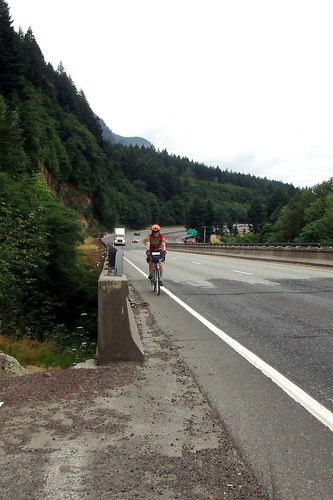
In Dodson the road ends, and anyone who wants to continue going east has to go onto I-84 (this is one reason I do not do the route in this direction when I am doing it on my own - if you go east on the Washington side and come back west in Oregon, you are on the freeway for less than 1.2 miles - going east in Oregon you are on the freeway for almost 2.5 miles. Fortunately, the shoulder is very wide and relatively clean -EXCEPT in two places, where you have to cross a short narrow bridge with practically NO shoulder. That part is, um, a little scary . . .
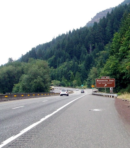
We exited the freeway at the Bonneville exit, and hopped onto the MUP (multi-use path) that connects the Tanner and Eagle Creek trails and eventually dumps out in Cascade Locks. The MUP is actually part of the old highway repurposed for better things, and it is the most beautiful part of the route. PNW rain forest complete with primeval ferns.
About a mile into the path is a set of stairs. Some inbred removed the "Stop" sign just before the stairs and tossed it down the side of the hill (last time Lynne and I went through we had rescued the sign from a similar fate, but this time it was too far down to pick up), but there is a yellow "Stop Ahead" sign (albeit somewhat hidden by foliage). The stairs are steep. They do have a bike gutter, but because they are so steep it is pretty useless. We just carried our bikes down.
There are many food options in Cascade Locks - ranging from the bakery and restaurant at Char Burger to a brewpub-slash-hostel to tribal members selling salmon in the parking lot. We ate food we packed from home, but I was tempted by the $1.95 Cinnamon Crispy at the Char Burger bakery, which looked like fried dough but which was described to me as a "flattened cinnamon roll." I decided to pass and ate my tofu jerky instead.
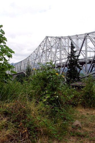
At Cascade Locks the route crosses over the Bridge of the Gods to Washington. If this is your first time over, don't look down. HA!, I have now guaranteed that you WILL look down. The road surface is a weird metal grate - skinny tires are at a definite disadvantage, especially in the rain. if it is dry, the crossing is not bad at all. There is NO toll for bicycles. I repeat, NO TOLL!
After crossing the BOG, the route heads east on SR-14 through Stevenson, where we found more markets --one selling soft ice cream, one selling hard ice cream, one selling both.We didn't get any ice cream. Stevenson is also home to Walking Man, one of the best microbreweries in the PNW. We didn't get any beer.
Shortly after leaving Stevenson, the route takes a left onto the Wind River Highway toward Carson. BE VERY CAREFUL MAKING THIS LEFT TURN - you will be climbing at this point and so moving somewhat slowly. Impatient drivers will zoom around to your right to get into the protected left turn lane before you do, thus cutting you off and almost killing you - much as two drivers did to Lynne (with a third who tried but couldn't get around her before she was into her turn.)
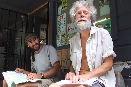
From the Carson turn-off it is an 8.5-mile climb to the Stabler Country Store. The grade never exceeds 4%, but it also never seems to end. There is no paved shoulder. Unless you like riding uphill in deep, soft gravel, you will be riding to the left of the fog line. If you are in a group, you will definitely need to ride single file - the drivers on this road are fast and inconsiderate. Just before the store is a short descent. There is a flush toilet at the Stabler store, but it has a slow-filling tank, so you might want to get your card signed before using it! The store is a popular mail drop for PCT hikers like "Voyageur,' the through-hiker we met on Sunday.
After getting our cards signed and chatting with the hikers, it was back the way we came to SR-14. The downhill side of the Wind River Highway was equally shoulder-free. The route then follows SR-14 west for just over 20 miles. Just before we reached Cape Horn, we took a right turn onto Krogstad Road. Look for the small house with the tall fence and giant satellite dish. Krogstad starts off as a one-lane private road but shortly afterwards becomes a regular ol' road with a yellow center line and everything. There are loose dogs on Krogstad that will run after you, but they responded well to a firm "Go home!" Don't miss the castle to your left; it has a glass blowing studio.
Just when we thought we couldn't climb anymore, we turned right on to Canyon Creek Road for a little more climbing, followed by a nice, gentle downhill to the control at Washougal River Mercantile where we found many snack foods, friendly service and another flush toilet! (Yes, these things are important to me).
From the WRM, we turned left on Washougal River Road toward Camas. The road parallels the river and is gently rolling. Traffic can be busy, and the shoulders are narrow. After about 9.5 miles we came come to a bridge. Directly before that bridge, and I mean DIRECTLY, was Shepherd Road, our next turn. Shepherd T's out at 3rd Street in Camas, where we turned right. 3rd T'd out at Adams, where we turned right again and climbed a short hill to 6th (look for the flashing yellow light), where we turned left. By this point we were holding our breath because we were skirting around the Georgia Pacific pulp mill, which is why Camas smells the way Camas does . . . note the "car shower" in the employee parking lot to the left, where GP employees can wash the poison off their cars before going home . . .
Shortly after the mill, the route takes a left to stay on 6th. There is a left turn lane, but watch out for oncoming traffic exiting the highway. 6th turns into the old Evergreen Highway, which the route follows for abut 7 miles. This stretch of road is home to some of the tackiest expensive houses I have ever seen! Also loads of blackberry vines and great views of the Columbia River.
About four miles along this road, just past the cemetery, is a fork where 164th St. goes off to the right. STAY LEFT. In another three miles or so, the route takes a right onto Ellsworth, which at 8% just happens to be the steepest climb of the day. Fortunately, we only had to winch ourselves up for less than one-tenth of a mile. Then it's a right onto 23rd to the I-205 bike path.
After a short climb to get onto the bridge, it's all downhill to the Oregon side. The path takes a sharp left turn, crosses a bridge and T's out. We turned right (away from the river) and then right again on Alderwood (the first street that the path crosses). At this point we were riding through the Land of Airport Business Parks, but it was okay because we were almost done and too tired to care about scenery, anyway. Just past the golf course we turned right on Cornfoot Road, which we followed all the way to a left turn on 47th (the entrance to Boeing was on our right). Now we really were almost done! We followed 47th past the compost plant and the pallet yards and crossed Columbia at the light. One more little climb up to Holman, right on Holman, and left at the roundabout onto 37th. We risked the dangerous crossing at Prescott, but other riders should just turn right on Prescott so as to avoid getting killed at a poorly designed intersection and then turn left at at 36th or 35th. After that it's only a block or so to the finish.