PROLOGUE: What the Aitch Eee Double Toothpicks Was I Thinking?
Each year I set new cycling goals. I used to just set a mileage goal, increasing the total with each passing year. But lately I have added specific event goals. For example, in 2006, I decided that I would do Cycle Oregon. In 2007, I started riding brevets, and decided to try for an R-12. I was halfway toward that goal when I got sidelined, so that is back on this year's plate. But that was an old goal; I needed to add something for this year. Overachiever that I am, I added TWO new goals. First, the fleche. I chalked that up last month. Second, I decided to try for a Super Randonneur medal.
To achieve SR status, I would have to ride at least one brevet each of 200, 300, 400, and 600 kilometers in length. I was not worried about the 200 and 300 km brevets. I have done quite a few of those in the last couple of years. The 400 and 600, on the other hand, would definitely be a challenge. The fleche was "only" 360 km, after all, and I was pretty dang miserable toward the end of that ride. But in for a penny, in for a pound ( I guess now that would be a Euro) - I had announced my goals and I had already done the 200 and 300. I had no choice but to follow through with the 400 and 600.
Most randonneuring clubs schedule their brevet series in order: 200, 300, 400, 600. Our club administrator decided to schedule the 400 and 600 out of order, though, because she believes that the 600 is actually easier than the 400, because there's more opportunity for down (as in sleep) time. So last weekend I rode the ORR Kings Valley 600 km brevet.
CHAPTER THE FIRST: In Which I Prepare for the Inevitable
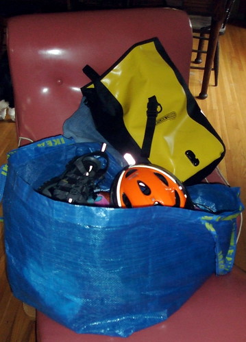
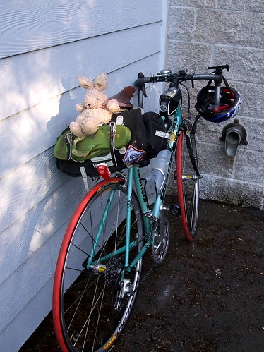
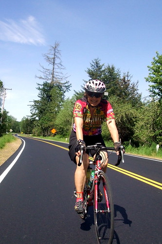
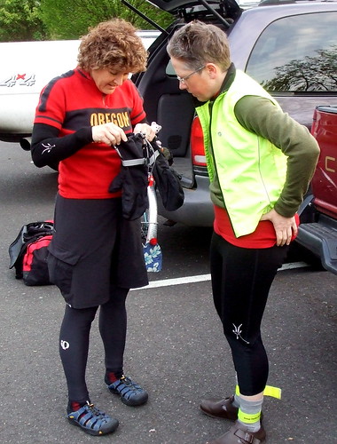
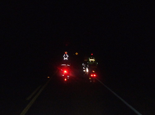
My ride really began on Wednesday, when I began to organize my clothing and supplies. I wanted to be sure that I had everything I could possibly need, but at the same time I didn't want to be hauling too heavy a load. I would have two bags on the bike: a small front bag for those items to which I would need quick and easy access (snacks, camera, money, first aid kit and sunscreen), and a small pannier on the rear rack for spare inner tubes, a patch kit, a multi-tool, and mini tire pump. The pannier would also be the repository for my reflective vest, spare batteries, spare socks and gloves, and a second pair of shorts. I have found that after 120 miles, it really helps to change shorts. I would keep my all-important brevet card in a sealed plastic bag in the rear pocket of my jersey. I had bungee cords on the rear rack to strap in my rain jacket and arm/leg warmers for when I was not wearing them. As usual, TRFKAF was also strapped to the back. Finally I installed my new taillight, which Greg had given me for my birthday. He worries about me riding alone at night in the dark. Now he's not so worried. This is the low setting:
Because the ride was designed as a double loop, I knew that I could leave supplies for the second day at the hotel that we were using as a base camp. So I made two piles, one for each day, of clothes and accessories. Each pile then went in its own plastic carrier bag. In a third bag I put clothes to change into after the ride was over. Loose, soft, fleecy clothes with zero spandex content. In yet another bag, I put my food: a loaf of bread, a jar of peanut butter and some bananas with which to make PB & Nanner sammiches, three small boxes of raisins, two small packs of jelly beans and a couple of fancy-schmancy energy bars. Although I knew that there would be any number of places to stop for food along the way, I did not want to risk bonking out in the middle of nowhere in the middle of the night. The clothing and food bags all then went into my giant blue IKEA reusable shopping bag, along with my helmet, cycling sandals and water bottles. My ride preparation also included a visit with Michael Sylvester, the professional bike fitter who worked with Natalie to design my bike. Because the bike had been fit to my measurements from the get-go, Michael did not need to make many changes, but he did need to adjust the seat that I had put out of whack when I switched out saddles for my ride to the coast on the old bike the week before. In the process, Michael noted that the bike's handlebars were slightly higher than called for by the original specs, but because I had been riding comfortably with them in that position we decided to leave them where they were.
The ride started in Newberg, Oregon, which is about halfway between my home in Portland and my job in Salem, so I decided to spend Friday night at the hotel so as to get as much sleep as possible before the ride. I also reserved a room for Saturday night, so that I could shower and nap in privacy in the two or three hours of down time I anticipated having (or at least hoped to have) between the two loops of the ride. That meant driving to work instead of taking my usual commuter bus, so Friday morning I loaded my gear in the car, strapped the bike to the rack, fed the dogs, kissed Greg good-bye and headed out. Friday evening I drove to Newberg, checked into the hotel, unloaded the car, walked downtown for a burrito dinner, went back to the hotel, popped a couple valerian capsules and went to bed. After first yelling at the kids in the hall way to shut the f*** up. Twice.
The annual "Reach the Beach" century was held this past Saturday (May 17). It is a fundraising ride for the American Lung Association. There were five routes to choose from, starting in various cities in the state and ranging in length from a 25-mile mountain bike ride to a 103-mile "century." All five routes ended at Cape Kiwanda, in Pacific City. The sponsors advertise it as a "season opener." Yeah, right. That assumes my riding season closed at some point. For most participants, however, it IS a season opener; I must have overheard at least 40 conversations that included the words "first time I've been on my bike since September." I am guessing that by the end of the day at least some of those folks were wishing they'd put in just a few more miles in the saddle the week or two before.
Lynne, Jason and I decided to ride the 103-mile route, which started at an elementary school in Beaverton. Our plan was to then spend the night in Pacific City and Lynne and I would ride home the next day. Jason's wife and daughter would drive out to join us for the night, and then Jason would drive home with them. Jason hasn't been riding much lately, and so was content with one day of riding. I am training for a 40-hour, 600 kilometer ride this coming weekend, and so needed as much saddle time as possible. Lynne has wisely decided NOT to attempt the 600, but she nevertheless was willing to spend another full day in the saddle.
The ride started at 7:30 Saturday morning. Lynne lives about 5 miles from the start, so I spent Friday night at her house. We took our overnight gear to Jason's house, so that his wife could bring it to the beach (and back!) in their car, thus allowing us to ride the non-rando (as in "faster") bikes since we would not have to carry luggage. Or at least more luggage than could be carried on the fast bike.
Saturday morning, we were up early. Lynne had cooked a big pot of steel-cut oats the night before and I had brought some left-over fruit salad from home, so breakfast was easy and quick. We had prepped our bikes the night before, and so that part was also easy. Our plan was to meet Jason somewhere on Murray Road and ride with him through the neighborhoods to the start. This involved Lynne giving me a little tour of the less-odious parts of Beaverton (houses, schools, some businesses, but only skirting one mega-mall). The weather was forecast to be hot and sunny, with highs in the 90s; at 6:30 it was already 60 degrees and we were all wearing the bare minimum of clothing necessary to cycle comfortably yet remain presentable (to the extent anyone is EVER presentable in Spandex or Lycra-based clothing). It was the first time I'd set out this year without arm warmers, leg warmers, a rain jacket and long-fingered gloves. I did have socks on under my cycling sandals and I would eventually remove even those (with dire consequences to be revealed later -- cue ominous music).
A lot of Oregon riders wait until the last minute to register for rides in order not to sign up for a ride and then not do it because of bad weather. The simple solution, of course, would be to acquire the proper equipment to allow riding in any weather . . . Anyway, that meant that the packet pick-up line was very long. I had picked my packet up at a pre-ride event last month, but Lynne and Jason had to wait in line.
I took advantage of the time to eat my second breakfast (a giant vegan muffin from Black Sheep Bakery by way of New Seasons) and visit the "blue rooms."
Once Lynne and Jason had their packets and had fastened their ride numbers to the jerseys and bikes, it was time to leave. In past years the first part of the ride was a rather unpleasant trek on Highway 99W, a busy roadway with bad shoulders. Last year they wised up and introduced a new route. I skipped the ride last year, so this was my first experience with the change. It was a definite improvement; following a number of my favorite hilly back roads through Sherwood. The only problem was that there are some fairly technical descents on those roads, and there were a lot of inexperienced riders - I saw one guy run off the road on a steep hairpin (he was okay) and witnessed a whole lot of near misses when inexperienced riders took up the middle of the road and then hit their brakes. I just did my best to hold my line and avoid the wobblies.
After having spent the last few months doing only unsupported randonnees, it was odd to be on a ride that was not only supported, but supported to a ridiculous extreme. There were 7 rest stops between Beaverton and the beach, averaging out to about one every 15 miles. Each rest stop was extremely well-stocked with food and fairly well-stocked with water. Water was the primary concern for everyone, though, because it was already well into the 80s by mid-morning. The line for water at the third rest stop, which we reached at about 11:00 AM was about four times as long as the line for the blue rooms.
Lunch was in Amity, about 45 miles into the ride. There was a sandwich "bar" at which riders could make their own enormous deli sandwiches. I wasn't all that hungry, so just made myself a small peanut butter and banana sandwich and chased it down with some chocolate pudding. By this point it was very warm and my feet were starting to overheat. So I decided to take off my socks. I had been slathering on the sunscreen all day, but forgot to add my newly naked feet to the sunscreened territory. That was a mistake.
Earlier in the ride we had enjoyed a very slight tailwind. After Amity, however, we "enjoyed" a brutal headwind and we "enjoyed" it all the way to the beach. Fun times. The temperatures continued to climb, and by the time we got to Sheridan I had a headache. Another rider kindly gave me some of her ibuprofen, which helped. It also helped to stand under the water mister that the volunteers had erected, at least until the water made the sunscreen on my forehead run into my eyes. Ow! What helped the most, however, was the seemingly endless supply of watermelon at that rest stop. I read somewhere that eating watermelon helps to cool overheated bodies; I believe it.
The stretch from Sheridan to Grande Ronde is the most unpleasant portion of the ride. It's not very pretty and the route forced us to ride on the shoulder of Highway 18, a very busy road, for an extended period of time. The shoulder there is narrow, and bordered by very deep rumble strips. Hitting one of those the wrong way on a bike can have disastrous consequences. As it was, I hit one while holding my camera. My camera went flying and hit the road with an ugly thud. "Good thing I bought that damage insurance," I thought to myself. Wonder of wonders (miracle of miracles), the camera survived the fall. I am assuming, of course, that had I NOT purchased that insurance the camera would have been destroyed. The funny thing is that there is a perfectly LOVELY road that parallels Highway 18 that we could have taken instead, but to get there would require crossing the highway and I guess the ride organizers were concerned about holding up (or dodging) traffic. We would take that road on the way back Sunday . . .
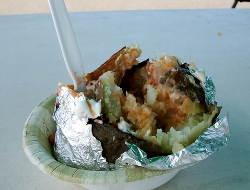
At Grande Ronde I was finally hungry. Fortunately, this was the second "lunch" stop, and so they had baked potatoes and veggie chili.
They also had cookies. Lots of cookies.
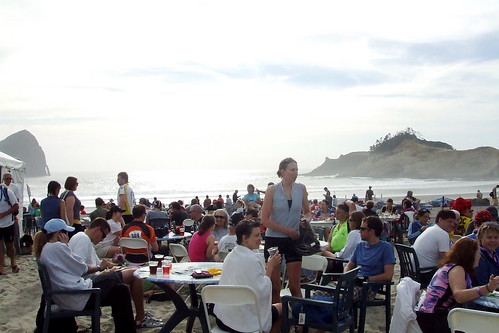
The last 25 miles (or so) from Grande Ronde to the beach were the prettiest part of the ride, as we climbed over Sourgrass Summit of the Coast Range and into the Siuslaw Forest on Little Nestucca River Road. We finally reached Cape Kiwanda at about 5:00 PM, just in time for one beer in the beer garden before we needed to meet Jason's wife at the beach house we were renting.
Our friends Diane and Ron were also staying at the house. Ron had social plans for the evening, and Jason went out for dinner with his family, so Lynne, Diane and I ordered a pizza. We soaked in the hot tub for a while and then it was time for bed; we had another ride in the morning, after all.
Morning arrived much sooner than any of us would have wanted, and we once again prepared to ride. It was cool and misty, but we were pretty sure that it would warm up before long, so we wore only light layers that could easily be shed. We met up with two of Diane's friends, Tess and Martin, for the ride back.
We retraced our route from Saturday with a couple of significant changes. First, we avoided the ugly part of Highway 18 between Grande Ronde and Sheridan by taking Yamhill River Road instead. This is a great road, and has recently been repaved, making it even better. We could see a rider on Highway 18 who clearly didn't know about this "secret" route. We felt sorry for him.
We reached Amity at noon and stopped for lunch, getting sandwiches at the deli and lounging in the park. It was pretty hot at this point, and it felt good to sit in the shade for a while. We still had at least 50 miles to go, however, and so we reapplied our sunscreen (this time I remembered my feet) topped off our water bottles, and headed out. We retraced Saturday's route as far as North Valley Road, but then veered off towards Hillsboro, thus avoiding some of the climbing that we had done at the beginning of Saturday's ride. Temps were in the upper 90s at this point, and water was at a premium. We had topped off in Lafayette, but then had a good 30 mile stretch of no services. By the time we reached the Forest Hills golf course, we were parched.
Shortly after leaving the golf course, our group split up. Tess and Martin were headed southeast to the start point of Saturday's ride to pick up Martin's car, and Lynne, Diane and I were headed northeast to Lynne's house. Either way, we all had about 20 more miles to go, and exhaustion was setting in. The last stretch before Lynne's house required navigating some very busy roads in Hillsboro and Beaverton, but Lynne knows those roads well and showed us the safest ways to get where we needed to go. We reached her house just about 11.5 hours after we started; hot, tired, and happy to be (almost) home. Diane and I threw our gear in my car, loaded the bikes on the rack and headed back to Portland. I dropped Diane off at her house, came home and ate the world's biggest burrito, drank a well-earned beer, and went to bed.
Saturday's stats:
107 miles Saddle Time 6:58:54 Total Ride Time 9:52:52 Avg Speed 14.6 mph Max Speed 41 mph Total Elevation 3297 feet Max Elevation 966 feet Average incline 2% Max incline 11% High temp 99 degrees
Sunday's stats:
114 miles Saddle Time 7:58:17 Total Ride Time 11:22:55 Avg Speed 14.3 mph Max Speed 38 mph Total Elevation 2711 feet Max Elevation 680 feet Average incline 1% Max incline 7% High temp 94 degrees
The rest of my pictures are here Lynne's pictures are here Lynne's write-up is here
Here's the thing. The 5K run is for a really good cause. The purpose is to raise money to help fund Portland's St. Andrew Legal Clinic. The clinic provides much-needed legal services for families who would otherwise have to navigate the difficult waters of Oregon domestic relations law without assistance.
Here's the other thing. Judging by my fund-raising results last year, people will PAY to see (or at least learn about) me hurt myself. Yes, it's true, the possibility that I might permanently injure myself encouraged a LOT of people to donate a LOT of money. Now, they all swore, of course, that seeing me in pain was NOT the reason they sponsored me, but I am pretty sure that at least some of them had their fingers crossed behind their back when they said that.
Which leads me to my point. Members of the Oregon State Bar Leadership College have put together a team to run in this years race on June 21. As a 2008 "Fellow" (or "feller," as I prefer to put it), I kind of sort of let myself get talked into doing the run again. Clearly I need to up my meds . . .
So here's your chance. You too can encourage me in my foolishness, and support a truly good cause at the same time. it's a win-win. To sponsor me on-line, follow this here link
Click on the "Sponsor a participant in the Race for Justice" radio button, and enter my name "Cecil Reniche-Smith" in the box. Click "Continue" and follow the payment instructions. Thank you for your support!
(And, yes, I know that I don't HAVE to RUN the 5K. If you know me at all, however, you will also know that when everyone else starts running I will feel the need to beat at least some of them to the finish line. Call it a sickness.)
Last weekend I put the limits of my strength and endurance, not to mention sanity, to the test by participating in the Oregon Randonneurs "Fleche Ouragon". A "fleche" is a 24-hour team cycling event in which each team must complete at least 360 kilometers in 24 hours. There is a central finish point, but each team creates its own route to get to that point - usually a straight(ish) line from a distant point, but some routes have a more loop-like quality than others. The rule is that you cannot start and end your ride in the same town. But if you just HAPPEN to plan a route that starts in the next town over from the end, and if that next town over is, say, 1.5 miles from the town you end in, well, that's not EXACTLY a loop, is it?
Completing a fleche would mean riding at least 225 miles in one shot (the longest rest period allowed is 2 hours). That is 28 miles longer than my previous one-day record of 197 miles. But I've been riding further and further each time out, so I figured it was worth a try. So when my friend Rickey Smith started talking about doing a fleche last fall, I started giving the concept serious thought. And when my friend Susan France suggested I be on the all-woman team, I said sure. That was before Susan advised me that she wasn't actually riding and that I would have to be the team captain and put together the route and other documents. Fortunately, she let me use the route she designed last year; with a little tweaking to make it less loop-like (they had started and ended in the same location, a no-no under the new rules - or "non-non," I guess, given that the rulemakers are French). Instead of starting in Forest Grove, we would start in Cornelius. Normally, to get to Forest Grove from Cornelius, you would head west on Highway 8 for about 1.5 miles. We took the scenic route instead, and got there by way of Corvallis. Corvallis is roughly 97 miles south of Cornelius.
Having chosen a route, the next item of business was to chose a team name. My in-depth research had shown that past fleche teams have generally chosen names that played on the word "fleche." Names like "In the Fleche," "Fleche for Fantasy," you get the picture. So we bandied some of those kinds of names about: "Fleche Pots," "Fleche-Eating Bacteria,' "Flechely Delights," "Fleche-Ripping Weasels," etc. None of those really caught our fancy, and in the end we went with "Full Metal Fleche": an homage to one of my favorite movies and an acknowledgment that we all ride steel bikes. The fact that the movie is about the idiocy of entering into an extended ordeal with no clear exit strategy did not factor into the decision. Perhaps it should have.
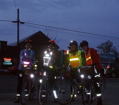
We decided to start at 9:00 PM. When you do a 24-hour ride, you have no choice but to ride at night at some point. We wanted to get the night riding out of the way while we were still relatively alert. Of course, when we picked that starting time I had no idea that an emergency situation at work would have me pulling some all-nighters at the beginning of the week and just draining me in general. Oh well, if I was going to test my endurance, this was going to be the mother of all tests.
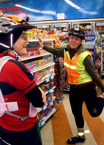
We met at the Grand Lodge, with the plan being to ride from there to our starting point in Cornelius. We all arrived at the Grand Lodge at around 7:30, giving us plenty of time to mess with our bikes and other gear. At 8:30 we saddled up and rode over to the start. It took us all of 15 minutes to get there, so we hung around the local Plaid Pantry. The clerk was extremely tolerant of our odd behavior, even though every time one of us went in or out the front door an annoying little bell went off. Peg started jumping over the electric eye beam that triggered the bell, but none of the rest of us were willing to risk a slip and fall.
9:00 came, and we had the clerk sign our cards, and we were off. By this time it was dark.
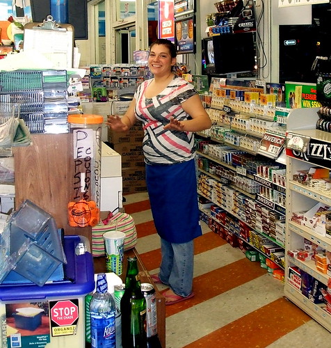
Heading south (and slightly west) out of Cornelius, we traveled on winding rural roads through wine country. Because it was night, we were not worried about being run over by inebriated wine tasters. Inebriated locals in big pickup trucks, perhaps, but there weren't many of them, either. Our first control was in Dayton. Although it was close to 11 PM when we arrived, the local convenience store was open. I highly recommend the hot chocolate machine there. Its product actually tastes like chocolate. The man at the counter was somewhat bemused by our appearance, and our request that he sign our brevet cards. While we were standing outside finishing our drinks, a car pulled up and a rotound young man who looked like he was straight out of Yoknapatawpha County rolled out of the back seat, looked at us, flashed devil's horns with his hands, and yelled "Smoke marijuana!" No wonder the cashier was so perplexed by us. We were not his usual demographic.
From Dayton we continued to roll south, through the western outskirts of Salem toward our next control in Independence. I have been known to describe Salem as "flat, flat, and more flat." That's true, if your definition of "flat" contains room for the occasional 11% grade. One nice thing about night riding is that when you can't see the top of a hill, you can't psych yourself out thinking how far away from that hilltop you are. . After our tour of the West Salem hills, we turned west onto the debris-filled shoulder of Highway 22 for a mercifully short distance, after which we turned south on to the slightly less debris-filled, but also slightly less-existent shoulder of State Route 51, which we would follow into Independence. Independence was rocking. Well, at least the one bar across the street from the surprisingly nice public restroom was rocking. Rocking with very bad, live band backed karaoke. I have heard some bad versions of "Dream On" before, but I am pretty sure the one we heard in Independence was the worst. We decided not to try to get our cards signed at the bar, and hit up an ATM machine, instead.
Next stop, Albany, where there were no businesses, but I had the address for another ATM at which we obtained a time-stamped receipt. At this point, all the water I had been drinking decided to make its presence felt, and we lost some time while I tried to locate a discreet place to relieve the pressure. Another good thing about night riding.
And it was on to Corvallis, where breakfast awaited us in Lynne's son's apartment. Breakfast ingredients, at least; the fixing of said breakfast was up to us. A very sleepy boy greeted us at the door, initialed our cards, and sat up with us while we ate. Lynne set the alarm on her cell phone for 1/2 an hour, and we all catnapped until the alarm startled us all awake. We has wasted too much time, he sun was up and it was time to leave. We still had 12 hours and at least 130 miles to go.
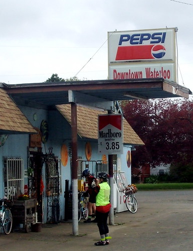
From Corvallis, we turned east toward the bustling metropoli of Shedd and Waterloo, our next two controls. The market in Shedd was open, and we got our cards signed and lost some time snacking, using the bathroom, and changing clothes as it was starting to get warm. Of course, as soon as I stripped off some of my warmer layers, the sun went behind a cloud never to return.
Waterloo, our next control, is a tiny town with one market and no other businesses.
Although it was almost 10 AM, the market was closed. I had a postcard we could have used to show we had been there, except I had forgotten to stamp it. Oops. Fortunately, we found a man standing in his front yard, and had him sign our cards.
From Waterloo, we turned to the northwest, directly into the wind. This would be the story for the rest of the day. I hate wind. It utterly demoralizes me. And this particular wind was particularly demoralizing; it just didn't let up. It was a struggle to maintain a speed greater than 12 mph. I began to obsess that we were not going to make it on time. That obsession would only get worse as the day progressed. From Waterloo we passed through Lebanon and on to the next control in Jefferson. There is a very nice market there, and Peg and Lesli bought jo-jos, which we all shared. I followed the jo-jos with a jelly bean chaser. My devotion to healthy food had dropped by the roadside somewhere on the outskirts of Waterloo. It was around this time that I stopped taking pictures - I was too tired to reach into my jersey pocket for my camera while riding, and we did not have time to stop.
In Aumsville, I decided that I REALLY REALLY REALLY needed to change my shorts. Earlier in the day, Peg had quoted a friend as describing some difficult rides as "death by a thousand cuts." Well, I was dying that death, and all thousand of those cuts were in one very specific, and very sensitive, place. The new shorts helped. About 15 minutes after I changed into the new shorts, the skies opened up and dumped a few hundred buckets of rain directly on me. Fortunately, we had seen the rain in the distance and put on our jackets, but our shorts and feet were soaked. I had spare socks and bootie in my pannier, though, and at the next control in Gervais I put them on, along with my leg warmers. After which, of course, the rain stopped and the temperature went back up.
It was around Gervais that I started losing the will to live. The wind continued to make forward progress difficult, time was ticking off, and I was convinced we were not going to make it. Lynne kept reassuring me we would be okay, but I was running on empty with 65-some miles to go. In Donald, I told the other three to go ahead without me; I'd try to catch up with them for the 22-hour control, but couldn't promise. As long as the three of them finished, they'd get credit. They were all riding more strongly than I was, and I didn't want to keep them back. They reluctantly agreed, but after that slowed down enough that I was able to keep up. I am not sure if it was intentional on their part, but I sure appreciated it.
The next 3 or 4 hours all sort of blurred together. I was in Bataan Death Ride mode; I just wanted it to be over. Lesli said I looked like I'd gotten a second wind. I told her no, it was merely sheer desperation to be done. We made it through our Wilsonville control, which involved a short stretch of travel on the shoulder of I-5 over the Willametter River. and headed toward our 22-hour control, which was supposed to be the Starbucks in a strip mall at the corner of Scholls Ferry Road and Murray Blvd. in Beaverton (or is it Scholls?). We were about 3 miles away from there when the 22-hour point hit, though, so our 22-hr point was a house on Roy Rogers Road, instead.
We still had to go to the Starbucks, however, because we needed the distance to ensure we'd get in 360 K by 9 PM. Sadly for my no-longer-working left leg, the 3 miles from where we were to the Starbucks was comprised of three very steep hills, separated by a couple not quite as steep hills. I gritted my teeth and powered through, even though I was still convinced we would fall short of our goal.
We were now on the home stretch, riding roads that Lynne and I have ridden dozens of times on Portland Velo rides. This was good, because I was officially on auto-pilot. The wind had turned very cold, and there was just a hint of drizzle in the air. At some point on Rood Bridge Road, or maybe it was Burkhalter, Lynne turned to me and said "Cecil, we did it. You can relax now." I started to cry. At the 24-hr mark, we stopped, noted our mileage and signed each other's cards. We were still five miles from the Grand Lodge, however, so we could not rest on our laurels quite yet. We limped on in to Forest Grove, finally arriving at the Lodge sometime around 9:30 PM. I checked in, showered, and headed straight for the bar. I wanted to enjoy a beer before I fell asleep, and I figured I had a window of about 45 minutes before I became comatose. Lesli, Peg, and Lynne arrived shortly thereafter, along with Lynne's husband, Fitz, and we ordered dinner. Tater tots. Lots of tots. Then it was time for me to go to bed. Normally I have trouble falling asleep. Not this time.
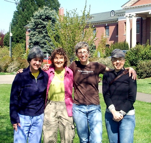
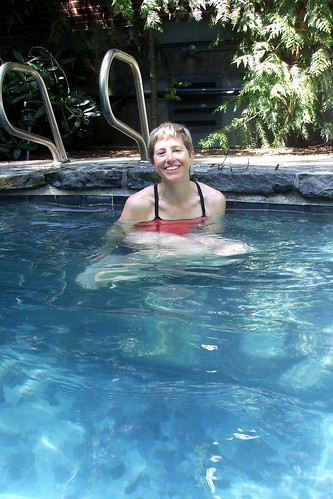
The next morning we all gathered for breakfast to share our stories and eat large quantities of starchy food. Another rider, Dave Read, had brought me a doughnut from Voodoo Doughnuts in Portland (one of his team's controls) and I enjoyed that as a pre-breakfast snack. Later we posed for a non-lycra clad team photo, and then I had a much-needed soak in the Japanese-style soaking pool before heading for home.
Total distance: 226-234 miles, depending on whose computer we looked at Total ride time: 24 hours Total saddle time: 19 hours, 8 minutes, 49 seconds Average speed: 12.2 mph (damned wind!) Total elevation gain: 5002 feet Max altitude: 484 feet Average climb: 2% Max climb: 11 %

