I read in the New York Times the other day that 40% of the adults in the US between the ages of 26 and 40 have at least one tattoo. I would guess that in Portland the percentage is even higher. I am firmly in that demographic.
When I got my first tattoo twelve years ago, it was a really big deal. I had just graduated from law school, I was 35 years old, and the last thing I wanted was to be sucked into "The Establishment." I figured it was time for a tattoo. I spent months deciding exactly what I wanted, a Celtic "shield knot" on the skin over my Achilles tendon, and when I finally went through with it I thought I would faint from the pain. It was like a hive of angry hornets trying to break through my skin from the inside . . .
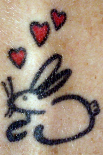
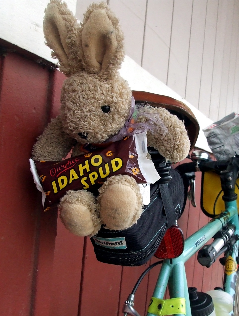
Five years later, I had forgotten the pain and was ready for Tat Two (Ha!). At Greg's suggestion, this one was of a cartoon bunny that I used as my signature on notes to him (Awwwwwww), on my back between my shoulder blades.
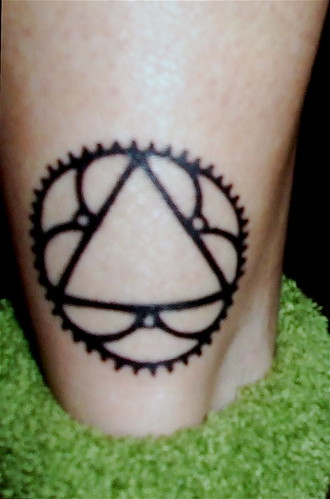
Again, it hurt (especially the little red heart that landed right on top of a vertebra) but apparently not as much, because I was ready for #3 within three years. This time, I chose a 1930s Bianchi chain ring design that I found on a friend's website:
#3 hurt a bit, mainly because it, like #1 and parts of #2, it was on a body part where there was no fat pad to cushion against. But once again the pain must not have been daunting, because today, less than two years after getting #3, I was back for #4.
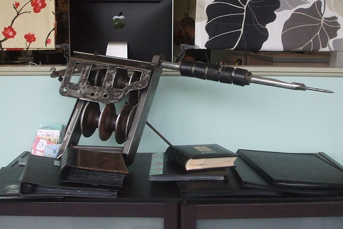
A few months back, on an especially difficult ride, I leaned against my bike to rest and managed to give myself one of the most perfect chain ring grease tattoos ever:
A light bulb went off in my head, and that perfect grease tattoo (or a reasonable facsimile thereof) is now part of my permanent collection:
This one didn't really hurt at all; it was more like a persistent itch/scratch that felt a little warm at times. Either I am getting used to the pain, or I am beginning to actually enjoy it. Or maybe it's just that endurance riding has raised my pain threshold to new heights of absurd.
While I was getting #4, I had Tyler touch up my first tattoo to turn it into a chain ring. Call it Tattoo #4.5, if you will:
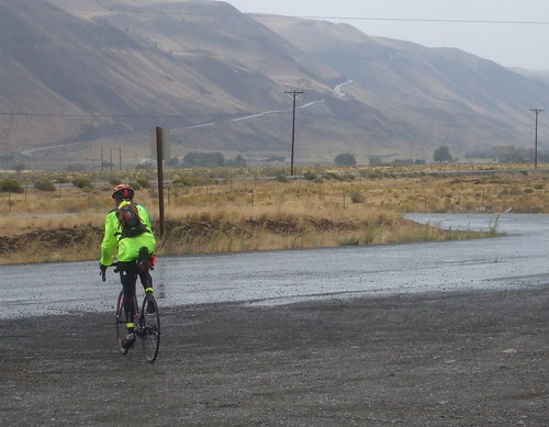
Let's be very, very clear about this. It wasn't Paul's fault. He did not design the route to be brutal. He's just not that kind of guy. So when I was cursing him somewhere around the 500th kilometer of last weekend's 600 kilometer ride, I was not being fair to him. Because it was not his fault. The true blame has to be placed on the wind. And, boy, was there a lot of wind to blame.
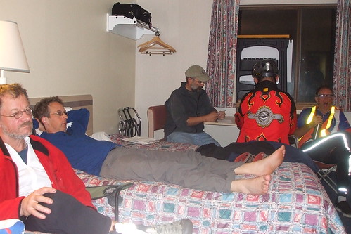
I still haven't recovered enough to do a detailed post; perhaps I never will. So here's a photo essay for you to look at, while listening to this little gem from the mid-70s . . .
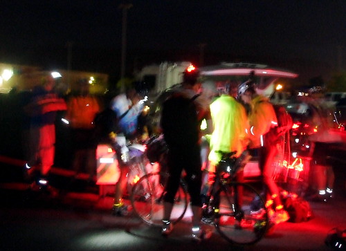
We started the day with the traditional pre-dawn registration and sacrifice to the flat tire gods . . .
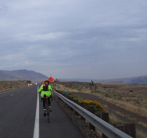
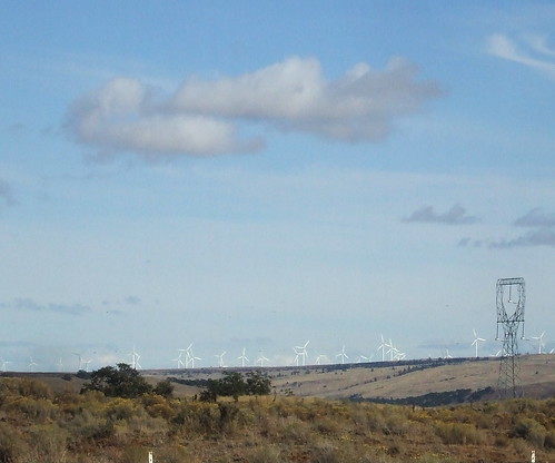
We then crossed over the Columbia to Washington, battling a vicious wind out of the WNW for the first 7.5 miles. At one point, the wind picked me up, bike and all, and set me in a ditch on the side of the road. Fortunately, I unclipped in time not to turn turtle, but it was damned scary there for a moment. As the sun rose, we turned east on SR 14 and, with the wind at our backs sped toward the first control in Roosevelt.
By the time we got to Roosevelt, it had started to rain - not hard, but persistent - just enough to make the road wet and jackets advisable.
From Roosevelt we continued east on SR 14 another 45 or so miles, to Plymouth, where we turned south to cross over the Columbia river (again) to the next control in Umatilla, Oregon. The tailwind was so strong that most of us covered the 104 miles from The Dalles to Plymouth in less than 6 hours. It was my first sub-6 century: 5 hours, 50 minutes, 5 seconds.
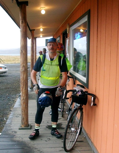
After a refreshing lunch in Umatilla,
we rode on through Hermiston,
Stansfield and Echo,
and Reith
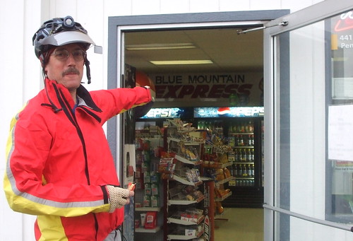
to the next control in Pendleton. There was some confusion over the location of the control, because the sign identifying it was actually INSIDE the store. Ooops.
From Pendleton, we headed back to Hermiston by way of an information control in Holdman. While we were in Holdman, the drizzling mist became a cold heavy rain. It rained on us for the next 20 miles, and we were all very happy to reach the shelter of the Hermiston Safeway, where a randonneurs' reunion of sorts was going on.
Although we no longer had our tailwind, we still had a significant cushion of time, and so we hung around the Safeway for a while, drying out and eating. Then it was back across the bridge to Plymouth and a grinding 15-mile climb up South Plymouth Road. By this time it was too dark to take pictures. There must not be much to do in Plymouth, because the entire male population between the ages of 18 and 35 was out racing their cars up and down South Plymouth Road. Only slightly disconcerting for a cyclist . . .
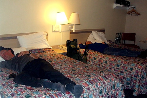
The pay off for the 15-mile grind was a swooping 9-mile descent. I took it as fast as I could, considering it was pitch dark (hurray for big headlights). At the bottom of the descent was Richland, where we would stay overnight. Of course, by "overnight," I mean 5 hours. I arrived in Richland at 00:45, and left at 5:45. 3 of those 5 hours were spent sleeping, the other two I spent getting ready to sleep and getting ready to ride.
Day Two started with a long climb back out of Richland, through Benton City, and into the Washington Wine Country via the Old Inland Empire Highway.
After passing through controls at Prosser and Sunnyside, it was time to start the day's first serious climb.
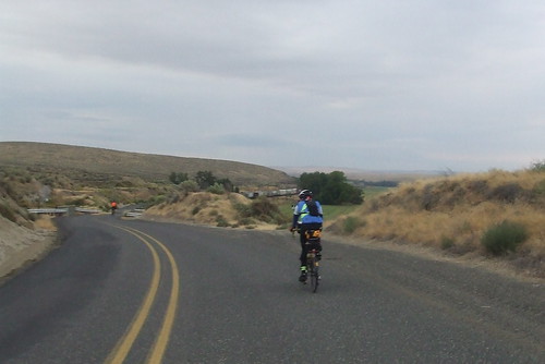
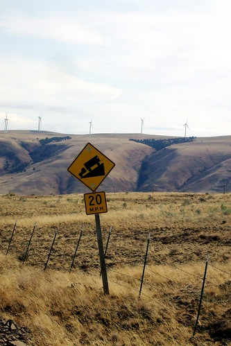
Day Two was supposed to be the "easy" day. Yes, there would be climbing, but of the minor grade, switchback variety. Unfortunately, the wind was uncooperative. Actually, to say it was "uncooperative" does not do it justice. It was downright belligerent. The 75-mile stretch from Mabton to Bickleton was without doubt the hardest thing I have ever done. Much harder than the Torture 10,000. Not because the grades were steep in reality, but because the headwind made a 2% grade seem like 20%. 7.5 miles an hour uphill is a perfectly respectable speed. 7.5 miles per hour DOWNHILL means that something is terribly, horribly wrong. I had way to many of those slow downhills on Sunday. I seriously began to doubt that I would make it to the Goldendale control before it closed. Every time that I thought the climb was over, I would turn a corner and see the road stretch out (and up) before me for what seemed like miles. And all the while the wind was blasting me backward and sideways, but never forward.
I stopped in Bickleton for some water and a snack. I thought that this HAD to be the end of the climb. Again, I was wrong. I was on a high plateau that stretched for miles and miles and miles and miles, and had nothing taller than a fencepost to break the wind that was rushing across it. At one point, the road pitched steeply downhill into a canyon, and then just as steeply back uphill to another high, endless plateau.
It was at about that point that I started screaming. Literally. Guttural, ear-shattering, primal screams. But I kept pushing on. Mainly because I had no choice. I finally reached the "real" descent, shortly before Goldendale. If I pushed it, I'd make it to the control there with about 15 minutes to spare.
At the Goldendale control, I ran in and got my card signed, did some quick wardrobe changes, filled my water bottles and took off. I had four hours to get to the final control in The Dalles, 45 miles away. It was getting dark, and I would be riding into a head wind on SR 14; there was still a very good possibility that I would DNF. Although I left the Goldendale control with another rider, Gary, he quickly outpaced me and I struggled on alone.
Riding west on SR 14 in the pitch dark is easily one of the stupidest, most dangerous things I have ever done. And I have done some stupid and dangerous things. But I made it to the turn off to The Dalles safely, and was rewarded with a tailwind aided 7-mile descent down to the river, over the bridge and into town. I made a wrong turn about 2 miles from the end, but nevertheless reached the final control with 40 minutes to spare.
My carpool mates, Andrew and Sal, eventually straggled in and we all took showers and a nap before loading the bikes on the car and heading for home.
In just an hour or so I will be heading out for The Dalles for a 600K that starts at 6:00 AM tomorrow. My bike is cleaned, my bags are packed with everything I need, or think I might need, but yet still I am sitting here perseverating over my readiness.
I know I can do this. I have already done one 600 this year, and finished with a whole hour to spare. But in talking with my friend Andrew about this ride, he kept going on and on about how all the riders he was with on another 600 this year "traveled light," and how that was the key to completing the ride within the time limit. My friend David has offered to help me get faster and he, too, suggests that one way is to lighten up.
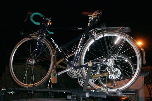
Faster is always good, of course, but I could not travel light if I tried. First of all, there's the bike. It's heavy. Mainly because I designed it that way. It has certain features that I consider important for comfort, but those same features practically guarantee decreased speed. A steel frame, saddle with springs, heavy (i.e. puncture-proof) tires, generator hub. Add on a front bag filled with real food in case services are scarce and a rear bag filled with tools, tire tubes, rain gear, spare batteries, an extra pair of shorts and socks, and a back-up light, and I am nearing the curb weight of a Smart Car.
But like I said, I know I can do this. I carried this much gear on the last 600, and finished. I can finish this one, too. Even if it takes me all 40 hours to do it. I just need to be harder, better, faster and stronger . . . .
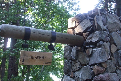
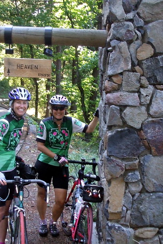
This past Sunday, I rode my bike to Heaven. That wasn't my plan. At least I didn't think it was. The plan was that I would ride my bike up Larch Mountain, and then maybe to Multnomah Falls. Definitely my idea of a heavenly ride, but only in a figurative sense.
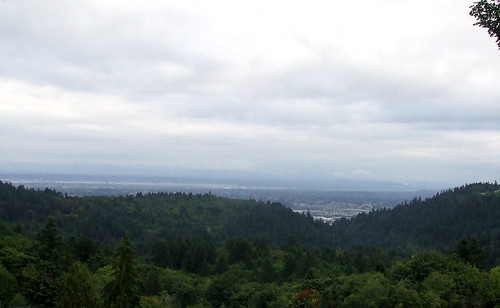
How was I to know that the US Forest Service had finally figured out what every cyclist in Northwest Oregon knows - the stretch of the Historic Columbia River Highway between Crown Point and Multnomah Falls is Heaven. Especially now that it has been repaved.
More pictures from our celestial adventure are here
I am now ninth months into my attempt to earn an R-12. From March through August, it is not that difficult to complete a brevet of at least 200 kilometers, because both the Oregon and Seattle randonneuring clubs schedule multiple events, ranging from 200 to 600 kilometers. Beginning in September, however, it becomes a little trickier. I am signed up for a 600 kilometer ride at the end of September, but it is going to be challenging, and there is a good chance I could fail to finish in the alloted time. There was a 200 kilometer ride scheduled for September 6 in Bend, but that was just too far for me to drive. I needed insurance, and that meant I needed to ride a "permanent.".
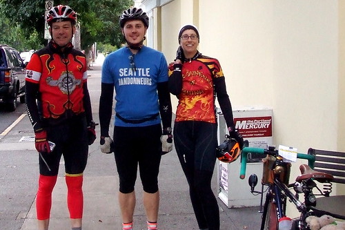
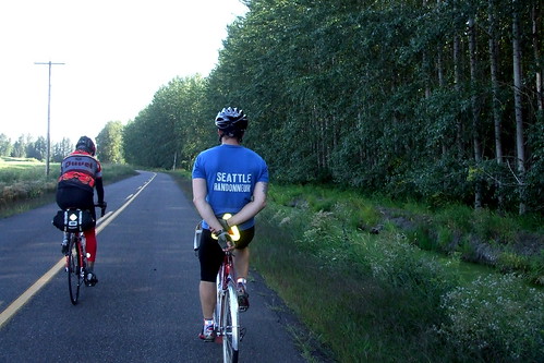
As luck would have it, my friend Bill Alsup, who is also in search of an R-12, and who is also signed up for the 600, decided he needed an insurance perm as well. He sent out a call to the club listserv suggesting a Labor Day ride, on the Or Rando Vernonia-Skyline Route. I was intrigued. It was a route I had not yet done, and I could ride to the start from home. I was in. Another club member, Joshua Bryant, also signed up. We three agreed that we would start from the Starbucks at Lombard and Philadelphia in St. John's at 7:30 AM.
I left home a little after 6:00AM Labor Day morning. The weather forecast was for warm, sunny weather but it was fairly chilly that early, so I had on a jacket and leg and arm warmers. I was trying to pack lightly, because I had a feeling we would be doing a lot of climbing, but at the same time I wanted to be warm enough to enjoy the ride. I get cold easily, and then my hands go numb. Having feeling in your fingers is a good thing when you are trying to do things like brake and shift.
I got to the Starbucks early, but Joshua was already there. He had also ridden to the start from his house in the Woodstock neighborhood; about 5 miles further from the start than my place in Ladd's Addition. He was eating an egg/english muffin sandwich that looked pretty tasty. I had already had my first breakfast, but was ready for my second. We had plenty of time, so I got some sort of egg-tomato-feta wrap thing. It wasn't bad, considering the source. The women working the counter wanted to know where we were riding to; when I explained the route they were duly impressed.
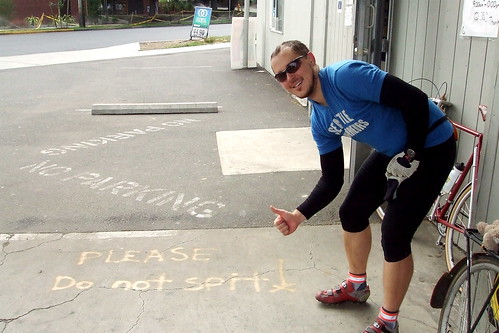
Bill arrived and ordered his traditional pre-ride teeny tiny espresso drink. After some inevitable faffing, we were ready to go. The women at the counter initialed our cards and we headed out. Bill got out his camera to take a pre-ride picture of me and Josh, and a women who was sitting outside offered to take one of all of us. So I handed her my camera, too. She was EXTREMELY wound-up for 7:30 in the morning. I am pretty sure there was more than caffeine in her coffee.
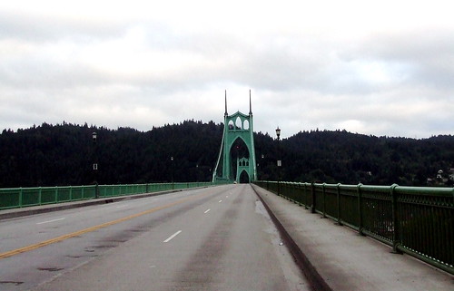
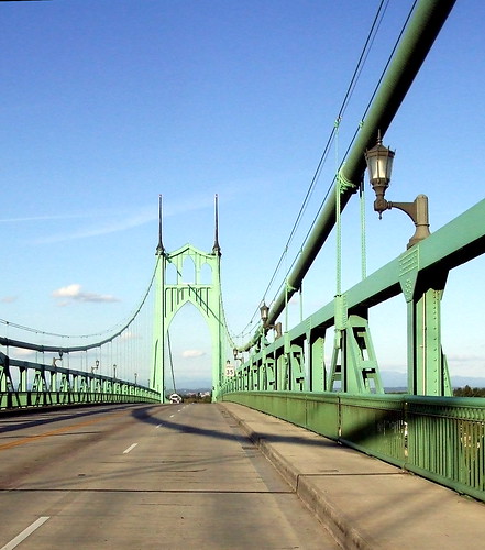
We started by heading west over the Willamette River via the St. John's Bridge. The St. John's is my favorite bridge in Portland. For one thing, it's lovely.
For another thing, I love riding over it because it has two lanes, so I can take the right lane and cars can pass me in the left. And unlike crossing on the Hawthorne bridge, I don't have to play dodge 'em with pedestrians. I know that other people have complained about drivers on the bridge, but I have never really had any problems with them.
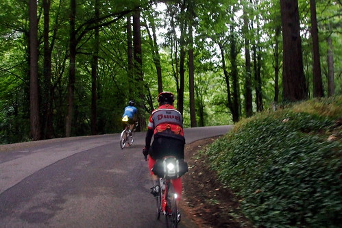
Once we were over the bridge, we turned south on Hwy 30 toward Portland. We would follow Hwy 30 into Northwest Portland, skirt Montgomery Park (an office building, not an actual park) and start heading uphill toward Washington Park and, eventually, Skyline Boulevard.
We entered Washington Park via Stearns Way, an old road that has been blocked to car traffic for a while now. The entrance is somewhat hidden and I never knew it existed until I rode the Worst Day of the Year Ride, which took way into the park. It's now one of my favorite roads.
We wound our way through the park and at the top turned right toward Skyline. Usually when I am riding up through the park, I am on my way to Lynne's house, in which case I would turn left. I had to remind myself to turn right this time. We turned onto Skyline from Fairview, which was also the site of our first information control. Unlike some of our info controls, there was no need to debate what the correct answer might be.
Skyline is one of Portland's premier cycling roads. A long series of rollers that stretches the length of the summit of the West Hills, it offers some gentle climbs, terrific descents and spectacular views.
Sadly, it is also a favorite road for morons in fast cars or on fast motorcycles, and it does not have very wide shoulders. Fortunately, traffic was light for us.
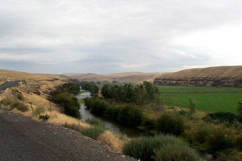
From Skyline we dropped down into rural Washington County by way of Old Cornelius Pass Road, another great cycling road (not to be confused with regular Cornelius Pass Road, which is definitely NOT a great cycling road). We pedaled along past hay fields and llamas, through the towns of North Plains (being sure to come to a full stop at the Glencoe Road intersection) and Verboort, and eventually on into Forest Grove, our second control. The bakery we usually go to was closed, so we got ATM receipts to show our time, and then stopped at the somewhat weird and dingy local market for some water, Gatorade and snacks.
From Forest Grove we headed out to the town of Timber, via Gales Creek Road, Hwy 6 and Timber Road, and then from Timber to our next control in Vernonia. It was deja vu all over again for me, because I had just taken this route the week before, on the 400. The climb up to Timber summit gets a little less intimidating every time I do it. The stretch from Timber to Vernonia, on the other hand, seems longer every time I do it.
By the time we got to Vernonia, we were all pretty hungry. Bill and I had packed peanut butter sandwiches, and so really only need some side snacks, but Joshua was hankering for a meal. So instead of our usual stop at the Shell station, we went to the Black Bear Cafe (cue foreshadowing . . . .), where Joshua ordered an enormous meatball sandwich.
Sandwiches disposed of, it was time to once again hit the road. The sun was finally starting to make its presence known, but I was getting a little chilly sitting still and so was happy to start pedaling again. We stayed on familiar (to me) roads for a few more miles, but then turned onto the Vernonia-Scappoose Road to head up over the hills to, well, Scappoose. The V-S Road is 20 miles long. 10 miles UP, 10 miles DOWN. When Joshua and I finally got to the top, Joshua turned and said, "That climb was a lot harder than I'd expected." No kidding. I was very much looking forward to the next 10 miles of "down."
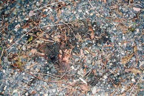
Bill was having knee pain trouble, and so was a little slower on the climb. While we waited at the top for him, we were passed too closely by a speeding Volvo. As we turned to watch it go down the road, we saw a large black animal lope across the road right in front of the car, about 200 feet from where we were standing. At first both Joshua and I thought it was a big black lab, but then realized it was a medium-sized black BEAR! The driver managed to brake in time, but I bet she had a heart attack. Serves her right. I was too slow to get a picture of the bear, but I got a picture of its track . . .
Bill arrived a few minutes later, and we headed down the hill to Scappoose. In Scappoose, we headed across Highway 30 and onto Dike Road, which circles around some fields and changes its name just enough times to confuse tired riders.
We then returned to Highway 30, and the home stretch. We were making excellent time, and I anticipated reaching the Starbucks in less than 11 hours f we pushed it. From Scappoose to the St. John's bridge is ever so slightly uphill, with a nasty steep bit to get up to the bridge itself.
Joshua and I reached the Starbucks 10 hours and 47 minutes after we left; Bill was about 7 minutes behind us. It was a good ride. And now I can DNF the 600 and still be on track for the R12. Of course, I'd chew my right arm off before I DNF'd the 600 . . .