Tuesday, July 17, 2007

Mt. St. Helens, You Can Kiss My Ash

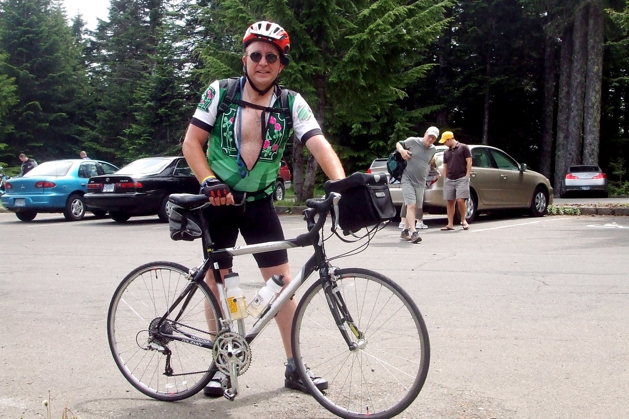
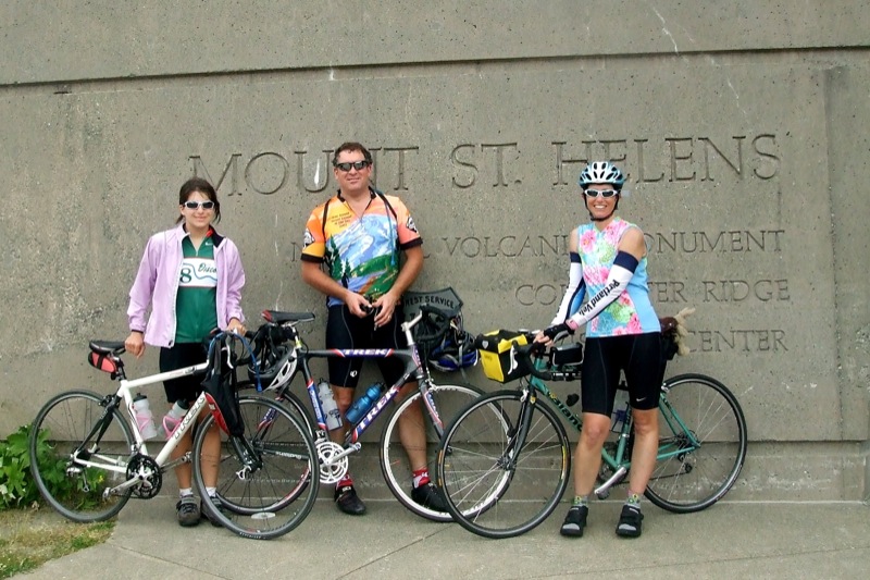
On Sunday, July 15, my friend Steve, his daughter Laurel and I decided to ride the Spirit Lake Highway up Mt. St. Helens to Johnston Ridge. Mt. St. Helens is an active (very active) volcano in southwest Washington, about an hour's drive from Portland (an hour to the base - it's another 54 or so miles from I-5 to Johnston Ridge).


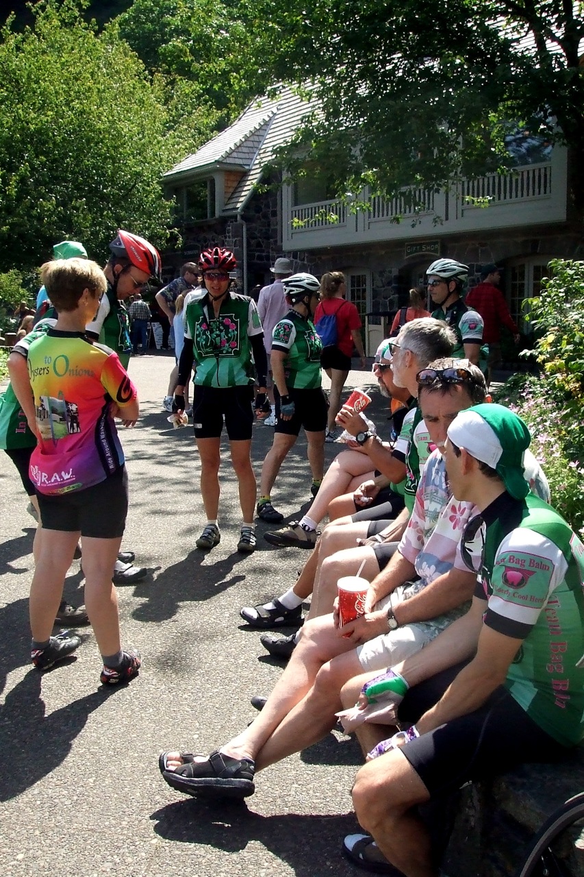
Every year there is an organized ride up the mountain in late June, called the Tour de Blast. I've done it a few times, but this time we decided to do the ride on our own on a day when we wouldn't be sharing the road with hundreds of other cyclists. This did, of course, mean that we were also on our own for food and water, but that's why God created handlebar bags.

Steve and Laurel planned to start riding from the high school in Toutle, which is where the Tour de Blast always starts. Round trip from the high school would be 88 miles. I wanted more miles than that, and so they dropped me off at the exit from I-5, and I headed southwest into Castle Rock to check out a side loop a friend had told me about that would eventually bring me back to the Spirit Lake Hwy about halfway between the freeway and the Toutle high school.

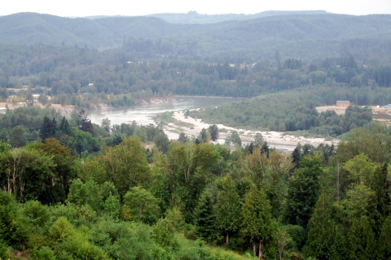
The side route turned out to be an excellent adventure - about 12.5 miles of deserted, winding, well-paved, and only a little bit steep, country roads with incredible views of the Cowlitz River valley to the west and Silver Lake to the north(ish).

The climb woke me up, that's for sure, but the long, fast swoop back down to Spirit Lake Hwy was well worth it. The high school was another 5.5 miles or so. The entire side trip was just over 18 miles. I figured that Steve and Laurel would probably have an hour's head start on me and that I would most likely meet up with them somewhere around Coldwater Lake, when I would be on my way up the last 6 miles to Johnston Ridge while they were coming down.

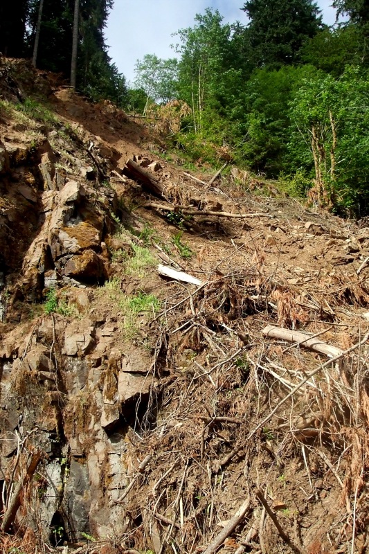
Not too long into the ride, I saw a orange warning sign on the side of the road: "SLIDE." Oh dear - perhaps my ride would be over before it really even got started! Fortunately, they had cleared the road and put up Jersey barriers to keep the slide back enough for cars and bikes to get by. The hillside did not look very stable, though, and given the amount of seismic activity on the mountain I was not so sure it was safe to hang around much looking at it . . .

The highway up to Johnston Ridge from the high school is not ALL uphill. Just mostly. The first 20 to 25 miles is a series of gentle rollers; I was steadily climbing, but not working too hard. I stopped at the Shell station in Kid Valley (last chance for gas) and got a soda and chatted with the owner. He apologized for not having any bananas, "I know you bike riders sure like bananas." I told him not to worry, I had a couple in my pack. He then told me about how he gets leg cramps when he is hunting - I recommended Cytomax.

After Kid Valley, the road started to pitch up a little more steeply and the "down" part of the rollers became a mere memory. Climbing, climbing, climbing, for about 9 miles past various tourist traps, rest areas and Weyerhouser propaganda centers, until I finally reached Elk Rock.


At just over 3000 feet it's the first "crest" of the day. From Elk Rock, it's a 4.5 mile drop down to the Coldwater Visitors' Center, and another 2 mile drop from the visitors' center to Coldwater Lake. From Coldwater Lake, it's just under 7 miles uphill to Johnston Ridge, elevation 4200 feet.
I had just passed the lake when I saw Steve and Laurel heading toward me from the direction of Johnson Ridge. It was getting kind of late, so I turned around to catch them, thinking that if they needed to get home I should probably cut my ride short. If I kept going, it would be at least another hour before I got back to this point, and I wasn't sure they had that much time. Steve stopped to talk, while Laurel plugged on up the hill toward the visitors' center. He told me that they had stopped short about 5 miles from the top because Laurel was not feeling well. He told me I should go on and go to the top, because they were going to get some lunch at Coldwater and let Laurel take a nap. I told him OK, and that I would get back to the visitors' center in about 1.5 hours so we could ride the rest of the way home together.

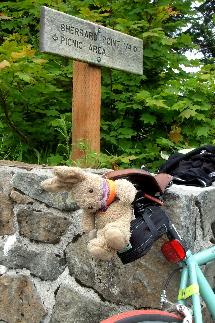
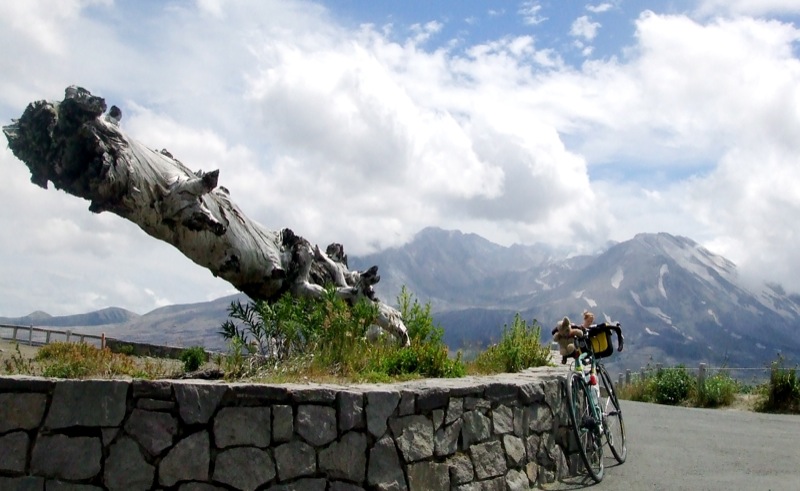
I stopped at the Loowit Viewpoint just below Johnston Ridge for a TRFKAF photo op - because of the cloud cover, the view of the crater there ended up being better than the view further up!


The last 5 miles up to Johnston Ridge are brutal, and the last 1/2 mile is particularly cruel. The first time I did this route, I walked my bike that last 1/2 mile and felt no shame whatsoever. I ride it now, but I curse the whole time.


People passing me in their cars honked and waved encouragement -at least most of them did. One guy gave me the finger - and he had a bike rack on his car! Not what I would have expected from a fellow cyclist. I decided it must not have been his car.

I got back to the visitors' center to find Laurel curled up on a stone wall sleeping. Woke her up, located Steve, and we were off. The 4.5 mile climb back up to Elk Rock was tough - I bonked about a mile in. I had been eating all day, but apparently not eating enough. I stopped and finished off the rest of my supplies while Steve and Laurel (the well-rested Steve and Laurel who had put in 28 fewer miles than I had, I might add) continued on. They waited for me at the top of the climb so we could all start down together, but then they had to stop to put on their jackets (it was getting chilly, and we would be going downhill fast). I had already put my armwarmers on, so I kept going.

Coasting at 35+ miles per hour in full aero-tuck for 9 miles was almost as tiring as pedaling up those 9 miles had been in the morning. Well, maybe not THAT tiring. There were some wicked head and cross winds, though, which kept me busy correcting and prevented me from reaching maximum velocity. I was bummed about that - usually on MSH I can break 50 mph, if even only for a second or two, but this time my maximum speed was only 44.

I got back down to Kid Valley far ahead of Steve and Laurel - I got another soda pop and talked to some folks from Massachusetts until S & L showed up. From there it was about 12 miles back to town on those gentle rollers and we stayed together, occasionally taking turns blocking the wind, although Steve is the only one big enough to effectively serve as a wind block.

At the high school, my computer showed 105.1 miles, so my guess from the morning was pretty darn accurate. It was late, and my average speed slower by almost 2 mph from last year's Tour de Blast - but then last year I hadn't ridden an additional 18 miles of hills before the start.

Sunday, July 08, 2007

The Pre-Ride

[Picture Hint: Click on the photos for larger versions]

On July 14, my randonneuring club is having its "July Grab Bag" brevet. It's a set of 3 loops, each roughly 100km, and riders have a choice of doing 200 or 300 km. I volunteered to pre-ride the route yesterday, in order to make sure there weren't any problems like road construction or washed out bridges that would require detours. Like this, for instance, where 4th Street in Gervais used to be:


This would be my first pre-ride, but I was joined by Rickey Smith, a veteran randonneur. I had a goal - finish the 300 km course in less than 16 hours total. Rickey had a system that, assuming nothing went wrong, would get us done in 15. "1 mile every 5 minutes, 12 miles every hour, 100 km every 5 hours." Including stoppage time, that translated out to an average riding speed of 15 mph. The route seemed pretty flat, so I figured it was possible.

The loops each started and ended at the Travelodge in Newberg, Oregon. I stayed there Friday night because we planned to leave at 5 AM and I did not feel like getting up (and getting the dogs up) at 3 AM in order to drive from home. I met up with Rickey in the parking lot at 4:55, and we were off. The first loop took us roughly NE to Forest Grove and then back down through and around Sherwood to Newberg. Most of the roads for the first 30 miles were familiar because they are all parts of various PDX Velo routes. Some of the other roads I hadn't ridden since 1993. Boy had some things changed - a lot more development, for one thing.

The cue sheet ended up being incorrect for one part of the ride through Sherwood - we wasted about half an hour and gained about 5.5 miles in distance trying to figure it out - our average speed also took a beating because we were going so slowly looking at street names and the distance markers. We finally figured out (with the help of passing motorists) were we needed to go. The most interesting part of the first loop was a long climb up Kruger Road, followed by some truly thrilling technical descents on hairpins. At one point I was going so fast I missed our next turn, and had to backtrack. Fortunately, it was at the end of the hill, and so I did not have to back track uphill . . .

Although we made up some time after Sherwood, we missed the "100km every 5 hours" mark by 5 minutes. A friend of Rickey's was waiting for us there, to join us for the second loop. Sadly for him, the second loop was the least interesting part of the day. He complained a lot. But Rickey said that he ALWAYS complained a lot. I started calling him "Eeyore."

Eeyore . . .

By this point it was about 75 degrees, but getting hotter by the minute. The first 7.5 miles (and last 7.5 miles, for that matter) of the loop required us to ride on 99W, which is a major state route and, in this particular part of the state, very busy. This is "wine country," and the wine tasters were out in force. Fortunately, it was still relatively early, so at least most of them weren't tipsy already. In any event, we rode hard and fast to get off that road ASAP.

Once we got off 99W, the second loop became quite enjoyable. Rolling roads through peaceful vineyards and pastureland. Very little shade, however. What shade there was had been taken over by roving gangs of freshly sheared alpaca.


At around km50 of the second loop, we were hot, tired and very hungry. Fortunately, our next control point was a Dairy Queen on Highway 18.


I'm pretty sure the last time I went to a Dairy Queen was sometime in 1970. It could easily be another 37 years before I go to one again, if ever. We arrived there at the same time as a bus load of some very scary children. I am pretty sure they were The Children of the Corn out on a field trip. At least my milkshake was cold and I had a chance to change into fresh shorts. Aaaah.

Feeling somewhat refreshed, we set out for the second half of Loop 2. The roads on this half were busier, and the shoulders more narrow. We didn't spend much, if any, time enjoying the scenery- we just wanted this part to be over. Rickey and I needed to begin the 3rd loop no later than 3:30 if we were going to finish before sunset, and I wanted as much "down" time between Loops 2 and 3 as possible. With the added incentive of getting the heck off of 99W before we were run over by a tour bus full of winos, we made it back to the Travelodge by 3:04. Despite the DQ delay, we had managed to get back on track with Rickey's "5 hours - 100km" plan!

By 3:30, we were in the road again. This third loop went east of the Willamette River and followed the same roads as almost every organized ride I have been on - so I could pretty much operate on autopilot. But we still had to watch the cue sheets carefully to make sure they matched up for those riders who may not be on autopilot next week.

Outside of St. Paul we rode through the hop fields. The last time I had been through, in June, the hops had been about 6 feet high. Now they were much taller.


For the first half of the ride, we had a tailwind and so were able to quickly click off the clicks. The scenery was bucolic - acres and acres of vegetables, berries and, surprisingly to me, cultivated wildflowers (is that an oxymoron?)


We followed the same roads home, as we did out, and so battled the wind that had been helping us earlier. But we were still pushing a good pace and figured we would be back well before sunset. So our new goal was to come in under 15 hours. But push as hard as we could, we just couldn't do it - we pulled into the Travleodge lot one last time at 8:16 PM - 15 hours and 16 minutes after we first left. I was thrilled - I had broken 16 hours. Rickey was bummed because if we hadn't lost time in Sherwood on the first loop we would have been back in 14:45. He'll get over it.

Total distance: 190.8 miles
Total time: 15 hours, 16 minutes
Saddle time: 12 hours, 56 minutes
Faffing around time: 2 hours, 20 minutes (45 of which - at least- were at the DQ)
Avg. Speed: 14.7mph riding, 12.7 including stoppage time

Monday, July 02, 2007

And Now . . . The Larch

[Picture Hint: Click on the photos for larger versions]

Chuck from the Far Eastern Pastures was in town last weekend, and he had sent out a call to the Herd for a ride to remember. As if Team Bag Balm needed an excuse to ride herd. After tossing around a few ideas - Bridge of the Gods? Tour de Frank? - we settled on an old stand-by, the "Falls and Fries" route from McMenamin's Edgefield to Multnomah Falls, and back. But to make sure that C from the FEP did indeed get "a ride to remember," we decided to throw in a trip up Larch Mountain.

The plan was to leave from the Edgefield parking lot at 9:00 AM. As usual, I planned to ride from home - I figured the distance to be about 20 miles, give or take. Neighbor Nat sent me an e-mail Saturday night suggesting we ride together and leave his place at just before 8:00. By my calculations, that meant we would have to average 20+ miles an hour to get there on time - I figured Nat could do that, but not I - not at that hour of the morning and not while I was still feeling the effects of Saturday's run. Instead, I headed off on my own at about 7:15 - I figured Nat would probably end up passing me on the way. I went my usual route to Troutdale (the only one I know - or knew) - over Mt. Tabor to the I-205 bike path, north to Marine Drive and then east on Marine Drive to 257th/Graham/Halsey. 20.5 miles all told. I didn't meet up with Nat until I arrived in the Edgefield parking lot at 8:45. He had been there at least 10 minutes. I was dumbfounded until he explained that he took a more direct route that was only 12 miles. Live and learn . . .

The herd was out in force. The usual suspects (Nat, Richard & Nance, Diane, Nora, Michael G., Ron, Chuck (from the FEP), Don, Andrew, Amy, Tweety, Edna) were there, as well as many new-to-me faces. Nanci from Salem had come up with Chuck and Don, and there was a group of recumbent riders, as well. Some folks planned to do the whole route, others had time constraints that would prevent them from tackling The Larch (or so they claimed). After some minimal faffing around and group photo shots, we were off.


We started off through Troutdale to the Historic Columbia River Highway and started climbing up to our first re-group point, the Portland Women's Council Forum (or whatever it's called - all those words are in there somewhere). Somewhere between Springdale and Corbett we caught up with Dave Van Gundy, who had started from his home in SE Portland. The weather was perfect and the view from the Forum incredible. At this point we parted ways with our friend Ron, who was out on his first significant ride since hip surgery. He looked great, but he wasn't going to push it.


Then it was down, down, down, past the Vista House on Crown Point (going too fast to stop, and it would be there when we came back up) to Multnomah Falls. ODOT finally got around to repaving the HCRH last year, and the smooth pavement was a joy. I was following Nat and Don down, but they outdistanced me pretty rapidly - they knew the road well, and this was my first time down it on a bike. There were the usual collection of mutants in pickup trucks and RVs on the road, but we could all take the curves faster than they could, so we were always well ahead of them (coming back up would, of course, be a different story).

Another regroup at the Falls - hordes of tourists, as usual, many of whom were fascinated by the recumbents. A couple of "real" Biker Dudes (as in scary guys in black leather vests, heavy boots, and do-rags) posed for photos next to a couple of 'bents as if they were theirs. We augmented what portable calories we had brought with salty, greasy food from the snack bar. The Polish dogs (as in floor polish, I believe) seemed quite popular - I stuck with potato chips. Don got a cookie as big as his head, but size was apparently all it had going for it. I believe the flavor was "particle board."


Then it was time to leave - Larch Mountain beckoned, at least for some of us. Richard & Nance were already on their way, as well as the 'bents. We were down to a subgroup of me, Nat, Diane, Don, Nora, Michael, Chuck, Andrew, Amy, and Nanci. A & A were on the tandem (much discussion of whether Amy was turning into a "tandem slut") and had time restraints, so weren't sure how far they would get. Nora and Michael also had time restraints - their plan was to ride up the mountain for exactly 1 hour and 45 minutes before turning around (I wasn't there, but I have it on good authority that when they got to that point there was some debate as to whether they should extend the ride up for just "5 minutes more.") Chuck's plan was to "see how far he'd get." (He promised not to complain about the climb if we promised not to complain about how long we waited for him at the top). The rest of us were going to get to the top if it killed us. After a quick stop for the restrooms at the Vista House (and magnificent restrooms they are) and a short period of making fun of the bicycle racks that had been donated by a local bike club (the design was completely ineffective and no one used them - bikes were parked everywhere BUT in the rack) we were off. We met up with Ron again at the turn off to Larch Mountain Rd. - he declined our invitation to join us. Smart man.


The climb up to the top of Larch is 14 miles of grind. It's never THAT steep, it's just loooooooooooooooooong. As usual, Nat took off like a mountain goat. How he does what he does on a double is beyond me. I spent most of the ride in the granny range - and still had to stop a couple of times to nibble on my portable calories - mmm, Paley's Liquid Sunshine. The 'bent riders whizzed past on their way down - the temptation to turn around and follow them was great. But I kept pushing on, and two hours later I was at the top and out of food. Richard & Nance were just heading out for their descent as I pulled into the parking lot - Nat had arrived about 30 minutes earlier than I, and was hanging out soaking up the sun. After a short while, Diane, Nanci & Don arrived - and then came Chuck! He had made it to the top, and didn't look that bad at all.


TRFKAF, on the other hand, looked like hell. Or maybe that was just because of the bungee cord wrapped around his neck.


Once we had all caught our breath (and once the Larch "virgins" had hiked out to the viewpoint), it was time to jet down. And I do mean jet. One nice thing about the Larch descent is that there are very few sharp turns, so you can go full out for very long periods of time. I was ahead of the rest, so didn't see when Nat developed a speed wobble that took him off the road - but he didn't crash! Just a few scrapes and bruises to show for it. I had developed "a touch of the bonk" by the time we regrouped at the Women's Forum, but Chuck saved the day with his stash of Rice Krispy Treats and Pay Day bars. Note to self: bring Rice Krispy Treats on next weeks 300K . . .

The last leg was a long, easy descent into Troutdale - we were running on empty, but the thought of the "real" food that awaited us at Edgefield kept us going. Nat and I scored a table outside while the rest of the gang stowed their bikes in their cars and then it was down to the serious business of eating. We ordered some sweet potato fries to start, and they came soon enough (by McMenamin's time) but not so soon that Nat wasn't seriously considering mainlining ketchup from the condiment tray. Nat and I still had at least 12 miles to go (if we went his sensible way, rather than my silly long way) so no beer for us, but we each inhaled a Commie Garden (the Communications Breakdown burger with a gardenburger instead of beef). I sort of regretted that about 6 miles into the last leg home . . .


So there we were, peacefully eating our dinner, recapping the high points of the ride, when Don suddenly let out a yell and jumped up from his seat, almost spilling his beer in the process. We all assumed he'd been stung by a bee. But no, it was "just" a cramp. What away to end the day.

And a fitting way to end this report . . .