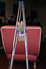
I'm told my severely strained hamstring will heal enough so that I'll be able to ride again sometime in December. Whether that means I'll be able to ride 200K or more at a stretch remains an open question. It doesn't feel THAT bad. Except, of course, when I try to walk without dragging my left foot behind me like Marty Feldman in "Young Frankenstein."
It didn't help when the doctor said "This is the kind of injury that keeps a ball player out for the season." At least he didn't say career-ending. . . .
The REALLY depressing thing? I can't even claim a spectacular bike crash as the cause. Nope, just sheer over-enthusiasm during the "rapid repeat lunge" sequence in gym class . . . .
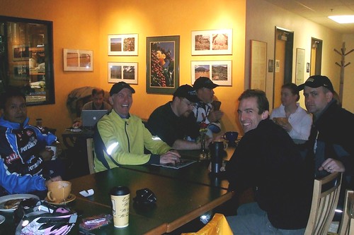
Next Saturday, November 3, 2007, is the Oregon Randonneurs' Verboort Sausage Populaire. Our fearless leader, Susan France, had put out a call for volunteers to staff the first "control," which would be at Longbottom Coffee in Hillsboro, and to pre-ride the course.
I considered the following factors: (1) the weather on October 27, the day set for a pre-ride, was supposed to be sunny and dry; (2) it was not guaranteed the weather on November 3 would ALSO be sunny (last year the ride took place in monsoon conditions); (3) I don't eat sausage; and (4) I do eat scones, and those at Longbottom are gigantic and delicious. Let's just say the decision to volunteer was not a tough one.
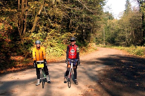
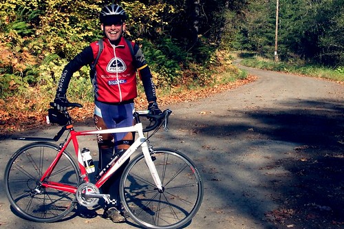
Bill Alsup also volunteered, and he and I agreed to set out from the start point at the Grand Lodge in Forest Grove at 8:30 AM on Saturday. My friend Steve asked if he could tag along.
The three of us got to the Grand Lodge in plenty of time for the 8:30 start, but then Steve starting having second thoughts about his rear tire. As well he should have:
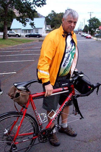
After Bill and I stopped laughing, Bill offered Steve a tire off a spare wheel he had in his car. A new tire, some air (hurray for the Topeak Road Morph!) and we were ready to go and only 10 minutes behind schedule.
It was COLD COLD COLD at 8:40, but bright enough for sunglasses. I hadn't bothered to put on or bring sunscreen - I paid for that later. I started off the ride wearing tights under riding knickers, a wool jersey, arm warmers, my Showers Pass jacket, a wool skull cap, wool socks, and Descente "Wombat" gloves. That combination was just right until about 10 AM, at which point I stripped of the arm warmers. By the end of the ride I had unzipped my jacket, but was never too cold or too warm.
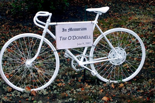
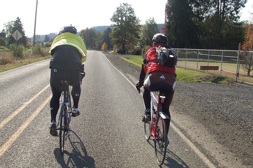
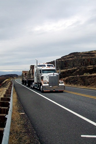
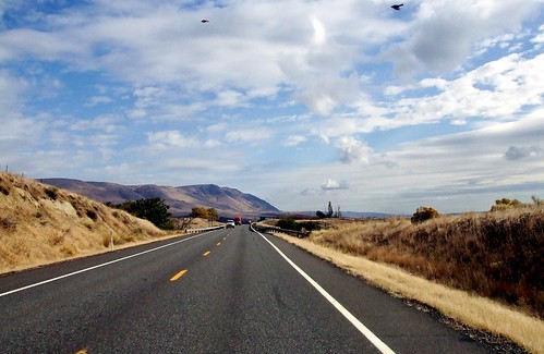
The first section of the ride took us from Forest Grove to Hillsboro. It's a left turn out of the parking lot onto Highway 47, which can sometimes take some time to negotiate - traffic there is a bit unpredictable. The route follows 47 for just a few blocks and then turns right onto Martin. Martin is a good road, but heavily traveled. There are two roundabouts on it, which are always fun. After the second roundabout, we ended up on Cornelius-Schefflin Road, which can also be pretty busy. There's a left turn off C-S into Long Road, which is not too difficult, but I get nervous making it now because a member of my cycling club was killed by a reckless driver making that turn last spring.
Long Road itself is quite pleasant. Pretty and quiet, especially in the early morning, with decent chip-seal. A few turns onto a couple more quiet roads, and then a fairly long stretch on Evergreen to the first control at Longbottom Coffee. Evergreen is busy, and there are a couple of intersections where I would advise taking the lane to avoid a right hook, but the bike lane is wide and usually pretty clean. I love Longbottom, but the counter service can be sort of slow when you are on a timed ride. Hence the value of a staffed control. On the other hand, the scones are well worth the wait in line . . . .
From Longbottom, we headed out toward the town of North Plains (if you haven't been to the North Plains market recently, it's worth a stop to just to see its amazing makeover), and then on to Dairy Creek Road. Dairy Creek Road is a really lovely cycling road. There's just the smallest of an uphill grade - just enough to make you wonder if you have a flat tire because the road LOOKS flat, but you sure are going slowly.
My only gripe about Dairy Creek is that for a road that eventually dead ends, there is an awful lot of large truck traffic on it. On Saturday, we were almost smooshed by a semi when its driver decided to swing out wide to pass the group of cyclists in his lane. It was nice of him to give them room, except for the fact that he almost killed us in the process of swinging into OUR lane.
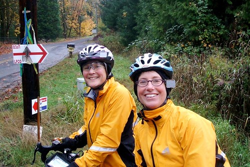
At the end of Dairy Creek Road is Snoozeville, or "Snooseville" as a poster to one of my listservs insists. (See the comment below as well and let the debate begin!) The route goes left there onto Fern Flat Road for about half a mile, to the second control. There's a rumour that there will be hot drinks and edible goodies there on the 3rd . . . Fern Flat is also quite pretty.
After stopping for pictures at Fern Flat, we turned around and headed back down (and it really is down) Dairy Creek to Mountaindale, where we turned right and headed on to the town of Banks and the third control at Cedar Canyon, crossing Hwy 26 at "Frogger Junction" along the way. Heading into Banks, the route again follows Hwy 47 for a short stretch, but the shoulders are wide enough that the heavy traffic is not too scary. Turning left to get to Cedar Canyon can be a bit tricky, though.
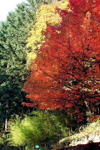
Cedar Canyon is another one of my favorite cycling roads. A nice gentle climb, followed by some minor rollers for about 3 miles. The trees are in full leaf-peeper fall foliage mode.
The Cedar Canyon info control (and no, I am not giving away the answer) is the last one before the end. Question answered, riders will make a left turn onto Hwy 6, which again can be pretty tricky. Fortunately, the right turn onto Stafford is only about a mile away. After the turn onto Stafford, the route goes uphill for about half a mile, followed by a really fun (at least I think so) descent, with lots of wide corners and hairpins. In dry weather it's a hoot. In wet weather, not so much. Finally, the route once again crosses Hwy 47 and, less than a mile later, ends at Visitation Parish in Verboort, where it will be a sausage free-for-all (okay $15-for-all). Of course, a week before the festival, they were still busy stuffing the sausage so we didn't see any . . . .
Ah, Oregon - they say that if we were to let a little rain stop us from riding, we'd never ride. Okay, we would ride, but not nearly as much.
These guys wimped out (all Mike G., who Lynne and I shamed into riding . . . ). Someone suggested to John that they ought to change their name to "Summer Velo."
[click on any picture to go to my Flickr photset of the ride]
Welcome to the Fall riding season in the Great Pacific Northwest. If it is not raining, the winds are howling - but usually it is a little of both. Yesterday was the annual Bingen Bikenfest 200 KM brevet and we came expecting rain. Well, to be precise, everyone but me came expecting rain. Cock-eyed optimist that I am, I had read the weather report, which indicated a SLIGHT chance of rain, to mean NO chance of rain. So, apart from my jacket, which I brought more for warmth and visibility than to fend off water, I did not bring any rain equipage (okay, to be entirely precise, I forgot to bring my fenders). Rickey, on the other hand, was so sure of rain that he brought the "rain bike."
I no longer even try to count how many bikes Rickey has. . . .
The ride started at 8:00 AM in the hamlet of Bingen, Washington - just across the Columbia River from Hood River, Oregon. It's about an hour and a half drive from my home in SE Portland, so I left home just before 6:00 AM to make sure I got there in time to faff around getting my card, checking my tires, etc.
About 5 miles from home, I remembered my fenders. Or, again, to be more precise, realized I had forgotten them. "Oh, well," I thought, "it's not supposed to rain today." Right. As I headed east in I-84, rain started splattering my windshield. I tried to ignore it, but I eventually had to admit it was happening and turn on the windshield wipers. Drat. I briefly pondered turning about to get the fenders, but then managed to convince myself that the rain would pass, even if I had to make it pass by sheer force of will. By the time I reached Cascade Locks, the rain had stopped. Chalk one up for willpower. Or at least slow moving weather systems. In any event, I decided that today I was going to go for speed - I figured the faster I went, the less time I would spend in the seemingly-inevitable rain.
I arrived in Bingen at about 7:20 AM and found the park where the ride was to start. There was no one there, which caused me some concern, but then another couple drove up - they, too, had been to the park and, finding no one there, gone driving around to see if maybe there was ANOTHER park. We finally decided that we had been right the first time (Bingen really isn't big enough for two parks, anyway) and shortly other folks started arriving. Turns out that some of them had been early and had gone to McDonald's for coffee and warmth. By 7:55, everyone had arrived and checked in and it was time for the last pre-ride instructions . . .
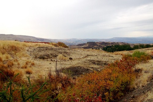
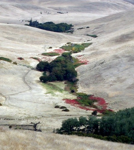
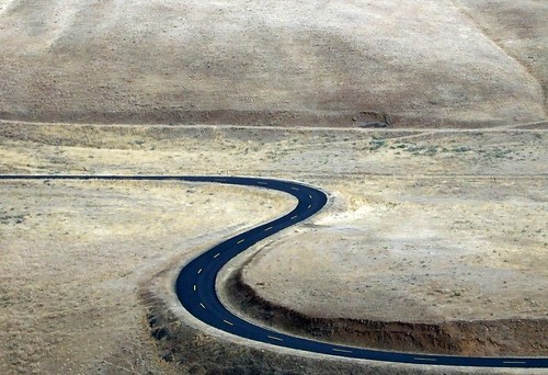
Of all the brevets I have done (and this being my first year, that isn't all that many), this one had the shortest cue sheet. With less than 10 turns in just over 125 miles, it was pretty nigh impossible to get lost. I am really good at getting lost, and even I didn't miss any turns. We started with a 34-mile run east on State Highway 14, which runs right along the Columbia River - water on one side, bluffs on the other. We were east of the Cascades by this point, so the terrain was very different from the lush greenery we usually ride through. Here, the predominant color is brown. Many different shades of brown, however, and beautiful in its own way . . .
Highway 14 is a major trucking route, and we were passed by some major trucks.
Fortunately, the highway shoulders were very wide and, even better, very clean. I was impressed by how little debris there was - just the occasional bit of tire or torn truck tie-on. I wish Oregon roads were so clean. I was also pleased that every single driver that passed us on the whole route was polite and gave us lots of room. Of course, it helps that Washington law requires them to do so . . .
The first 35 miles were a blur - not much climbing and a terrific tailwind. There's a lot to be said about coasting uphill at 20 MPH. Of course, that part of me that still remembers the terror of Sunday School couldn't help but think "This is too good - we are going to pay for this later." And pay we did. At mile 35 or so, we turned north off of 14 onto Hwy 97 and that wind that had been our friend became our enemy. It did not help that we were also beginning a 10-mile climb at that point. My average speed dropped from about 18 MPH to about 7 MPH. Maintaining vertical integrity became a priority. It helped to stop and take pictures. A lot of stopping, a lot of pictures.
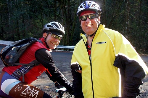
I began to doubt my chances of outrunning any rain that might be coming our way. By this time, I was riding with my friend Andrew, having either passed or been passed by everyone else. Except for running into folks at controls, and the occasional passing pick-up truck, Andrew and I were alone for about 80% of the time.
The first control was Goldendale. In a cruel test of my vow never to set foot in a Dairy Queen again, the stop was a combination DQ/Subway/Minimart. I went in the mini-mart side to get my card signed, but was dismayed to see that I might have to cross the invisible line to the DQ to get to the restroom. Rickey stood there pointing at the DQ and daring me to try. Pressing myself against the far wall, I sidled down the hall to the bathroom . . . whew! Okay, not really - I just held my hand to the side of my face so I couldn't see the Dairy Queen and ran for the bathroom chanting "I can't see you . . ."
From Goldendale, we turned northwest and headed for the second control in Glenwood. The wind was still against us and we were still going uphill. In fact, this would be the case for the next 40 miles or so. There was a brief respite from climbing in the form of a thrilling downhill to the Klickitat River. Or, rather, it would have been thrilling were it not for the diesel mini-van in front of me riding its brakes and puffing out fumes . . .or the truck in front of it that just came to a dead halt in the middle of the road for no apparent reason. Brakes are a good thing but not when you use them for no reason. Especially when you are already being tailgated by an impatient cyclist eager for her downhill payday.
Control #2 was at abut mile 82, at the Shade Tree Inn in Glenwood. Andrew was making noises about wanting to sit down and eat real food, but I was intent on pressing forward - still no sign of rain - just lots of cold wind - but the sky was looking more and more ominous. With less than 45 miles to go, I was in a hurry . . . I gave Andrew 10 minutes. To his credit, he was ready to go before I was (although he was still looking yearningly at the cafe stools . . .)
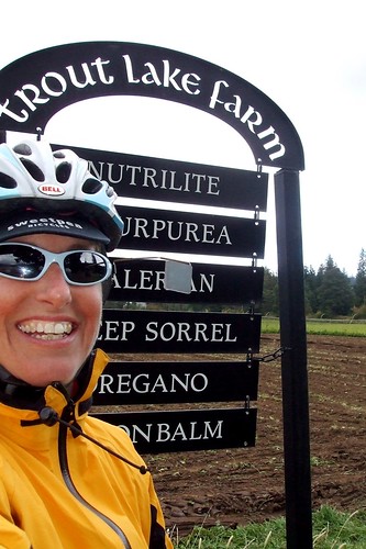
From Glenwood we finally started to do more descending than climbing. Sadly, because the wind was still in our face, it was about the same amount of work. Finally, at about mile 95, we turned out of the wind onto Sunnyside Road and headed toward the information control at Trout Lake Farm. The question seemed simple enough: What is the third plant on the list of crops. As it turned out, the question required more agricultural knowledge than I had.
What the hell is Nurtilite, anyway? And "purpurea" sounds like some nasty tropical skin disease, if you ask me . . . something both scabby and oozy at the same time, perhaps.
From the farm, the cue sheet directed us back uphill, and back into the wind, to the next control at the Trout Lake store. This was an out-and-back spur, and on our way in Andrew and I were passed by two riders headed home, with big smiles on their faces. A customer asked us about the ride and we described the route; he just shook his head and laughed. When we mentioned the wind in Goldendale, he said that he used to live there and sold his house because he got sick of the constant wind. I could relate. When it became out turn to head back out of Trout Lake, we quickly understood why the two riders that passed us were so happy - we finally had both a downhill AND a tailwind. Life was good. As we headed home, we passed Rickey, Lynne and Sal headed up to Trout Lake - later Lynne would say, "We wondered why you looked so happy - then when we turned around, we realized why."
The 25 miles from Trout Lake to White Salmon is almost all downhill. Almost. Again, my Sunday School training to anticipate that every good thing will have a really bad consequence was proven true by the cruel, cruel climb at Husum. My quads, which until that point had been merely tired, announced that this was it, they had had it, and I was on my own from now on. I convinced them that I couldn't very well leave them lying by the side of the road, no matter how inviting that seemed at the time, and they grudgingly agreed to keep going.
Starting somewhere between Goldendale and Glenwood, Andrew had been keeping tabs on our elevation - noting every once in a while that we must have reached maximum, only to shortly declare that NOW we had reached it, and so on. A particularly cruel series of rollers had us ascending 100 feet, descending 80, ascending another 100, descending another 80, etc. We finally topped out at something over 2200 feet, I think . . . anyway, heading into the town of White Salmon we still had about 420 feet to drop and a shorter and shorter distance in which to do so. I began looking forward to a precipitous fall through town to the river. For once, my anticipation was rewarded in a good way: not only did we have a steep downhill, but it was relatively straight, the road was wide, and there was very little traffic. Well, there was that one ambulance in my way . . . but it turned off at the hospital. At the bottom of the hill, Andrew observed that for someone who insists on coming to a full stop at stop signs, I seemed to have no qualms about exceeding the posted speed limit of 35 MPH. Guilty as charged.
We pulled into the end control at almost exactly 6:00 PM (by my watch, at least - I don't know what out "official" time was). At just about 10 hours it wasn't my fastest overall 200K, but given the terrain and the wind we battled, I was pleased.
And best of all, it didn't rain!
I drove home through Stevenson, rewarded myself with a pint of Barefoot Brown Ale and some tasty carrot-ginger soup at Walking Man, and looked back on what was, all in all, another beautiful day on my bike.
Here's the ride profile - did I mention there was some climbing?