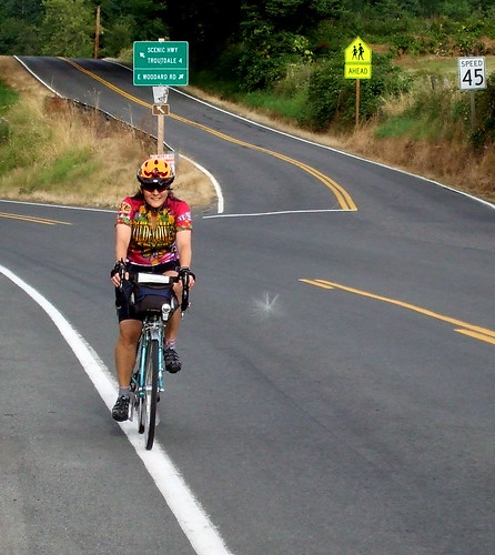
Like I said, Lynne and I were once again pre-riding a brevet route. I realized that half of the brevets that I have ridden this season have been as a volunteer. We've got to get more volunteers . . . . Anybody? Anybody? Bueller? Bueller? But I digress. here's the 411 (in addition to what Lynne has already related)
The route starts in NE Portland, at Wilshire Park - about .5 of a mile from the Kennedy School (if you're looking for lodging or post-ride beer) and the Concordia New Seasons (if you're looking for post-ride groceries). From there we headed northeast on 33rd Avenue, keeping to the right to go over Columbia Blvd. and then looping back down to continue on 33rd to where it T's out at Marine Drive. There is a bike lane on Marine Drive, but there is also a bike path that runs along the levee - we hopped on the bike path because it is prettier and there are fewer semis. The bike path ends at the I-205, where we jumped back onto Marine Drive. From the I-205 to Troutdale we stayed on Marine Drive. There are bike paths at random points on either side of the roads, but it was easier to just stay on the road in the bike lane.
Marine Drive ends at the frontage strip in Troutdale, where we turned left. There are a lot of fast food joints on the frontage road. After screaming at the tourist in the Econo Van who almost right hooked Lynne in their anxiety to get a fatso-burger, we turned onto 257th and climb up the hill toward the Historic Columbia River Highway. There's a protected left turn there, but watch out for drivers intent on getting into it before you do, even if it means running over you (this turned out to be a recurring theme on our ride). The main street in Troutdale is touristy, but you'll be passing through town too early to buy any tchotchkes. There's a short downhill from town to a park by the river. Multnomah County in its infinite wisdom required Troutdale to design the bike lane to take a very sharp right to avoid passing over a narrow bridge. It's safer to just ignore that lane and stay on the highway. To your left is a park with a flush toilet - you need to ride back into the park by the playground to find it.
Just past the park we crossed the bridge over the Sandy River and turned right. The road remained flat for a while, as we passed such local landmarks as Tad's Chicken and Dumplings, but shortly after the Stark Street bridge we started the first real climb of the day. It's a roughly 6-mile climb, but never very difficult - especially if you've got the wind at your back. Look for the Job Corps Dragon on your right as you grind your way up. The climb tops out in "historic Springdale," where there is a market.
The road then flattens for a while, and then there's a little more climbing around Corbett (where there is another market). Just outside of Corbett is the Portland Women's Forum viewpoint where, on a clear day you get a great view of the Vista House far below, site of the ride's first "control."
From the Women's Forum it's a short, steep drop to the Vista House. The building opens at 9 AM, and has flush toilets and a snack bar. It also has great views and quite possibly the world's least useful bike rack, which, amusingly enough, was placed there by the Portland Wheelmen TC. If I were them, I'd have asked for the money back. It's an embarrassment.
It's just about 10 miles from the Vista House to Multnomah Falls via a great swooping downhill, with a couple of sharp hairpins. The descent bottoms out at Latourelle Falls and from there it is a series of rollers to Multnomah Falls, where you will find more flush toilets, an espresso cart (with pastries!) and a very expensive snack bar. Watch out for the RVs in the parking lot backing up with no warning.
From Multnomah Falls we continued on the historic highway as far as Dodson. The highway was repaved a few years ago and the surface is nice and smooth, and pretty flat, to boot. There are lots of wildflowers blooming. LOTS of sweet peas . . .
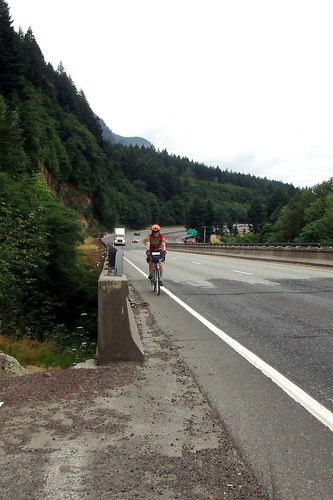
In Dodson the road ends, and anyone who wants to continue going east has to go onto I-84 (this is one reason I do not do the route in this direction when I am doing it on my own - if you go east on the Washington side and come back west in Oregon, you are on the freeway for less than 1.2 miles - going east in Oregon you are on the freeway for almost 2.5 miles. Fortunately, the shoulder is very wide and relatively clean -EXCEPT in two places, where you have to cross a short narrow bridge with practically NO shoulder. That part is, um, a little scary . . .
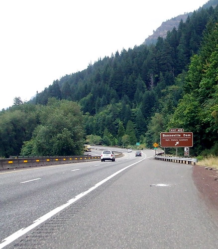
We exited the freeway at the Bonneville exit, and hopped onto the MUP (multi-use path) that connects the Tanner and Eagle Creek trails and eventually dumps out in Cascade Locks. The MUP is actually part of the old highway repurposed for better things, and it is the most beautiful part of the route. PNW rain forest complete with primeval ferns.
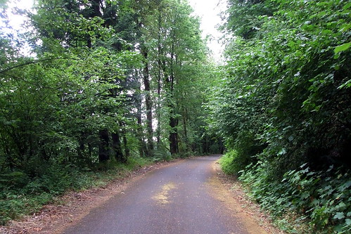
About a mile into the path is a set of stairs. Some inbred removed the "Stop" sign just before the stairs and tossed it down the side of the hill (last time Lynne and I went through we had rescued the sign from a similar fate, but this time it was too far down to pick up), but there is a yellow "Stop Ahead" sign (albeit somewhat hidden by foliage). The stairs are steep. They do have a bike gutter, but because they are so steep it is pretty useless. We just carried our bikes down.

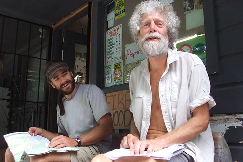
There are many food options in Cascade Locks - ranging from the bakery and restaurant at Char Burger to a brewpub-slash-hostel to tribal members selling salmon in the parking lot. We ate food we packed from home, but I was tempted by the $1.95 Cinnamon Crispy at the Char Burger bakery, which looked like fried dough but which was described to me as a "flattened cinnamon roll." I decided to pass and ate my tofu jerky instead.
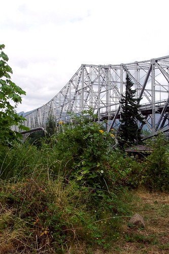
At Cascade Locks the route crosses over the Bridge of the Gods to Washington. If this is your first time over, don't look down. HA!, I have now guaranteed that you WILL look down. The road surface is a weird metal grate - skinny tires are at a definite disadvantage, especially in the rain. if it is dry, the crossing is not bad at all. There is NO toll for bicycles. I repeat, NO TOLL!
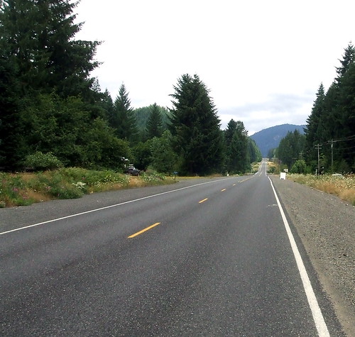
After crossing the BOG, the route heads east on SR-14 through Stevenson, where we found more markets --one selling soft ice cream, one selling hard ice cream, one selling both.We didn't get any ice cream. Stevenson is also home to Walking Man, one of the best microbreweries in the PNW. We didn't get any beer.
Shortly after leaving Stevenson, the route takes a left onto the Wind River Highway toward Carson. BE VERY CAREFUL MAKING THIS LEFT TURN - you will be climbing at this point and so moving somewhat slowly. Impatient drivers will zoom around to your right to get into the protected left turn lane before you do, thus cutting you off and almost killing you - much as two drivers did to Lynne (with a third who tried but couldn't get around her before she was into her turn.)
From the Carson turn-off it is an 8.5-mile climb to the Stabler Country Store. The grade never exceeds 4%, but it also never seems to end. There is no paved shoulder. Unless you like riding uphill in deep, soft gravel, you will be riding to the left of the fog line. If you are in a group, you will definitely need to ride single file - the drivers on this road are fast and inconsiderate. Just before the store is a short descent. There is a flush toilet at the Stabler store, but it has a slow-filling tank, so you might want to get your card signed before using it! The store is a popular mail drop for PCT hikers like "Voyageur,' the through-hiker we met on Sunday.
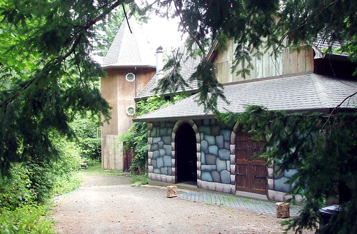
After getting our cards signed and chatting with the hikers, it was back the way we came to SR-14. The downhill side of the Wind River Highway was equally shoulder-free. The route then follows SR-14 west for just over 20 miles. Just before we reached Cape Horn, we took a right turn onto Krogstad Road. Look for the small house with the tall fence and giant satellite dish. Krogstad starts off as a one-lane private road but shortly afterwards becomes a regular ol' road with a yellow center line and everything. There are loose dogs on Krogstad that will run after you, but they responded well to a firm "Go home!" Don't miss the castle to your left; it has a glass blowing studio.
Just when we thought we couldn't climb anymore, we turned right on to Canyon Creek Road for a little more climbing, followed by a nice, gentle downhill to the control at Washougal River Mercantile where we found many snack foods, friendly service and another flush toilet! (Yes, these things are important to me).
From the WRM, we turned left on Washougal River Road toward Camas. The road parallels the river and is gently rolling. Traffic can be busy, and the shoulders are narrow. After about 9.5 miles we came come to a bridge. Directly before that bridge, and I mean DIRECTLY, was Shepherd Road, our next turn. Shepherd T's out at 3rd Street in Camas, where we turned right. 3rd T'd out at Adams, where we turned right again and climbed a short hill to 6th (look for the flashing yellow light), where we turned left. By this point we were holding our breath because we were skirting around the Georgia Pacific pulp mill, which is why Camas smells the way Camas does . . . note the "car shower" in the employee parking lot to the left, where GP employees can wash the poison off their cars before going home . . .
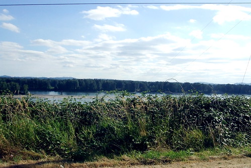
Shortly after the mill, the route takes a left to stay on 6th. There is a left turn lane, but watch out for oncoming traffic exiting the highway. 6th turns into the old Evergreen Highway, which the route follows for abut 7 miles. This stretch of road is home to some of the tackiest expensive houses I have ever seen! Also loads of blackberry vines and great views of the Columbia River.
About four miles along this road, just past the cemetery, is a fork where 164th St. goes off to the right. STAY LEFT. In another three miles or so, the route takes a right onto Ellsworth, which at 8% just happens to be the steepest climb of the day. Fortunately, we only had to winch ourselves up for less than one-tenth of a mile. Then it's a right onto 23rd to the I-205 bike path.
After a short climb to get onto the bridge, it's all downhill to the Oregon side. The path takes a sharp left turn, crosses a bridge and T's out. We turned right (away from the river) and then right again on Alderwood (the first street that the path crosses). At this point we were riding through the Land of Airport Business Parks, but it was okay because we were almost done and too tired to care about scenery, anyway. Just past the golf course we turned right on Cornfoot Road, which we followed all the way to a left turn on 47th (the entrance to Boeing was on our right). Now we really were almost done! We followed 47th past the compost plant and the pallet yards and crossed Columbia at the light. One more little climb up to Holman, right on Holman, and left at the roundabout onto 37th. We risked the dangerous crossing at Prescott, but other riders should just turn right on Prescott so as to avoid getting killed at a poorly designed intersection and then turn left at at 36th or 35th. After that it's only a block or so to the finish.
From the Carson turn-off it is an 8.5-mile climb to the Stabler Country Store. The grade never exceeds 4%, but it also never seems to end. There is no paved shoulder. Unless you like riding uphill in deep, soft gravel, you will be riding to the left of the fog line. If you are in a group, you will definitely need to ride single file - the drivers on this road are fast and inconsiderate. Just before the store is a short descent. There is a flush toilet at the Stabler store, but it has a slow-filling tank, so you might want to get your card signed before using it! The store is a popular mail drop for PCT hikers like "Voyageur,' the through-hiker we met on Sunday.
After getting our cards signed and chatting with the hikers, it was back the way we came to SR-14. The downhill side of the Wind River Highway was equally shoulder-free. The route then follows SR-14 west for just over 20 miles. Just before we reached Cape Horn, we took a right turn onto Krogstad Road. Look for the small house with the tall fence and giant satellite dish. Krogstad starts off as a one-lane private road but shortly afterwards becomes a regular ol' road with a yellow center line and everything. There are loose dogs on Krogstad that will run after you, but they responded well to a firm "Go home!" Don't miss the castle to your left; it has a glass blowing studio.
Just when we thought we couldn't climb anymore, we turned right on to Canyon Creek Road for a little more climbing, followed by a nice, gentle downhill to the control at Washougal River Mercantile where we found many snack foods, friendly service and another flush toilet! (Yes, these things are important to me).
From the WRM, we turned left on Washougal River Road toward Camas. The road parallels the river and is gently rolling. Traffic can be busy, and the shoulders are narrow. After about 9.5 miles we came come to a bridge. Directly before that bridge, and I mean DIRECTLY, was Shepherd Road, our next turn. Shepherd T's out at 3rd Street in Camas, where we turned right. 3rd T'd out at Adams, where we turned right again and climbed a short hill to 6th (look for the flashing yellow light), where we turned left. By this point we were holding our breath because we were skirting around the Georgia Pacific pulp mill, which is why Camas smells the way Camas does . . . note the "car shower" in the employee parking lot to the left, where GP employees can wash the poison off their cars before going home . . .
Shortly after the mill, the route takes a left to stay on 6th. There is a left turn lane, but watch out for oncoming traffic exiting the highway. 6th turns into the old Evergreen Highway, which the route follows for abut 7 miles. This stretch of road is home to some of the tackiest expensive houses I have ever seen! Also loads of blackberry vines and great views of the Columbia River.
About four miles along this road, just past the cemetery, is a fork where 164th St. goes off to the right. STAY LEFT. In another three miles or so, the route takes a right onto Ellsworth, which at 8% just happens to be the steepest climb of the day. Fortunately, we only had to winch ourselves up for less than one-tenth of a mile. Then it's a right onto 23rd to the I-205 bike path.
After a short climb to get onto the bridge, it's all downhill to the Oregon side. The path takes a sharp left turn, crosses a bridge and T's out. We turned right (away from the river) and then right again on Alderwood (the first street that the path crosses). At this point we were riding through the Land of Airport Business Parks, but it was okay because we were almost done and too tired to care about scenery, anyway. Just past the golf course we turned right on Cornfoot Road, which we followed all the way to a left turn on 47th (the entrance to Boeing was on our right). Now we really were almost done! We followed 47th past the compost plant and the pallet yards and crossed Columbia at the light. One more little climb up to Holman, right on Holman, and left at the roundabout onto 37th. We risked the dangerous crossing at Prescott, but other riders should just turn right on Prescott so as to avoid getting killed at a poorly designed intersection and then turn left at at 36th or 35th. After that it's only a block or so to the finish.
Lynne's Report is here
More Pictures are here
6 comments:
So, Mrs. Lincoln, how did you enjoy the play?
Ride: sounds like you had a great time.
Ride report: a few too many references to almost getting killed. As a teenager I did a lot of riding in the Gresham-Troutdale-Sandy area, and since I started doing OrRando rides on the west side I almost never go out to Troutdale anymore. I did a solo bike tour in that area a few years back and traffic got so threatening I had to turn back at one point near I-84. Oddly, I feel safer and more relaxed on the west side now.
(Just honoring my inner chicken, I suppose)
It wasn't Troutdale's idea to put that sharp right turn to the bike bridge. Multnomah County required it.
From what I've seen, bike riders don't use the new bridge. I don't either. I stay on the highway.
Lynne - I had a good time - I especially enjoyed meeting Voyaguer in Stabler.
Beth - Yes, almost getting killed was too much of a recurring theme.
Councilor Canfield - Thanks for the clarification on the bike path - I was unduly harsh on Troutdale. Like you, I don't know any biker that uses that path - especially heading IN to Troutdale from the Gorge, where it requires a rider to cross against oncoming traffic. Boo on MultCo!
Cecil,
I would have LOVED to go on this ride with you and seriously thought about it for Saturday but alas, I have Hood to Coast to run this weekend and unfortunately (last time I checked) they won't let me ride the course. Oh well, another time. :-)
And I've ridden on that bridge in Troutdale(going East only) - it seemed like a waste of time, but I did it just because... it was there!
Julie
Julie - perhaps we can do a BOG ride together soon. Good luck on the H to C - it's possible that I may see you (or someone on your team), as my 400K that is scheduled for Saturday shares the route with you all in the area of Jewell . . .
Post a Comment