This past weekend, the Oregon Randonneurs and the Seattle Int'l Randonneurs hosted a 12-Hour "Dart" event, in which teams from both clubs converged on a central point (in this case, Centralia, Washington) from various distant points (at least 180 kilometers distant) via routes designed and submitted by the individual teams. I really wanted to try a Dart this year, and when I learned that my friends Andrew and Bill were also interested, I immediately suggested we team up. We needed at least three riders for a team, but could have as many as five. We could not find anyone else to join us however, nor did the Oregon club field any other teams. As sole representatives of Or Rando, we were determined to do well. The Seattle club fielded four teams, but I think we had the best team name - because Andrew is English, and we are all a wee bit demented, Noel Coward's phrase seemed appropriate.
There are all sorts of tricky rules for a Dart. Your route has to be at least 180 kilometers in distance, and you get credit only for the shortest route between controls that is safe for cycling. So you could, in theory, design a longer route, but not get credit for all the distance. The other main rule is that your team must ride at least 25 kilometers between the tenth and twelfth hour. Andrew designed our route - a part of which I've described in earlier posts about my pre-rides of it. He promised it would not be too hilly.
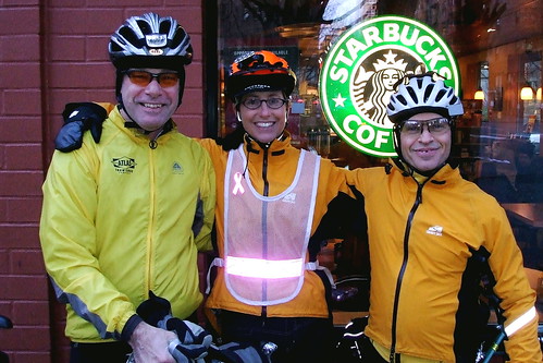
We left downtown Portland at 7:17 AM, two minutes after our scheduled start time. We needed someone to sign our brevet cars, so we stopped at the nearest Starbucks (none of the non-Starbucks shops was open yet) and bought the least expensive thing we could find - the teeny, tiny vanilla bean scone.

It was 35 degrees and very frosty, but we took that as a good sign that, after a week of rain, we were in for a clear day. We were all wearing multiple layers, and were already worrying about where we would stow all that extra clothing if we did, indeed, need to start stripping it off as (if) the day warmed up.
Our first control point was across the Columbia River in downtown Vancouver, Washington. Yet another Starbucks. Bill asked if we were going to do the Starbucks tour of Washington. A quick bathroom break and hot soy milk cocoa and we were ready to go, but then a man came out and started asking Andrew questions about his Bike Friday. Andrew politely answered his questions, and then the guy started talking about biking in general. He was a nice old guy, and we didn't want to be rude, but we were late out of the control and getting later by the minute. As Lynne would say, I was "starting to get all OCD" . . . Finally he went on his way, and we went on our way.
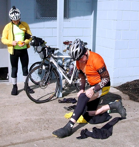
The sun was well up at this point, and it was obvious that it was going to be a glorious day. On to Battle Ground Safeway, and the second control. Again, this was a section of the route that I had pre-ridden, so I knew where most of the turns were well ahead of time. Nevertheless, for some reason I got confused on St. James Road, and for about 1/2 a mile was absolutely CONVINCED that we'd missed our turn. Andrew kept reassuring me that we had not, and eventually things started to look familiar again. We reached the second control in good time, but then spent more time faffing around there than we should have. Most of it was my fault - the elastic in my riding capris had come undone, and I spent at least 10 minutes fighting to get it back in place. Note to self: Next time bring a safety pin to attach to one end of the elastic.
Our next stop was the La Center Little League Field. It was not a scheduled control, but Andrew knew that it had a good restroom (always an important consideration) and it would also be a good point to make wardrobe adjustments. Given that we would be starting some serious hill climbing shortly after La Center, we wanted to pare off some of the heavier layers.
There were a couple of small climbs between Battle Ground and La Center (one especially nasty but short 16% pitch on J.A. Moore Road) but the first REAL climbing of the day came shortly after we passed through Woodland and turned up onto Green Mountain Road. I knew from my pre-ride that Green Mountain was steep, but now with my nifty new computer, I knew exactly how steep it was. It started at an incline of 9% and quickly ramped up - 11%, 12%, 13%, 14%, 18%!!! Most of the time it ranged between 11 and 14% - I started to look forward to those brief points when it was ONLY 9%. The view from the top, when I finally got there, was pretty nice, however.
The road down from the top of Green Mountain was also very steep, with many technical turns and a lot of loose gravel on the road surface. In the other words, all that climbing and no pay off. "Oh well," I thought to myself, "at least we are done climbing for the day." Silly me.
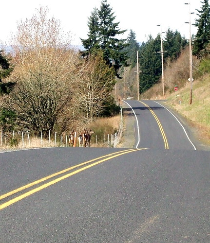
At the bottom of Green Mountain, we turned onto Cloverdale Road, which rolled gently north toward Kalama. We were surprised by a herd of deer, at least five or six head, which came bounding gracefully over the road ahead of us. Once they reached the other side of the road, they turned back, looked at us, and then bounded back the way they had come. A few stood still long enough for a photo, however.
Next stop, Kelso - our third control of the day. Another Safeway for me and Andrew and, for Bill, another Starbucks. It was also lunch time. I'd packed "real" food (as in "not Clif Bars")- some potatoes, a few bananas, a couple of eggs and some baked tofu that I had covered in VERY salty Cajun-style seasonings. I had already eaten most of the bananas at the previous controls, but proceeded to make quick work of the eggs, half of the potatoes and half of the tofu. Andrew bought some pita chips and I helped him with those, as well. Some more wardrobe adjustments, and some equipment repairs, and it was time to go.

Once again, we pulled out of the control a few minutes behind schedule, but I figured we'd make up the time because the rest of the course was pretty flat. Right.
We were now entering that part of the route that I had not pre-ridden, and we promptly got lost. Our cue sheet directed us to turn left on a street that (1) was one-way in the wrong direction and (2) we couldn't get to, anyway. So we went to the NEXT street and turned left there. That immediately took us up onto a bridge. I looked down from the bridge, and saw a sign for the street that was the next turn listed on our cue sheet. So we turned around, went back down off the bridge, figured out how to get under it and got onto the street our cue sheet said we should be on. Sadly, there was a street by the same name on the OTHER side of the Cowlitz River (over which the bridge we had just left went) and THAT was the one we were supposed to be on. We eventually figured this out, and got back on track.
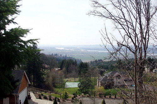
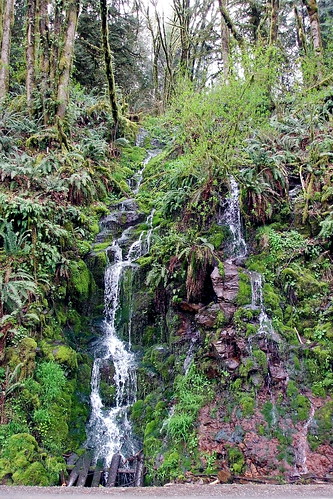
We were now on the west side of the Cowlitz River, heading north on the Westside Highway. Not the best of cycling roads, but not terrible. A little bit hilly, but mostly gentle rollers. The sun was out, it was warm, and we were making great time. We shortly turned off the Westside Highway, onto Sandy Bend Road, and I soon realized that we were not done with our climbing for the day, after all. Indeed, Green Mountain had just been the trailer for the main event, so to speak. For the next 20 miles we climbed roller after roller, each time thinking "This has to be the last of it." But the weather was still good, and the scenery beautiful, so I didn't mind the hills all that much.
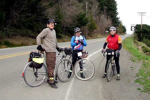
At the turn off onto Highway 506 toward our 10-Hour control, we crossed paths with one of the teams from the Seattle club. They, too, were headed toward their 10-Hour control. We chatted for a while, took each other's pictures, and headed off in opposite directions.
Our 10-Hour control was in Winlock, Washington. By Andrew's calculations, we would reach there at about 4:21 PM. We could not leave until 5:17 PM, the 10-hour mark, and so we were hoping we'd find ways to fill the 45 minutes or so. We needn't have worried. First of all, we had already proved that we could waste significant amounts of time at controls without even trying. Second of all, it turns out that Winlock offered of us all sorts of ways to waste time. For example, playing on the giant metal chickens that have been placed all along the (very short) main drag.

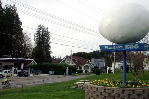
Or admiring the World's Largest Egg
We also made use of the public library's very nice rest room, did some administrative work on our brevet cards, and I ate the last of my potatoes and tofu. The 10-Hour point arrived, we got ATM slips to verify where we were, and started off on the home stretch. Finally, the route WAS completely flat, we had two hours to cover less than 18 miles, and the weather was perfect. We were golden.

Whoops.
One problem with Internet mapping tools is that they don't know when a highway overpass has been washed out by a humongous flood.
Let's just say that it was a good thing Andrew had his GPS with him, as I went into full OCD panic-mode. We were 11 miles from Centralia, but I had no idea how to get there without going on the road that no longer existed. But Andrew fiddled with his little satellite receiver and soon we were headed in something that appeared to be in the right direction. Shortly thereafter we found ourselves in downtown Chehalis, and back on our original route.
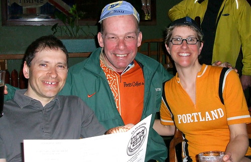
Our detour ended up being less than 2 miles, but we had eaten up some time fretting about where to go, so we knew that we might be cutting it close. We picked up the pace, and pulled into the 12-Hour control (and official finish line) at the Olympic Club Hotel with 17 minutes to spare. I was starving. I checked into the hotel, carried my bike up the (very) steep stairs to my room, came back down to the bar where the other riders had gathered, and promptly ordered a beer, a veggie burger, tater tots, and another beer. Bill and Andrew came in a few minutes later, and we celebrated a ride well done.
The next morning we all gathered for breakfast before dispersing back to our starting points. We shared our stories, and ate a few more mountains of food. I had been planning to take the train back to Portland, but my friend Susan pointed out that she had plenty of room for me, my bike and my luggage in her car and she had to go through Portland to get home, anyway. The train wasn't due for at least another two and one-half hours, and there was nowhere nice in Centralia to hang out and wait, so I took her up on her offer.

Ride Stats:
Total Distance: 118.59 miles/190.85 km
Total time: 11 hours, 43 minutes
Total saddle time: 8 hours, 47 minutes
Average Speed: 13.5 mph
Max Speed: 45 mph (I sense a trend here)
Min Speed: 2 mph (Green Mtn.)
Total Elevation Gain: 5465 ft
Max Elevation: 909 (Green Mtn.)
Max Incline: 18%
Average Incline: 3%
Calories burned: 5372
Calories consumed: At least that many ;-)
The rest of my pictures are here
4 comments:
Awesome ride, Cecil!
Just curious, which mapping program did you use, with so many issues. Not that the washout would have been seen in a satellite image, but that has helped me figure out a route "remotely" a time of two. And both MapMyRide and Bikely do include elevation detail, which can be quite helpful.
When Andrew first put the route together, he used some Google mapping program that uses destination points. I then pre-rode, and used mapmyride to clean up the sections I pre-rode, so i knew the elevations for that section. I find bikely too difficult to use on my Mac, for some reason it just isn't compatible.
Dahling, you are looking marvelous! Metal chickens (and all that riding) suit you.
I needs to get me a metal chicken for home . . . .
Post a Comment